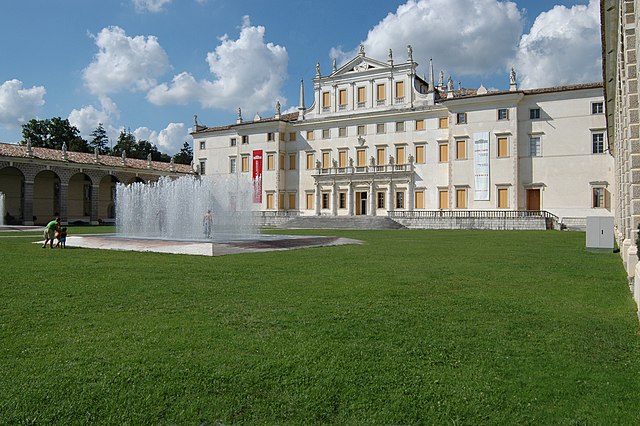
Седельяно (Sedegliano, Sedegliano)
.svg)
- коммуна Италии
 Hiking in Седельяно
Sedegliano is a charming town located in the Friuli Venezia Giulia region of northeastern Italy. While it may not be widely known as a hiking destination, the surrounding areas offer some beautiful landscapes and opportunities for walking and hiking enthusiasts. Here’s what you need to know about hiking near Sedegliano:
Scenic Hills and Countryside
- Proximity to Nature: The area around Sedegliano features rolling hills, picturesque vineyards, and serene countryside. The surrounding landscape provides plenty of gentle trails for walking and moderate hiking.
- Isonzo River: The nearby Isonzo River offers scenic views and trails along its banks, where visitors can enjoy nature walks and birdwatching.
Hiking Trails
- Local Trails: While Sedegliano itself may not have designated hiking trails, you can find local paths and roads that are great for leisurely hikes. Exploring the countryside can lead to charming views and local flora and fauna.
- Nearby Reserves: Consider heading to nearby natural reserves or parks in the region, such as the Natural Park of the Friulian Dolomites, which offers a variety of trails ranging from easy to challenging.
Cultural Exposure
- Historical Sites: While hiking, you may encounter historical sites, small villages, and vineyards that are characteristic of the Friuli region. It's a great way to combine outdoor activity with cultural exploration.
Practical Tips
- Gear: Wear suitable footwear for hiking and dress in layers, as weather can change.
- Maps: If you plan to venture into unmarked areas, consider having a map or hiking app to guide you along the way.
- Safety: Carry enough water, snacks, and a first aid kit, especially if you’re hiking in less populated areas.
Conclusion
While Sedegliano may not be a major hiking destination, its surrounding countryside and proximity to natural parks make it a delightful spot for those looking to enjoy a peaceful hike in a beautiful region of Italy. Whether you’re interested in casual walks or more energetic hikes, there are opportunities to immerse yourself in the stunning landscapes of Friuli.
- Страна:

- Почтовый код: 33039
- Телефонный код: 0432
- Код автомобильного номера: UD
- Координаты: 46° 0' 50" N, 12° 58' 29" E


- GPS треки (wikiloc): [Ссылка]
- Высота над уровнем моря: 84 м m
- Площадь: 50.53 кв.км
- Население: 3766
- Веб сайт: http://www.comune.sedegliano.ud.it
- Википедия русская: wiki(ru)
- Википедия английская: wiki(en)
- Википедия национальная: wiki(it)
- Хранилище Wikidata: Wikidata: Q53365
- Катеория в википедии: [Ссылка]
- код Freebase: [/m/0gkb9p]
- код GeoNames: Альт: [6539697]
- код VIAF: Альт: [159447951]
- ID отношения в OpenStreetMap: [79095]
- место в MusicBrainz: [af5a0de1-14ae-4850-93b3-4edf10d6e156]
- WOEID: [723963]
- UN/LOCODE: [ITUDS]
- код ISTAT: 030109
- кадастровый код Италии: I562
Граничит с регионами:
Сан-Джорджо-делла-Рикинвельда
- коммуна Италии
Hiking in Сан-Джорджо-делла-Рикинвельда
San Giorgio della Richinvelda is a charming village located in the Friuli Venezia Giulia region of Italy. While it may not be as widely known for hiking as some of the larger national parks or mountain ranges, there are definitely opportunities for scenic walks and hikes in the surrounding countryside....
- Страна:
- Почтовый код: 33095
- Телефонный код: 0427
- Код автомобильного номера: PN
- Координаты: 46° 3' 0" N, 12° 52' 0" E
- GPS треки (wikiloc): [Ссылка]
- Высота над уровнем моря: 86 м m
- Площадь: 48.15 кв.км
- Население: 4633
- Веб сайт: [Ссылка]
Сан-Мартино-аль-Тальяменто
- коммуна Италии
Hiking in Сан-Мартино-аль-Тальяменто
San Martino al Tagliamento is a picturesque village located in the Friuli Venezia Giulia region of northeastern Italy. Its surrounding natural landscapes offer beautiful opportunities for hiking enthusiasts who appreciate both scenic views and an immersive experience in nature....
- Страна:
- Почтовый код: 33098
- Телефонный код: 0434
- Код автомобильного номера: PN
- Координаты: 46° 1' 0" N, 12° 52' 0" E
- GPS треки (wikiloc): [Ссылка]
- Высота над уровнем моря: 71 м m
- Площадь: 17.98 кв.км
- Население: 1476
- Веб сайт: [Ссылка]

Кодройпо
- коммуна Италии
Hiking in Кодройпо
Codroipo, located in the Friuli Venezia Giulia region of northeastern Italy, offers a unique experience for hikers. The area is characterized by a mix of flat plains and gentle hills, making it suitable for hikers of all skill levels. While Codroipo itself may not be a well-known hiking destination, it's surrounded by beautiful landscapes and trails that can appeal to nature lovers....
- Страна:
- Почтовый код: 33033
- Телефонный код: 0432
- Код автомобильного номера: UD
- Координаты: 45° 57' 41" N, 12° 58' 39" E
- GPS треки (wikiloc): [Ссылка]
- Высота над уровнем моря: 43 м m
- Площадь: 75.22 кв.км
- Население: 16165
- Веб сайт: [Ссылка]


Козеано
- коммуна Италии
Hiking in Козеано
Coseano is a quaint town located in the Friuli-Venezia Giulia region of northeastern Italy. The area is known for its picturesque landscapes and proximity to various hiking opportunities. While Coseano itself might not be a major hiking hub, it serves as a gateway to several nearby hiking trails and natural attractions....
- Страна:
- Почтовый код: 33030
- Телефонный код: 0432
- Код автомобильного номера: UD
- Координаты: 46° 6' 0" N, 13° 1' 0" E
- GPS треки (wikiloc): [Ссылка]
- Высота над уровнем моря: 121 м m
- Площадь: 23.8 кв.км
- Население: 2181
- Веб сайт: [Ссылка]
Флайбано
- коммуна Италии
Hiking in Флайбано
Flaibano is a charming village located in the Friuli Venezia Giulia region of Italy. The surrounding area offers a variety of hiking opportunities that cater to different skill levels, with stunning views of mountains, valleys, and picturesque landscapes....
- Страна:
- Почтовый код: 33030
- Телефонный код: 0432
- Код автомобильного номера: UD
- Координаты: 46° 3' 0" N, 12° 59' 0" E
- GPS треки (wikiloc): [Ссылка]
- Высота над уровнем моря: 104 м m
- Площадь: 17.32 кв.км
- Население: 1122
- Веб сайт: [Ссылка]
Мерето-ди-Томба
- коммуна Италии
Hiking in Мерето-ди-Томба
Mereto di Tomba, located in the Friuli Venezia Giulia region of Italy, is a charming area that offers various hiking opportunities, especially for those looking to explore the natural beauty of northern Italy. The landscape is characterized by rolling hills, vineyards, and views of the surrounding mountains, making it a picturesque spot for outdoor activities....
- Страна:
- Почтовый код: 33036
- Телефонный код: 0432
- Код автомобильного номера: UD
- Координаты: 46° 3' 0" N, 13° 2' 0" E
- GPS треки (wikiloc): [Ссылка]
- Высота над уровнем моря: 98 м m
- Площадь: 27.30 кв.км
- Население: 2606
- Веб сайт: [Ссылка]