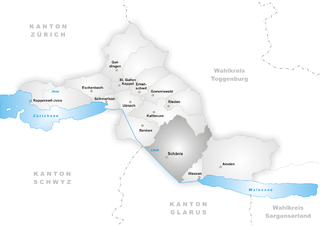
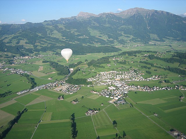
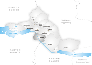
Зее-Гастер (See-Gaster Constituency, Wahlkreis See-Gaster)

 Hiking in Зее-Гастер
See-Gaster is a beautiful region in Switzerland, located in the canton of St. Gallen. It's known for its stunning landscapes, featuring picturesque lakes, rolling hills, and scenic mountain views. Here are some highlights about hiking in the See-Gaster area:
Key Attractions:
-
Lake Zürich: The region borders Lake Zürich, providing opportunities for lakeside walks and stunning views over the water.
-
Säntis Mountain: A major highlight is the Säntis mountain range. The summit offers panoramic views that are breathtaking, and there are various hiking trails that lead to and around the area.
-
Rapperswil: This charming town, often called the "Gate to Lake Zürich," has beautiful lakeshore pathways, historical sites, and a picturesque castle.
-
Nature Reserves: The region is home to several nature reserves where hikers can explore diverse ecosystems, including forests, meadows, and wetlands.
Hiking Trails:
-
Rapperswil to Pfäffikon: This scenic trail runs along the eastern shore of Lake Zürich, featuring beautiful views of the lake and the surrounding mountains.
-
Zurichsee Höhenweg (Zurich Lake High Trail): This long-distance trail offers various segments that allow hikers to experience the beauty of the area at different elevations.
-
Säntis Trails: Various trails of varying difficulty levels lead to the summit of Säntis, appealing to both experienced hikers and families.
-
Wald Trails: The area is crisscrossed with forest trails that provide a more shaded and tranquil hiking experience.
Practical Tips:
-
Weather: Always check the weather before heading out, as conditions can change rapidly in the mountains.
-
Gear: Wear appropriate footwear and clothing suitable for hiking. Consider layers that can be added or removed as needed.
-
Maps: Make sure to have a reliable map or GPS device, as some trails can be less clearly marked.
-
Local Regulations: Always adhere to local regulations regarding hiking trails and nature conservation.
-
Public Transport: The region is well-connected through public transport, making it easy to reach trailheads and return from hikes.
Conclusion:
Hiking in the See-Gaster region offers a delightful mix of natural beauty, cultural experiences, and historical sights. Whether you're looking for a relaxed lakeside stroll or a challenging mountain adventure, this area has something for every outdoor enthusiast. Enjoy your hike and take in the stunning Swiss landscapes!
- Страна:

- Столица: Рапперсвиль-Йона
- Код автомобильного номера: SG
- Координаты: 47° 13' 36" N, 8° 49' 6" E


- GPS треки (wikiloc): [Ссылка]
- Высота над уровнем моря: 525 м m
- Площадь: 246.16 кв.км
- Википедия русская: wiki(ru)
- Википедия английская: wiki(en)
- Википедия национальная: wiki(de)
- Хранилище Wikidata: Wikidata: Q661193
- Катеория в википедии: [Ссылка]
- код Freebase: [/m/0gn_f1]
- код GeoNames: Альт: [7285010]
- идентификатор местоположения ArchINFORM: [42752]
Включает регионы:

Шенис
Hiking in Шенис
Schänis is a charming municipality located in the canton of St. Gallen, Switzerland. It's a great area for hiking enthusiasts, offering a variety of trails that cater to different skill levels, along with stunning natural vistas....
- Страна:
- Почтовый код: 8718
- Телефонный код: 055
- Код автомобильного номера: SG
- Координаты: 47° 9' 32" N, 9° 2' 48" E
- GPS треки (wikiloc): [Ссылка]
- Высота над уровнем моря: 683 м m
- Площадь: 39.90 кв.км
- Население: 3812
- Веб сайт: [Ссылка]


Амден
Hiking in Амден
Amden is a charming village located in the canton of St. Gallen in Switzerland, nestled in the foothills of the Alps. It offers stunning panoramic views of Lake Zurich and the surrounding mountains, making it a popular destination for hikers of all skill levels....
- Страна:
- Почтовый код: 8875
- Телефонный код: 055
- Код автомобильного номера: SG
- Координаты: 47° 9' 37" N, 9° 9' 59" E
- GPS треки (wikiloc): [Ссылка]
- Высота над уровнем моря: 903 м m
- Площадь: 43.48 кв.км
- Население: 1784
- Веб сайт: [Ссылка]

Шмерикон
Hiking in Шмерикон
Schmerikon is a charming municipality located on the shores of Lake Zurich in Switzerland, and it offers some wonderful opportunities for hiking and outdoor activities. Here are some highlights:...
- Страна:
- Почтовый код: 8716
- Телефонный код: 055
- Код автомобильного номера: SG
- Координаты: 47° 13' 31" N, 8° 57' 0" E
- GPS треки (wikiloc): [Ссылка]
- Высота над уровнем моря: 408 м m
- Площадь: 5.98 кв.км
- Население: 3724
- Веб сайт: [Ссылка]


Гоммисвальд
Hiking in Гоммисвальд
Gommiswald is a charming village located in the canton of St. Gallen, Switzerland. It's an excellent starting point for hikers looking to explore the natural beauty of the region, with a variety of trails suitable for different skill levels. Here are some highlights about hiking in Gommiswald:...
- Страна:
- Почтовый код: 8737
- Телефонный код: 055
- Код автомобильного номера: SG
- Координаты: 47° 14' 26" N, 9° 2' 51" E
- GPS треки (wikiloc): [Ссылка]
- Высота над уровнем моря: 1074 м m
- Площадь: 33.59 кв.км
- Население: 5053
- Веб сайт: [Ссылка]

Кальтбрун
Hiking in Кальтбрун
Kaltbrunn, located in the beautiful region of Switzerland, offers a delightful experience for hikers of various skill levels. This picturesque area is surrounded by stunning landscapes, including rolling hills, lush forests, and scenic views of the nearby mountains....
- Страна:
- Почтовый код: 8722
- Телефонный код: 055
- Код автомобильного номера: SG
- Координаты: 47° 12' 59" N, 9° 2' 0" E
- GPS треки (wikiloc): [Ссылка]
- Высота над уровнем моря: 441 м m
- Площадь: 18.68 кв.км
- Население: 4798
- Веб сайт: [Ссылка]

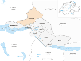
Эшенбах
- община в Швейцарии, Санкт-Галлен
Hiking in Эшенбах
Eschenbach, located in the canton of St. Gallen in Switzerland, is a charming village surrounded by beautiful landscapes, making it a fantastic destination for hiking enthusiasts. Here are some aspects to consider if you're planning a hike in this region:...
- Страна:
- Почтовый код: 8733
- Телефонный код: 055
- Код автомобильного номера: SG
- Координаты: 47° 16' 15" N, 8° 58' 12" E
- GPS треки (wikiloc): [Ссылка]
- Высота над уровнем моря: 763 м m
- Площадь: 54.82 кв.км
- Население: 9477
- Веб сайт: [Ссылка]


Уцнах
Hiking in Уцнах
Uznach is a charming village located in the canton of St. Gallen in Switzerland, surrounded by beautiful landscapes, making it an excellent destination for hiking enthusiasts. Here are some highlights and tips for hiking in the Uznach area:...
- Страна:
- Почтовый код: 8730
- Телефонный код: 055
- Код автомобильного номера: SG
- Координаты: 47° 13' 36" N, 8° 58' 53" E
- GPS треки (wikiloc): [Ссылка]
- Высота над уровнем моря: 417 м m
- Площадь: 7.55 кв.км
- Население: 6336
- Веб сайт: [Ссылка]
Бенкен
Hiking in Бенкен
Benken, located in the canton of St. Gallen, Switzerland, offers a variety of hiking opportunities that showcase the stunning landscapes and natural beauty of the region. The area is characterized by rolling hills, lush forests, and panoramic views of the Alps, making it a delightful destination for outdoor enthusiasts....
- Страна:
- Почтовый код: 8717
- Телефонный код: 055
- Код автомобильного номера: SG
- Координаты: 47° 11' 59" N, 9° 1' 0" E
- GPS треки (wikiloc): [Ссылка]
- Высота над уровнем моря: 420 м m
- Площадь: 16.48 кв.км
- Население: 3015
- Веб сайт: [Ссылка]
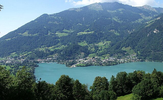

Везен
Hiking in Везен
Weesen, located in the canton of St. Gallen in Switzerland, is a picturesque village nestled along the shores of Lake Zurich and surrounded by the scenic Swiss Alps. It offers a wealth of hiking opportunities for both beginners and experienced hikers....
- Страна:
- Почтовый код: 8872
- Телефонный код: 055
- Код автомобильного номера: SG
- Координаты: 47° 7' 59" N, 9° 6' 0" E
- GPS треки (wikiloc): [Ссылка]
- Высота над уровнем моря: 423 м m
- Площадь: 5.39 кв.км
- Население: 1483
- Веб сайт: [Ссылка]


Рапперсвиль-Йона
Hiking in Рапперсвиль-Йона
Rapperswil-Jona is a picturesque town located at the northern end of Lake Zurich in Switzerland, known for its charming old town, scenic lakeside promenades, and surrounded by beautiful natural landscapes. The area offers a variety of hiking opportunities, suitable for different skill levels. Here are some highlights:...
- Страна:
- Почтовый код: 8640, 8645, 8646, 8715
- Телефонный код: 055
- Код автомобильного номера: SG
- Координаты: 47° 13' 43" N, 8° 49' 54" E
- GPS треки (wikiloc): [Ссылка]
- Высота над уровнем моря: 409 м m
- Площадь: 22.17 кв.км
- Население: 26989
- Веб сайт: [Ссылка]