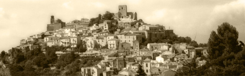
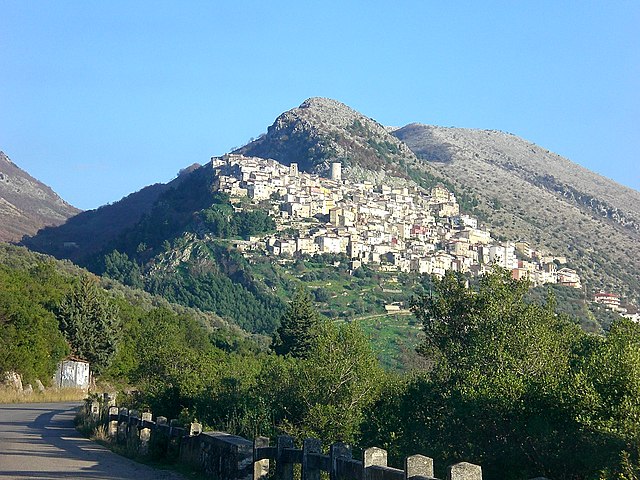
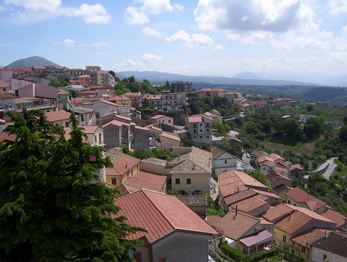
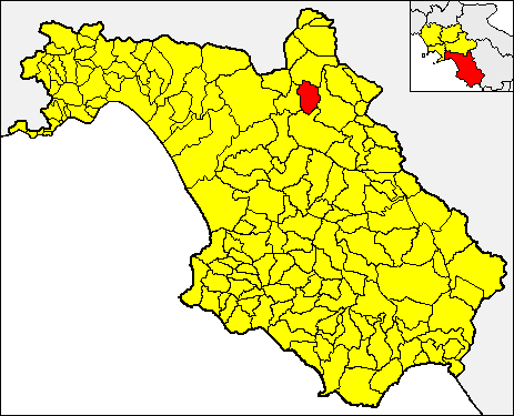
Сичиньано-дегли-Альбурни (Sicignano degli Alburni, Sicignano degli Alburni)

- коммуна Италии
 Hiking in Сичиньано-дегли-Альбурни
Sicignano degli Alburni is a charming town located in the Campania region of southern Italy. It’s nestled in the Alburni Mountains, which offer a diverse range of hiking opportunities, rich natural beauty, and stunning landscapes. Here’s an overview of hiking in and around Sicignano degli Alburni:
Trails and Routes
-
Sentiero degli Alburni: This is one of the main trails that traverses the Alburni Mountain range. It offers breathtaking views and a variety of terrains. The trail can be challenging, making it suitable for more experienced hikers.
-
Cerro di Cimitile: This hike provides access to some fascinating geological formations and panoramic views of the surrounding countryside. The trail is moderately difficult, making it accessible for many hikers.
-
Serpentone: A scenic trek that takes you through lush forests and offers glimpses of local wildlife. It’s a great trail for families and casual walkers.
Points of Interest
-
Natural Beauty: The Alburni Mountains are known for their stunning landscapes, with rocky outcrops, dense forests, and diverse flora and fauna. Be prepared to encounter beautiful vistas and perhaps some native wildlife.
-
Cultural Landmarks: While hiking, you might come across ancient ruins, churches, and other historical landmarks scattered throughout the area.
-
Local Cuisine: After a long day of hiking, you can enjoy the local cuisine in Sicignano degli Alburni. The town is known for its traditional dishes, often made with locally sourced ingredients.
Best Time to Hike
The ideal months for hiking in Sicignano degli Alburni are usually spring (April to June) and early autumn (September to October), when the weather is mild and the flora is at its peak.
Preparation Tips
- Gear: Wear sturdy hiking boots and carry a backpack with essentials like water, snacks, a map, and a first-aid kit.
- Weather: Check the weather forecast before heading out, as conditions can change rapidly in mountainous areas.
- Local Advice: Consider seeking local guidance or hiring a guide, especially if you’re unfamiliar with the area.
Safety Considerations
Always inform someone about your hiking plans, follow marked trails, and be aware of your physical limits. If you're hiking in more remote areas, having a GPS or a physical map can be extremely helpful.
Hiking in Sicignano degli Alburni can be a rewarding experience, combining the beauty of nature with the cultural richness of the region. Enjoy your adventure!
- Страна:

- Почтовый код: 84029
- Телефонный код: 0828
- Код автомобильного номера: SA
- Координаты: 40° 33' 35" N, 15° 18' 25" E


- GPS треки (wikiloc): [Ссылка]
- Высота над уровнем моря: 605 м m
- Площадь: 81.11 кв.км
- Население: 3411
- Веб сайт: http://sicignanodeglialburni.asmenet.it
- Википедия русская: wiki(ru)
- Википедия английская: wiki(en)
- Википедия национальная: wiki(it)
- Хранилище Wikidata: Wikidata: Q81705
- Галерея изображений в википедии: [Ссылка]
- Катеория в википедии: [Ссылка]
- код Freebase: [/m/0frh0_]
- код GeoNames: Альт: [6537418]
- код VIAF: Альт: [303046642]
- ID отношения в OpenStreetMap: [40588]
- код ISTAT: 065143
- кадастровый код Италии: M253
Граничит с регионами:


Аулетта
- коммуна Италии
Hiking in Аулетта
Auletta, a small town in the province of Salerno in southern Italy, is surrounded by beautiful landscapes and offers several opportunities for hiking enthusiasts. Nestled in the foothills of the Apennines, Auletta provides access to picturesque trails, rolling hills, and views of the surrounding countryside....
- Страна:
- Почтовый код: 84031
- Телефонный код: 0975
- Код автомобильного номера: SA
- Координаты: 40° 33' 40" N, 15° 25' 28" E
- GPS треки (wikiloc): [Ссылка]
- Высота над уровнем моря: 280 м m
- Площадь: 35.68 кв.км
- Население: 2520
- Веб сайт: [Ссылка]

Буччино
- коммуна Италии
Hiking in Буччино
Buccino is a town located in the province of Salerno in the Campania region of Italy. Nestled in the Apennine Mountains, it offers a range of outdoor activities, including hiking, thanks to its beautiful landscapes and rich history. Here are some insights about hiking in and around Buccino:...
- Страна:
- Почтовый код: 84021
- Телефонный код: 0828
- Код автомобильного номера: SA
- Координаты: 40° 38' 0" N, 15° 23' 0" E
- GPS треки (wikiloc): [Ссылка]
- Высота над уровнем моря: 663 м m
- Площадь: 65.92 кв.км
- Население: 4889
- Веб сайт: [Ссылка]

Кастельчивита
- коммуна Италии
Hiking in Кастельчивита
Hiking in Castelcivita, located in the Campania region of Italy, offers a unique blend of stunning landscapes, historical sites, and natural beauty. The area is known for its rugged terrain and the nearby Castelcivita Caves, which are a fascinating attraction for both hikers and nature enthusiasts....
- Страна:
- Почтовый код: 84020
- Телефонный код: 0828
- Код автомобильного номера: SA
- Координаты: 40° 30' 0" N, 15° 14' 0" E
- GPS треки (wikiloc): [Ссылка]
- Высота над уровнем моря: 487 м m
- Площадь: 57.64 кв.км
- Население: 1653
- Веб сайт: [Ссылка]

Контурси-Терме
- коммуна Италии
Hiking in Контурси-Терме
Contursi Terme is a picturesque town located in the Campania region of Italy, known for its thermal springs and stunning natural landscapes. Here’s a guide to hiking in and around Contursi Terme:...
- Страна:
- Почтовый код: 84024
- Телефонный код: 0828
- Код автомобильного номера: SA
- Координаты: 40° 38' 0" N, 15° 14' 0" E
- GPS треки (wikiloc): [Ссылка]
- Высота над уровнем моря: 250 м m
- Площадь: 28.93 кв.км
- Население: 3332
- Веб сайт: [Ссылка]


Оттати
- коммуна Италии
Hiking in Оттати
Ottati is a small town located in the Province of Salerno, in the Campania region of Italy. It's known for its picturesque landscapes and proximity to the beautiful natural surroundings of the Alburni Mountains and other nearby natural areas, making it a great destination for hiking enthusiasts. Here are some highlights and tips for hiking in and around Ottati:...
- Страна:
- Почтовый код: 84020
- Телефонный код: 0828
- Код автомобильного номера: SA
- Координаты: 40° 28' 0" N, 15° 19' 0" E
- GPS треки (wikiloc): [Ссылка]
- Высота над уровнем моря: 529 м m
- Площадь: 53.61 кв.км
- Население: 606
- Веб сайт: [Ссылка]

Паломонте
- коммуна Италии
Hiking in Паломонте
Palomonte, a charming town in the Campania region of Italy, offers various hiking opportunities, particularly for those who enjoy exploring the natural beauty and rural landscapes of the area. Here are some highlights about hiking in and around Palomonte:...
- Страна:
- Почтовый код: 84020
- Телефонный код: 0828
- Код автомобильного номера: SA
- Координаты: 40° 40' 0" N, 15° 18' 0" E
- GPS треки (wikiloc): [Ссылка]
- Высота над уровнем моря: 550 м m
- Площадь: 28 кв.км
- Население: 4103
- Веб сайт: [Ссылка]


Петина
- коммуна Италии
Hiking in Петина
Petina, a charming village in the Campania region of Italy, offers a variety of hiking opportunities that showcase its beautiful natural landscapes and rich history. Here are some highlights for hiking in and around Petina:...
- Страна:
- Почтовый код: 84020
- Телефонный код: 0828
- Код автомобильного номера: SA
- Координаты: 40° 32' 0" N, 15° 22' 0" E
- GPS треки (wikiloc): [Ссылка]
- Высота над уровнем моря: 649 м m
- Площадь: 35.47 кв.км
- Население: 1110
- Веб сайт: [Ссылка]


Постильоне
- коммуна Италии
Hiking in Постильоне
Postiglione is a municipality located in the Province of Salerno, Italy, nestled in the picturesque region of Campania. Known for its charming landscapes and rural settings, Postiglione offers various hiking opportunities that cater to different skill levels....
- Страна:
- Почтовый код: 84026
- Телефонный код: 0828
- Код автомобильного номера: SA
- Координаты: 40° 34' 0" N, 15° 14' 0" E
- GPS треки (wikiloc): [Ссылка]
- Высота над уровнем моря: 615 м m
- Площадь: 48.24 кв.км
- Население: 2090
- Веб сайт: [Ссылка]