Зистранс (Sistrans, Sistrans)
 Hiking in Зистранс
Sistrans is a small village located near Innsbruck in Tyrol, Austria. It offers several hiking opportunities that take you through the beautiful Tyrolean landscape, characterized by stunning views of the Alps, lush forests, and charming alpine meadows. Here are some key points about hiking in Sistrans:
Popular Hiking Trails:
-
Sistrans to the Nordkette Mountain Range:
- This trail leads hikers toward the Nordkette range, which provides breathtaking panoramic views of Innsbruck and the surrounding mountains. The paths can vary in difficulty, making this suitable for both beginners and experienced hikers.
-
Sistrans to the Glungezer Mountain:
- For a more challenging hike, the route to Glungezer is an excellent option. It offers a steep ascent but rewards you with incredible vistas from the summit.
-
Local Trails:
- There are several local marked trails starting from Sistrans itself, which can be combined for longer treks or enjoyed as shorter, family-friendly walks.
Nature and Scenery:
- The region is rich in biodiversity, with various flora and fauna. The trails often lead through scenic forests, alpine meadows, and past serene mountain streams.
Accessibility:
- Sistrans is accessible by public transport from Innsbruck, making it easy to reach for day hikes. Ensure to check bus schedules to plan your hike accordingly.
Best Time to Hike:
- The best time for hiking in Sistrans is typically between late spring and early autumn (May to September) when the weather is more stable and trails are clear of snow.
Essential Tips:
- Always carry sufficient water and snacks, as some trails may not have easy access to shops or facilities.
- Dress in layers, as the weather can change rapidly in the mountains.
- Wear appropriate footwear with good grip, especially for rocky or steep paths.
- It's advisable to carry a map or use a hiking app and be mindful of the trail markers.
With stunning landscapes and a variety of trails, Sistrans is a wonderful destination for both casual walkers and serious hikers alike. Enjoy your adventures in the Austrian Alps!
- Страна:

- Почтовый код: 6073
- Телефонный код: 0512
- Код автомобильного номера: IL
- Координаты: 47° 14' 17" N, 11° 26' 48" E


- GPS треки (wikiloc): [Ссылка]
- Высота над уровнем моря: 919 м m
- Площадь: 7.9 кв.км
- Население: 2255
- Веб сайт: http://www.sistrans.tirol.gv.at/
- Википедия русская: wiki(ru)
- Википедия английская: wiki(en)
- Википедия национальная: wiki(de)
- Хранилище Wikidata: Wikidata: Q546918
- Катеория в википедии: [Ссылка]
- код Freebase: [/m/02rnwvf]
- код GeoNames: Альт: [7873621]
- код VIAF: Альт: [248720228]
- идентификатор местоположения ArchINFORM: [10492]
- WOEID: [551229]
- код австрийского муниципалитета: [70353]
Граничит с регионами:

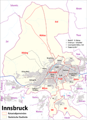
Инсбрук
- город, административный центр федеральной земли Тироль, Австрия
Hiking in Инсбрук
Innsbruck, located in the heart of the Austrian Alps, is a fantastic destination for hikers of all skill levels. Surrounded by stunning mountain ranges, including the Nordkette, Patscherkofel, and Axamer Lizum, there are numerous trails offering breathtaking views, diverse landscapes, and varying degrees of difficulty....
- Страна:
- Почтовый код: 6080; 6010–6040; 6020
- Телефонный код: 0512
- Код автомобильного номера: I
- Координаты: 47° 16' 0" N, 11° 23' 0" E
- GPS треки (wikiloc): [Ссылка]
- Высота над уровнем моря: 574 м m
- Площадь: 105 кв.км
- Население: 130894
- Веб сайт: [Ссылка]