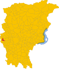
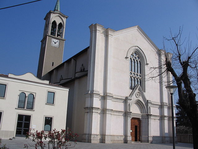
Сотто-иль-Монте-Джованни-XXIII (Sotto il Monte Giovanni XXIII, Sotto il Monte Giovanni XXIII)
.svg)
- коммуна Италии
 Hiking in Сотто-иль-Монте-Джованни-XXIII
Sotto il Monte Giovanni XXIII is a picturesque area located in the Lombardy region of Italy, known for its natural beauty, rolling hills, and historical significance, particularly as the birthplace of Pope John XXIII. Hiking in this area offers a blend of serene landscapes, cultural landmarks, and opportunities for various outdoor activities.
Hiking Trails
-
Nature Paths: There are multiple trails that meander through the countryside, featuring lush greenery, vineyards, and farms. These paths are generally well-marked and suitable for hikers of all levels.
-
Cultural Routes: Some hikes may take you past historical and religious sites, including churches and structures related to Pope John XXIII. These routes offer insight into the local history and culture.
-
Panoramic Views: The area is characterized by its hills, providing several vantage points with stunning views over the surrounding landscape, including the Alps on clear days.
Suggested Hikes
- Monte Bolognese: A popular hike that offers a moderate challenge, with rewarding views at the summit.
- The Greenway to Calusco d’Adda: This route connects Sotto il Monte to nearby towns while showcasing the natural beauty of the Adda river.
- Trail of the Saints: This scenic hike takes you through paths lined with chapels and small churches, rich in local history.
Hiking Tips
- Footwear: Wear appropriate hiking shoes for comfort and support on varied terrain.
- Weather: Check the weather before heading out, as conditions can change, especially in the mountains.
- Local Guides: Consider hiring a local guide for a more in-depth experience and to discover hidden gems.
- Hydration and Snacks: Bring plenty of water and snacks, particularly on longer hikes.
Nearby Attractions
- Bergamo: A nearby city known for its charming old town and historical sites.
- Campagnola Park: Offers a great spot for picnicking and relaxation after hiking.
- Cultural Events: Check for local festivals or events that may be happening during your visit for an immersive experience.
Hiking in Sotto il Monte Giovanni XXIII is not just about the physical activity; it’s also an opportunity to connect with nature and the local culture, making it a rewarding experience for all visitors.
- Страна:

- Почтовый код: 24039
- Телефонный код: 035
- Код автомобильного номера: BG
- Координаты: 45° 42' 26" N, 9° 29' 57" E


- GPS треки (wikiloc): [Ссылка]
- Высота над уровнем моря: 305 м m
- Площадь: 5.02 кв.км
- Население: 3864
- Веб сайт: http://www.comune.sottoilmontegiovannixxiii.bg.it
- Википедия русская: wiki(ru)
- Википедия английская: wiki(en)
- Википедия национальная: wiki(it)
- Хранилище Wikidata: Wikidata: Q101616
- Галерея изображений в википедии: [Ссылка]
- Катеория в википедии: [Ссылка]
- код Freebase: [/m/0cl9gy]
- код GeoNames: Альт: [6542163]
- код VIAF: Альт: [234237936]
- ID отношения в OpenStreetMap: [45789]
- место в MusicBrainz: [714587db-68d7-4638-9753-1760b26790ed]
- код TGN: [7039276]
- UN/LOCODE: [ITSNX]
- код ISTAT: 016203
- кадастровый код Италии: I869
Граничит с регионами:

Карвико
- коммуна Италии
Hiking in Карвико
Carvico, located in the Lombardy region of Italy, is a charming destination for hikers and nature enthusiasts. Situated near the stunning Orobie Alps and not far from the picturesque Lake Como, Carvico offers a variety of trails that cater to different skill levels, from leisurely walks to more challenging hikes....
- Страна:
- Почтовый код: 24030
- Телефонный код: 035
- Код автомобильного номера: BG
- Координаты: 45° 42' 0" N, 9° 29' 0" E
- GPS треки (wikiloc): [Ссылка]
- Высота над уровнем моря: 287 м m
- Площадь: 4.59 кв.км
- Население: 4659
- Веб сайт: [Ссылка]


Мапелло
- коммуна Италии
Hiking in Мапелло
Mapello, located in the Lombardy region of Italy, is a charming area that offers various opportunities for hiking enthusiasts. The landscape surrounding Mapello features rolling hills, woodlands, and scenic views of the surrounding mountains and countryside, making it a great destination for outdoor activities....
- Страна:
- Почтовый код: 24030
- Телефонный код: 035
- Код автомобильного номера: BG
- Координаты: 45° 42' 32" N, 9° 32' 52" E
- GPS треки (wikiloc): [Ссылка]
- Высота над уровнем моря: 255 м m
- Площадь: 8.66 кв.км
- Население: 6840
- Веб сайт: [Ссылка]


Понтида
- коммуна Италии
Hiking in Понтида
Pontida is a charming town located in the province of Bergamo, in the Lombardy region of northern Italy. It is situated near the foothills of the Italian Alps, which makes it an excellent base for hiking and outdoor activities. Here's what you should know about hiking in and around Pontida:...
- Страна:
- Почтовый код: 24030
- Телефонный код: 035
- Код автомобильного номера: BG
- Координаты: 45° 44' 2" N, 9° 30' 23" E
- GPS треки (wikiloc): [Ссылка]
- Высота над уровнем моря: 313 м m
- Площадь: 10.38 кв.км
- Население: 3358
- Веб сайт: [Ссылка]


Терно-д'Изола
- коммуна Италии
Hiking in Терно-д'Изола
Terno d'Isola is a charming town located in the province of Bergamo, Lombardy, Italy. While it’s not typically recognized as a primary hiking destination, the surrounding region offers some lovely trails and opportunities for outdoor activities. Here are some insights about hiking in and around Terno d'Isola:...
- Страна:
- Почтовый код: 24030
- Телефонный код: 035
- Код автомобильного номера: BG
- Координаты: 45° 41' 0" N, 9° 32' 0" E
- GPS треки (wikiloc): [Ссылка]
- Высота над уровнем моря: 299 м m
- Площадь: 4.13 кв.км
- Население: 8106
- Веб сайт: [Ссылка]

Амбивере
- коммуна Италии
Hiking in Амбивере
Ambivere, located in the Indian state of Karnataka, is a hidden gem for hiking enthusiasts. Nestled in the picturesque landscapes of the Western Ghats, this area offers a range of outdoor activities amid lush greenery, hills, and serene natural beauty. Here’s what you might want to know about hiking in Ambivere:...
- Страна:
- Почтовый код: 24030
- Телефонный код: 035
- Код автомобильного номера: BG
- Координаты: 45° 43' 4" N, 9° 32' 55" E
- GPS треки (wikiloc): [Ссылка]
- Высота над уровнем моря: 261 м m
- Площадь: 3.28 кв.км
- Население: 2348
- Веб сайт: [Ссылка]