Стаццона (Stazzona, Stazzona)
.svg)
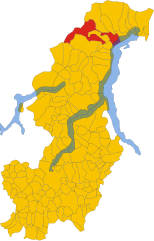
- коммуна Италии
 Hiking in Стаццона
Stazzona is a scenic area located in the Italian region of Lombardy, near the northern shores of Lake Como. Known for its stunning landscapes, charming villages, and diverse hiking trails, Stazzona offers outdoor enthusiasts a variety of options for exploration.
Hiking Trails
-
Sentiero del Viandante: This historical path runs along the eastern shore of Lake Como and provides breathtaking views of the lake and surrounding mountains. Along the way, you can discover small hamlets and lush forests.
-
Monte Giumello: For those looking for a moderate challenge, the hike to Monte Giumello offers panoramic views of the lake and surrounding peaks. The trailhead is easily accessible from Stazzona, and the ascent rewards hikers with stunning vistas.
-
Hiking in the Valchiavenna: Just a short distance from Stazzona, the Valchiavenna region features trails that cater to all skill levels. You can explore the valley, discover waterfalls, and enjoy the unique flora and fauna.
Best Times to Hike
The best time for hiking in this region is during the spring and fall when temperatures are mild, the landscape is lush, and you can avoid the summer crowds. Summer can also be a good time, but be prepared for heat and remember to bring enough water.
Preparation
- Gear: Make sure to wear sturdy hiking boots and weather-appropriate clothing. Always carry a map or a GPS device.
- Safety: Inform someone about your hiking plans and expected return time. It’s advisable to hike in groups if possible.
- Local Regulations: Respect local wildlife and environmental guidelines. Stay on marked trails, and avoid leaving any trash behind.
Conclusion
Hiking in Stazzona is a delightful experience filled with natural beauty and cultural richness. Whether you're exploring the lakeside paths or venturing into the mountains, you're sure to enjoy the stunning scenery and tranquility that this area has to offer.
- Страна:

- Почтовый код: 22010
- Телефонный код: 0344
- Код автомобильного номера: CO
- Координаты: 46° 8' 20" N, 9° 16' 31" E


- GPS треки (wikiloc): [Ссылка]
- Высота над уровнем моря: 540 м m
- Площадь: 7.29 кв.км
- Население: 604
- Веб сайт: http://www.comune.stazzona.co.it
- Википедия русская: wiki(ru)
- Википедия английская: wiki(en)
- Википедия национальная: wiki(it)
- Хранилище Wikidata: Wikidata: Q47485
- Катеория в википедии: [Ссылка]
- код Freebase: [/m/0gj1x_]
- код GeoNames: Альт: [6542518]
- ID отношения в OpenStreetMap: [46919]
- код ISTAT: 013218
- кадастровый код Италии: I943
Граничит с регионами:

Gravedona ed Uniti
- коммуна Италии
Hiking in Gravedona ed Uniti
Gravedona ed Uniti is a charming town located on the northern shores of Lake Como in Italy, known for its beautiful landscapes and rich history. Hiking in this area offers a variety of trails that cater to different skill levels, providing stunning views of the lake, surrounding mountains, and picturesque villages....
- Страна:
- Почтовый код: 22015
- Телефонный код: 0344
- Код автомобильного номера: CO
- Координаты: 46° 9' 0" N, 9° 18' 0" E
- GPS треки (wikiloc): [Ссылка]
- Высота над уровнем моря: 201 м m
- Площадь: 39.85 кв.км
- Население: 4198
- Веб сайт: [Ссылка]


Донго
- коммуна Италии
Hiking in Донго
Dongo, located in the Lombardy region of northern Italy along the shores of Lake Como, is a beautiful area for hiking and outdoor activities. Here are some key points and popular hiking opportunities in and around Dongo:...
- Страна:
- Почтовый код: 22014
- Телефонный код: 0344
- Код автомобильного номера: CO
- Координаты: 46° 7' 48" N, 9° 16' 54" E
- GPS треки (wikiloc): [Ссылка]
- Высота над уровнем моря: 208 м m
- Площадь: 7.04 кв.км
- Население: 3380
- Веб сайт: [Ссылка]