
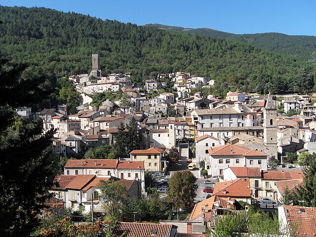
Сульмона (Sulmona, Sulmona)
.svg)
- коммуна Италии
 Hiking in Сульмона
Sulmona, located in the Abruzzo region of Italy, is renowned for its stunning landscapes and rich cultural heritage, making it a fantastic destination for hiking enthusiasts. The surrounding area offers a diverse range of trails, from gentle walks to challenging hikes, many of which provide breathtaking views of the Apennine Mountains and the beautiful countryside.
Hiking Trails
-
Parco Nazionale della Majella:
- This national park, not far from Sulmona, features numerous hiking trails that wind through rugged terrain, dense forests, and alpine meadows. Trails vary in difficulty, making it suitable for beginners and experienced hikers.
- Notable hikes in the park include the path to the Pizzo della Ventina, which offers stunning views, and the trail to the Eremo di San Bartolomeo in Legio, a hermitage nestled in the mountains.
-
Gole di San Venanzio:
- A less strenuous hike, this area features a beautiful gorge with scenic views, walking paths, and opportunities for photography. The river and surrounding cliffs create a picturesque natural setting.
-
Bagni di Romagna to Campo di Giove:
- This hike leads you through rich forests and hilly terrain, connecting Sulmona with Campo di Giove. It's a great option for those looking to explore the natural beauty while experiencing charming mountain villages.
Key Considerations
-
Season: The best time to hike in Sulmona and its surroundings is spring (April to June) and autumn (September to October) when the weather is pleasant, and the landscapes are particularly beautiful. Summer can be hot, while winter offers opportunities for snow-related activities such as snowshoeing and winter hiking.
-
Gear: Make sure to wear appropriate hiking boots and bring layers, as weather conditions can change rapidly in the mountains. Carry sufficient water, snacks, and a map or GPS.
-
Local Guides: If you're unfamiliar with the area or prefer a guided experience, consider hiring a local guide who can provide insights into the flora, fauna, and history of the region.
Overall, hiking in Sulmona offers a rich combination of natural beauty, cultural exploration, and outdoor adventure, making it a rewarding experience for hikers of all levels. Don’t forget to try some local cuisine and explore the charming streets of Sulmona itself after your hikes!
- Страна:

- Почтовый код: 67039
- Телефонный код: 0864
- Код автомобильного номера: AQ
- Координаты: 42° 2' 53" N, 13° 55' 34" E


- GPS треки (wikiloc): [Ссылка]
- Высота над уровнем моря: 405 м m
- Площадь: 58.33 кв.км
- Население: 24173
- Веб сайт: http://www.comune.sulmona.aq.it
- Википедия русская: wiki(ru)
- Википедия английская: wiki(en)
- Википедия национальная: wiki(it)
- Хранилище Wikidata: Wikidata: Q50157
- Галерея изображений в википедии: [Ссылка]
- Катеория в википедии: [Ссылка]
- Карты в википедии: [Ссылка]
- код Freebase: [/m/06k8gj]
- код GeoNames: Альт: [6540713]
- код BNF: [14538179p]
- код VIAF: Альт: [240930329]
- ID отношения в OpenStreetMap: [41721]
- идентификатор местоположения ArchINFORM: [870]
- код LCNAF: Альт: [n83031972]
- место в MusicBrainz: [7e375877-b8ac-425b-bbab-05ef66fa5389]
- код темы Quora: [Sulmona]
- UN/LOCODE: [ITSLP]
- код в энциклопедии «Британника онлайн»: [place/Sulmona]
- EMLO location ID: [10b8c65a-83b2-4515-b000-bbd83948151b]
- код Цифрового атласа Римской империи: [16755]
- dmoz: Альт: [Regional/Europe/Italy/Abruzzo/Localities/Sulmona/]
- Google Maps Customer ID: [5925025671325386833]
- код ISTAT: 066098
- кадастровый код Италии: I804
Граничит с регионами:


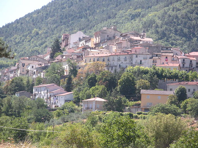
Буньяра
- коммуна Италии
Hiking in Буньяра
Bugnara is a small village located in the province of L'Aquila in the Abruzzo region of Italy, known for its stunning natural landscapes and outdoor activities, including hiking. The area is characterized by beautiful mountains, valleys, and a rich diversity of flora and fauna, making it an attractive destination for nature lovers and hikers....
- Страна:
- Почтовый код: 67030
- Телефонный код: 0864
- Код автомобильного номера: AQ
- Координаты: 42° 1' 29" N, 13° 51' 44" E
- GPS треки (wikiloc): [Ссылка]
- Высота над уровнем моря: 580 м m
- Площадь: 25.12 кв.км
- Население: 1106
- Веб сайт: [Ссылка]


Кансано
- коммуна Италии
Hiking in Кансано
Cansano is a quaint village situated in the Abruzzo region of Italy, known for its picturesque landscapes and access to a variety of hiking trails. The area is characterized by rolling hills, lush forests, and stunning mountain views, making it a fantastic destination for outdoor enthusiasts....
- Страна:
- Почтовый код: 67030
- Телефонный код: 0864
- Код автомобильного номера: AQ
- Координаты: 42° 0' 19" N, 14° 0' 46" E
- GPS треки (wikiloc): [Ссылка]
- Высота над уровнем моря: 835 м m
- Площадь: 37.7 кв.км
- Население: 244
- Веб сайт: [Ссылка]

Интродаккуа
- коммуна Италии
Hiking in Интродаккуа
Introdacqua is a charming village located in the Abruzzo region of Italy, known for its stunning natural landscapes and picturesque views. Hiking in this area offers a variety of trails that cater to different skill levels. Here are some highlights and tips for hiking around Introdacqua:...
- Страна:
- Почтовый код: 67030
- Телефонный код: 0864
- Код автомобильного номера: AQ
- Координаты: 42° 0' 30" N, 13° 53' 57" E
- GPS треки (wikiloc): [Ссылка]
- Высота над уровнем моря: 642 м m
- Площадь: 37.11 кв.км
- Население: 2101
- Веб сайт: [Ссылка]

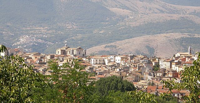
Пачентро
- коммуна Италии
Hiking in Пачентро
Pacentro, located in the Abruzzo region of Italy, is a charming hilltop village known for its stunning views, ancient architecture, and access to beautiful natural landscapes. Hiking in and around Pacentro offers a unique experience, blending culture, history, and nature....
- Страна:
- Почтовый код: 67030
- Телефонный код: 0864
- Код автомобильного номера: AQ
- Координаты: 42° 3' 2" N, 13° 59' 29" E
- GPS треки (wikiloc): [Ссылка]
- Высота над уровнем моря: 653 м m
- Площадь: 72.59 кв.км
- Население: 1140
- Веб сайт: [Ссылка]

Петторано-суль-Джицио
- коммуна Италии
Hiking in Петторано-суль-Джицио
Pettorano sul Gizio is a charming village located in the province of L'Aquila in the Abruzzo region of Italy. Surrounded by the beautiful Apennine mountains, it offers numerous hiking opportunities, showcasing stunning landscapes, rich biodiversity, and fascinating historical sites....
- Страна:
- Почтовый код: 67034
- Телефонный код: 0864
- Код автомобильного номера: AQ
- Координаты: 41° 58' 32" N, 13° 57' 35" E
- GPS треки (wikiloc): [Ссылка]
- Высота над уровнем моря: 625 м m
- Площадь: 62.85 кв.км
- Население: 1414
- Веб сайт: [Ссылка]

Пратола-Пелинья
- коммуна Италии
Hiking in Пратола-Пелинья
Pratola Peligna, located in the province of L’Aquila in the Abruzzo region of Italy, is a beautiful area known for its stunning landscapes and rich natural heritage. Here are some aspects to consider for hiking in this region:...
- Страна:
- Почтовый код: 67035
- Телефонный код: 0864
- Код автомобильного номера: AQ
- Координаты: 42° 5' 57" N, 13° 52' 29" E
- GPS треки (wikiloc): [Ссылка]
- Высота над уровнем моря: 342 м m
- Площадь: 28.67 кв.км
- Население: 7528
- Веб сайт: [Ссылка]


Прецца
- коммуна Италии
Hiking in Прецца
Prezza is a charming village located in the Abruzzo region of Italy, surrounded by beautiful landscapes that make it an excellent destination for hiking enthusiasts. Here’s what you need to know about hiking in and around Prezza:...
- Страна:
- Почтовый код: 67030
- Телефонный код: 0864
- Код автомобильного номера: AQ
- Координаты: 42° 3' 37" N, 13° 50' 8" E
- GPS треки (wikiloc): [Ссылка]
- Высота над уровнем моря: 480 м m
- Площадь: 21.6 кв.км
- Население: 940
- Веб сайт: [Ссылка]


Караманико-Терме
- коммуна Италии
Hiking in Караманико-Терме
Caramanico Terme is a charming village located in the Abruzzo region of Italy, renowned for its thermal springs and stunning natural beauty. It’s nestled in the Majella National Park, making it an excellent destination for hiking enthusiasts. Here are some key points about hiking in the area:...
- Страна:
- Почтовый код: 65023
- Телефонный код: 085
- Код автомобильного номера: PE
- Координаты: 42° 9' 0" N, 14° 1' 0" E
- GPS треки (wikiloc): [Ссылка]
- Высота над уровнем моря: 650 м m
- Площадь: 84.99 кв.км
- Население: 1872
- Веб сайт: [Ссылка]


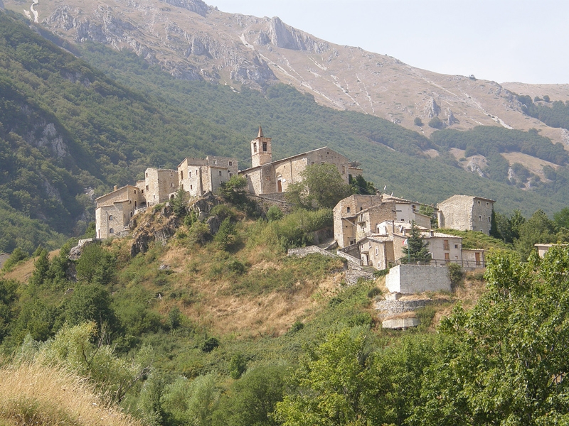
Салле
- коммуна Италии
Hiking in Салле
Salle, a charming village in the Abruzzo region of Italy, is surrounded by the stunning natural landscapes of the Majella National Park and the Gran Sasso and Monti della Laga National Park. This area offers a variety of hiking opportunities for all skill levels, featuring breathtaking views, rich biodiversity, and historical sites....
- Страна:
- Почтовый код: 65020
- Телефонный код: 085
- Код автомобильного номера: PE
- Координаты: 42° 10' 37" N, 13° 57' 35" E
- GPS треки (wikiloc): [Ссылка]
- Высота над уровнем моря: 450 м m
- Площадь: 21.8 кв.км
- Население: 291
- Веб сайт: [Ссылка]

Сант'Эуфемия-а-Маелла
- коммуна Италии
Hiking in Сант'Эуфемия-а-Маелла
Sant'Eufemia a Maiella is a beautiful village located in the Abruzzo region of Italy, surrounded by the stunning landscapes of the Maiella National Park. It's an excellent destination for hiking enthusiasts, offering a variety of trails that cater to different skill levels. Here are some key points to consider when hiking in this area:...
- Страна:
- Почтовый код: 65020
- Телефонный код: 085
- Код автомобильного номера: PE
- Координаты: 42° 7' 0" N, 14° 1' 0" E
- GPS треки (wikiloc): [Ссылка]
- Высота над уровнем моря: 878 м m
- Площадь: 40.42 кв.км
- Население: 263
- Веб сайт: [Ссылка]