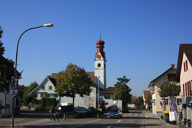
Тегериг (Tägerig, Tägerig)

 Hiking in Тегериг
Tägerig, located in the canton of Aargau in Switzerland, offers a variety of hiking opportunities that cater to different skill levels and preferences. The region is characterized by its beautiful landscapes, rolling hills, forests, and views of the nearby mountains. Here's an overview of what you can expect when hiking in Tägerig:
Hiking Trails:
-
Marked Trails: Tägerig has a network of well-marked hiking trails that guide you through the stunning countryside. These trails typically vary in difficulty, from easy family-friendly paths to more challenging hikes.
-
Scenic Routes: Many routes take you through picturesque villages, vineyards, and farmland. The trails might also lead along rivers and lakes, providing great photo opportunities.
-
Nature Reserves: The area around Tägerig includes nature reserves where you can enjoy the local flora and fauna. These spots are perfect for nature enthusiasts and birdwatchers.
Tips for Hiking in Tägerig:
- Dress Appropriately: The weather can change quickly, so wear layers and bring a waterproof jacket just in case.
- Stay Hydrated and Nourished: Always carry enough water and snacks to keep your energy levels up.
- Respect Nature: Stay on trails, follow local regulations, and pack out what you pack in to preserve the area.
- Prepare for Terrain: Some trails may have uneven or rugged sections; consider wearing sturdy hiking boots.
Additional Activities:
- Photography: The diverse landscapes and changing seasons make Tägerig an excellent spot for photography.
- Cultural Exploration: In addition to hiking, take time to explore local villages and enjoy regional cuisine in restaurants or during picnics.
Best Time to Hike:
- Spring and fall are particularly lovely for hiking, with mild temperatures and beautiful scenery. Summer can be warm, while winter may provide opportunities for snowshoing or winter hiking, depending on conditions.
Whether you're an experienced hiker looking for a challenging trail or a beginner seeking a leisurely walk, Tägerig and its surroundings offer something for everyone. Enjoy your hike!
- Страна:

- Почтовый код: 5522
- Телефонный код: 056
- Код автомобильного номера: AG
- Координаты: 47° 24' 14" N, 8° 16' 50" E


- GPS треки (wikiloc): [Ссылка]
- Высота над уровнем моря: 418 м m
- Площадь: 3.30 кв.км
- Население: 1521
- Веб сайт: http://www.taegerig.ch
- Википедия русская: wiki(ru)
- Википедия английская: wiki(en)
- Википедия национальная: wiki(de)
- Хранилище Wikidata: Wikidata: Q65190
- Катеория в википедии: [Ссылка]
- код Freebase: [/m/0fr0t7]
- код GeoNames: Альт: [7287274]
- код VIAF: Альт: [234846451]
- ID отношения в OpenStreetMap: [1684440]
- идентификатор HDS: [1676]
- код швейцарского муниципалитета: [4077]
Граничит с регионами:


Хеглинген
Hiking in Хеглинген
Hägglingen is a lovely area located in Switzerland, known for its beautiful landscapes and a variety of hiking trails suitable for all skill levels. Situated near the city of Aarau, it offers both scenic views and a peaceful natural environment....
- Страна:
- Почтовый код: 5607
- Телефонный код: 056
- Код автомобильного номера: AG
- Координаты: 47° 23' 24" N, 8° 15' 30" E
- GPS треки (wikiloc): [Ссылка]
- Высота над уровнем моря: 473 м m
- Площадь: 7.73 кв.км
- Население: 2421
- Веб сайт: [Ссылка]

Нидервиль
Hiking in Нидервиль
Niederwil, located in the Aargau region of Switzerland, offers several scenic hiking opportunities that showcase the beautiful landscapes of the area. The region features rolling hills, lush forests, and picturesque agricultural lands, making it ideal for both casual walkers and more experienced hikers....
- Страна:
- Почтовый код: 5524
- Телефонный код: 056
- Код автомобильного номера: AG
- Координаты: 47° 22' 49" N, 8° 17' 50" E
- GPS треки (wikiloc): [Ссылка]
- Высота над уровнем моря: 405 м m
- Площадь: 6.15 кв.км
- Население: 2840
- Веб сайт: [Ссылка]