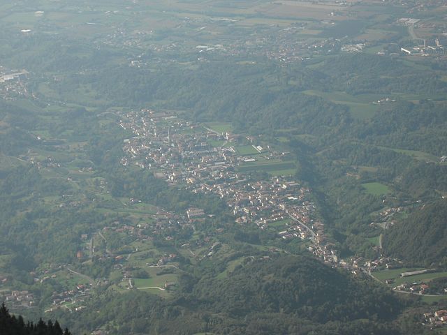
Тамбре (Tambre, Tambre)
.svg)
- коммуна Италии
 Hiking in Тамбре
Tambre, located in the Veneto region of Italy, is renowned for its stunning landscapes and outdoor activities, especially hiking. The hills and mountains in and around Tambre provide a variety of trails suitable for different skill levels, from leisurely walks to more challenging treks.
Key Highlights of Hiking in Tambre:
-
Scenic Trails: The area boasts numerous well-marked trails that lead hikers through picturesque landscapes, including dense forests, alpine meadows, and breathtaking mountain views, particularly of the Dolomites.
-
Variety of Routes: Whether you're looking for a short family-friendly walk or a longer trekking experience, Tambre offers a range of options. Trails can vary in difficulty, allowing beginners and experienced hikers alike to find suitable routes.
-
Natural Attractions: Hikes often lead to various natural attractions, including waterfalls, lakes, and panoramic viewpoints. The rich biodiversity in the area also makes it a great place for wildlife observation.
-
Local Culture: Some trails not only highlight natural beauty but also cultural landmarks, such as old farms, churches, and historic sites, giving you a taste of local traditions and history.
-
Seasonal Considerations: The best time for hiking in Tambre is generally late spring through early fall. Winter hikes may be challenging due to snow and ice, but they can offer a magical and different experience for those equipped for winter conditions.
-
Safety Tips: Always check the weather forecast before heading out, stay on marked paths, and carry enough water and snacks. Having a map or GPS device is also advisable, especially for unfamiliar areas.
-
Guided Tours: If you're new to hiking or want to explore the area more thoroughly, consider joining a guided hiking tour. Local guides can provide insights into the area's ecology, geology, and culture.
Before you go, it's recommended to check for any local regulations or trail closures, and always share your hiking plans with someone. Enjoy your adventure in Tambre!
- Страна:

- Почтовый код: 32010
- Телефонный код: 0437
- Код автомобильного номера: BL
- Координаты: 46° 8' 0" N, 12° 25' 0" E


- GPS треки (wikiloc): [Ссылка]
- Высота над уровнем моря: 922 м m
- Площадь: 45.27 кв.км
- Население: 1366
- Веб сайт: http://www.comune.tambre.bl.it
- Википедия русская: wiki(ru)
- Википедия английская: wiki(en)
- Википедия национальная: wiki(it)
- Хранилище Wikidata: Wikidata: Q40149
- Катеория в википедии: [Ссылка]
- код Freebase: [/m/0gk2c_]
- код GeoNames: Альт: [6543571]
- ID отношения в OpenStreetMap: [46794]
- код ISTAT: 025060
- кадастровый код Италии: L040
Граничит с регионами:


Кьес-д'Альпаго
- коммуна Италии
Hiking in Кьес-д'Альпаго
Chies d'Alpago is a beautiful destination for hiking enthusiasts, located in the Veneto region of northern Italy. Nestled in the Alps, this area offers stunning views, diverse landscapes, and a variety of trails suitable for all skill levels....
- Страна:
- Почтовый код: 32010
- Телефонный код: 0437
- Код автомобильного номера: BL
- Координаты: 46° 9' 21" N, 12° 23' 22" E
- GPS треки (wikiloc): [Ссылка]
- Высота над уровнем моря: 647 м m
- Площадь: 44.97 кв.км
- Население: 1328
- Веб сайт: [Ссылка]

Фрегона
- коммуна Италии
Hiking in Фрегона
Fregona, a charming village located in the Treviso region of Italy, offers several opportunities for hikers and outdoor enthusiasts. Nestled within the foothills of the Prealps, it's surrounded by beautiful landscapes, scenic trails, and historical sites....
- Страна:
- Почтовый код: 31010
- Телефонный код: 0438
- Код автомобильного номера: TV
- Координаты: 46° 0' 29" N, 12° 20' 19" E
- GPS треки (wikiloc): [Ссылка]
- Высота над уровнем моря: 251 м m
- Площадь: 42.72 кв.км
- Население: 2970
- Веб сайт: [Ссылка]


Авиано
- коммуна Италии
Hiking in Авиано
Aviano, located in the northeastern part of Italy, is surrounded by beautiful landscapes that offer numerous hiking opportunities for outdoor enthusiasts. Nestled near the Friuli Venezia Giulia region and the Dolomites, the area provides a mix of mountainous terrain, forests, and valleys, making it an excellent destination for hikers of all levels....
- Страна:
- Почтовый код: 33081
- Телефонный код: 0434
- Код автомобильного номера: PN
- Координаты: 46° 4' 0" N, 12° 35' 0" E
- GPS треки (wikiloc): [Ссылка]
- Высота над уровнем моря: 159 м m
- Площадь: 113.35 кв.км
- Население: 9080
- Веб сайт: [Ссылка]


Барчис
- коммуна Италии
Hiking in Барчис
Barcis is a picturesque village located in the Friuli Venezia Giulia region of northeastern Italy, surrounded by stunning natural landscapes, including mountains, lakes, and forests. Hiking in Barcis offers a fantastic opportunity to explore the beautiful surroundings and experience the region's rich biodiversity....
- Страна:
- Почтовый код: 33080
- Телефонный код: 0427
- Код автомобильного номера: PN
- Координаты: 46° 11' 0" N, 12° 34' 0" E
- GPS треки (wikiloc): [Ссылка]
- Высота над уровнем моря: 409 м m
- Площадь: 103.41 кв.км
- Население: 256
- Веб сайт: [Ссылка]


Будоя
- коммуна Италии
Hiking in Будоя
Budoia, a picturesque village located in the Friuli Venezia Giulia region of northeastern Italy, offers some beautiful hiking opportunities for outdoor enthusiasts. The surrounding landscape is marked by stunning views, rolling hills, and lush vegetation, making it a great place for both novice and experienced hikers....
- Страна:
- Почтовый код: 33070
- Телефонный код: 0434
- Код автомобильного номера: PN
- Координаты: 46° 3' 0" N, 12° 32' 0" E
- GPS треки (wikiloc): [Ссылка]
- Высота над уровнем моря: 135 м m
- Площадь: 37.36 кв.км
- Население: 2571
- Веб сайт: [Ссылка]
Канева
- коммуна Италии
Hiking in Канева
Caneva is a charming town located in the Province of Treviso in northern Italy, not far from the picturesque landscape of the Friuli Venezia Giulia region. The area is known for its beautiful countryside, vineyards, and proximity to the foothills of the Alps. While Caneva itself may not be as famous for hiking as some other locations, there are still several hiking opportunities in and around this region....
- Страна:
- Почтовый код: 33070
- Телефонный код: 0434
- Код автомобильного номера: PN
- Координаты: 45° 58' 0" N, 12° 27' 0" E
- GPS треки (wikiloc): [Ссылка]
- Высота над уровнем моря: 57 м m
- Площадь: 41.79 кв.км
- Население: 6339
- Веб сайт: [Ссылка]


Польчениго
- коммуна Италии
Hiking in Польчениго
Polcenigo is a charming village located in the Friuli Venezia Giulia region of Italy, known for its beautiful landscapes and varied hiking options. The area features rolling hills, lush greenery, and scenic views of the surrounding countryside, making it a great choice for outdoor enthusiasts....
- Страна:
- Почтовый код: 33070
- Телефонный код: 0434
- Код автомобильного номера: PN
- Координаты: 46° 2' 0" N, 12° 30' 0" E
- GPS треки (wikiloc): [Ссылка]
- Высота над уровнем моря: 42 м m
- Площадь: 49.69 кв.км
- Население: 3151
- Веб сайт: [Ссылка]