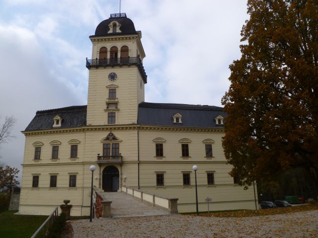
Тауфкирхен-на-Тратнахе (Taufkirchen an der Trattnach, Taufkirchen an der Trattnach)
 Hiking in Тауфкирхен-на-Тратнахе
Taufkirchen an der Trattnach is a charming municipality located in Upper Austria, known for its picturesque landscapes and access to various outdoor activities, including hiking. Here are some highlights and tips for hiking in the area:
Hiking Trails
-
Voralpenweg: This trail runs through the foothills of the Alps and offers stunning views of the surrounding landscape. Parts of the trail traverse near Taufkirchen, making it accessible for day trips.
-
Local Trails: There are several marked local hiking paths that take you through forests, meadows, and along the Trattnach river. These smaller trails can provide a more tranquil hiking experience.
-
Scenic Routes: Look for trails that lead to viewpoints or historical sites, such as old churches or local farms. These routes not only offer exercise but also a chance to experience the cultural richness of the area.
Best Times to Hike
- Spring and Fall: These seasons are ideal for hiking due to mild temperatures and beautiful landscapes. Spring brings blooming flowers, while fall showcases stunning foliage.
- Summer: The weather can be warm, making it a great time for longer hikes, but be prepared with plenty of water and sunscreen.
- Winter: Snowshoeing or winter hiking can be popular, but always check trail conditions and be equipped for winter weather.
Safety Tips
- Map and Compass: While many trails are marked, some can be less maintained. Carrying a map or GPS device is a good idea.
- Footwear: Wear sturdy hiking boots to handle various terrains, especially if you plan to venture onto less-traveled paths.
- Weather Awareness: Always check the weather conditions before heading out. The weather can change quickly in mountainous regions.
Local Attractions
- Cultural Sites: After a day on the trails, consider visiting local attractions such as churches and villages that highlight the region's heritage.
- Trattnach River: Many trails will lead you along the river, providing beautiful scenery and options for relaxing by the water.
Additional Resources
For detailed trail maps, local hiking groups, or guided hikes, check with the local tourism office or online forums dedicated to hiking in Upper Austria.
By exploring the hiking opportunities in Taufkirchen an der Trattnach, you can enjoy both the natural beauty and cultural richness of this lovely region of Austria!
- Страна:

- Почтовый код: 4715
- Телефонный код: 07734
- Код автомобильного номера: GR
- Координаты: 48° 14' 51" N, 13° 45' 0" E


- GPS треки (wikiloc): [Ссылка]
- Высота над уровнем моря: 377 м m
- Площадь: 24.6 кв.км
- Население: 1970
- Веб сайт: http://www.taufkirchen.at/
- Википедия русская: wiki(ru)
- Википедия английская: wiki(en)
- Википедия национальная: wiki(de)
- Хранилище Wikidata: Wikidata: Q686331
- Катеория в википедии: [Ссылка]
- код Freebase: [/m/03gv5ld]
- код GeoNames: Альт: [7873152]
- код VIAF: Альт: [241226068]
- код австрийского муниципалитета: [40829]
Граничит с регионами:
Толлет
Hiking in Толлет
Tollet, a beautiful region surrounded by stunning natural landscapes, offers a variety of hiking opportunities for enthusiasts of all skill levels. While specific trails and conditions may change, here are some general aspects to consider for hiking in Tollet:...
- Страна:
- Почтовый код: 4710
- Телефонный код: 07248
- Код автомобильного номера: GR
- Координаты: 48° 14' 44" N, 13° 48' 2" E
- GPS треки (wikiloc): [Ссылка]
- Высота над уровнем моря: 381 м m
- Площадь: 9.6 кв.км
- Население: 920
- Веб сайт: [Ссылка]
Пёттинг
Hiking in Пёттинг
Pötting, a small town or village in Austria, offers a variety of hiking opportunities that showcase the beautiful landscapes and natural surroundings of the region. Here are some key points to consider when planning a hiking trip in and around Pötting:...
- Страна:
- Почтовый код: 4720
- Телефонный код: 07733
- Код автомобильного номера: GR
- Координаты: 48° 17' 0" N, 13° 46' 27" E
- GPS треки (wikiloc): [Ссылка]
- Высота над уровнем моря: 381 м m
- Площадь: 7.4 кв.км
- Население: 541
- Веб сайт: [Ссылка]

Санкт-Георген-Грискирхен
Hiking in Санкт-Георген-Грискирхен
Sankt Georgen bei Grieskirchen, located in the beautiful Upper Austria region, is a charming destination for hikers. The surrounding area boasts a variety of trails that cater to different skill levels, making it a great spot for both beginners and experienced hikers....
- Страна:
- Почтовый код: 4710
- Телефонный код: 07248
- Код автомобильного номера: GR
- Координаты: 48° 12' 45" N, 13° 46' 47" E
- GPS треки (wikiloc): [Ссылка]
- Высота над уровнем моря: 396 м m
- Площадь: 11.41 кв.км
- Население: 1336
- Веб сайт: [Ссылка]
Ноймаркт
- община в Австрии, Верхняя Австрия, Грискирхен
Hiking in Ноймаркт
Neumarkt im Hausruckkreis, located in the Upper Austria region of Austria, is a great destination for hiking enthusiasts. The area is characterized by its beautiful natural landscapes, rolling hills, forests, and charming small villages, making it an excellent location for outdoor activities....
- Страна:
- Почтовый код: 4720
- Телефонный код: 07733
- Код автомобильного номера: GR
- Координаты: 48° 16' 27" N, 13° 43' 35" E
- GPS треки (wikiloc): [Ссылка]
- Высота над уровнем моря: 388 м m
- Площадь: 2.11 кв.км
- Население: 1465
- Веб сайт: [Ссылка]

Кальхам
Hiking in Кальхам
Kallham, located in Austria, is a charming area known for its beautiful landscapes and outdoor recreational opportunities, including hiking. Here are some highlights you might find interesting if you are considering hiking in the Kallham region:...
- Страна:
- Почтовый код: 4720
- Телефонный код: 07733
- Код автомобильного номера: GR
- Координаты: 48° 17' 2" N, 13° 42' 53" E
- GPS треки (wikiloc): [Ссылка]
- Высота над уровнем моря: 397 м m
- Площадь: 26.7 кв.км
- Население: 2498
- Веб сайт: [Ссылка]

Хофкирхен-на-Тратнахе
Hiking in Хофкирхен-на-Тратнахе
Hofkirchen an der Trattnach is a charming village located in the Austrian state of Upper Austria. It offers a peaceful environment and scenic landscapes, making it a great place for hiking enthusiasts....
- Страна:
- Почтовый код: 47115
- Телефонный код: 07734
- Код автомобильного номера: GR
- Координаты: 48° 13' 11" N, 13° 44' 24" E
- GPS треки (wikiloc): [Ссылка]
- Высота над уровнем моря: 389 м m
- Площадь: 1798 кв.км
- Население: 1667
- Веб сайт: [Ссылка]
Вендлинг
Hiking in Вендлинг
Wendling is a quaint village in the Breckland area of Norfolk, England, known for its picturesque landscapes and natural beauty. While it may not be as widely recognized as some other hiking destinations, it offers a variety of walking trails and scenic routes for outdoor enthusiasts....
- Страна:
- Почтовый код: 4741
- Телефонный код: 07736
- Код автомобильного номера: GR
- Координаты: 48° 13' 51" N, 13° 40' 0" E
- GPS треки (wikiloc): [Ссылка]
- Высота над уровнем моря: 400 м m
- Площадь: 12.9 кв.км
- Население: 838
- Веб сайт: [Ссылка]