
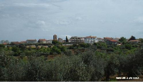
Термоли (Termoli, Termoli)
.svg)
- коммуна Италии
 Hiking in Термоли
Termoli is a charming coastal town located in the Molise region of Italy, known for its beautiful beaches, historic architecture, and stunning views of the Adriatic Sea. While Termoli itself may not be renowned specifically for hiking, there are several opportunities for outdoor enthusiasts in the surrounding areas and nearby countryside. Here are some highlights for hiking in and around Termoli:
Local Highlights:
-
Termoli’s Old Town: While not a traditional hiking experience, exploring the narrow streets of the old town, with its stunning medieval walls and castles, can be a pleasant way to stretch your legs. Don’t miss the Swabian Castle and the Cathedral of Santa Maria della Vittoria.
-
Coastal Walks: The promenade along Termoli's beachfront offers a leisurely walk with beautiful sea views. You can stroll along the sandy beaches and enjoy the refreshing sea breeze.
Nearby Hiking Opportunities:
-
National Park of Abruzzo, Lazio, and Molise: Located less than two hours from Termoli, this national park offers a vast range of hiking trails through picturesque forests, mountains, and valleys. You can experience wildlife, such as wolves and deer, as well as stunning landscapes.
-
Gargano National Park: A bit further away (about an hour and a half by car), this park features rugged coastlines, dramatic cliffs, and dense forests. The trek along the coast or through the Foresta Umbra (Umbra Forest) offers various trails suitable for all levels.
-
History and Nature Trails: The area around Termoli has various trails that connect historical sites and natural wonders. Check for local guided tours that can give you insight into the history and biodiversity of the region.
Tips for Hiking Near Termoli:
- Weather: Always check the local weather forecast before heading out, as conditions can change rapidly in coastal regions.
- Footwear: Wear comfortable, sturdy footwear suitable for hiking.
- Hydration and Snacks: Carry enough water and some snacks to keep your energy up while hiking.
- Local Maps: Consider getting a map or a hiking app that can help you navigate the trails in the area.
Whether you're looking for a leisurely stroll along the coast or a challenging hike in the nearby national parks, Termoli serves as a great base for exploring the natural beauty of the Molise region and beyond. Enjoy your outdoor adventures!
- Страна:

- Почтовый код: 86039
- Телефонный код: 0875
- Код автомобильного номера: CB
- Координаты: 42° 0' 10" N, 14° 59' 41" E


- GPS треки (wikiloc): [Ссылка]
- Высота над уровнем моря: 15 м m
- Площадь: 55.64 кв.км
- Население: 33583
- Веб сайт: http://www.comune.termoli.cb.it/
- Википедия русская: wiki(ru)
- Википедия английская: wiki(en)
- Википедия национальная: wiki(it)
- Хранилище Wikidata: Wikidata: Q118642
- Галерея изображений в википедии: [Ссылка]
- Катеория в википедии: [Ссылка]
- код Freebase: [/m/03_p3_]
- код GeoNames: Альт: [6541934]
- код VIAF: Альт: [129026053]
- ID отношения в OpenStreetMap: [41671]
- код темы Quora: [Termoli]
- UN/LOCODE: [ITTMI]
- код в Большой каталанской энциклопедии: [0065661]
- код Цифрового атласа Римской империи: [29123]
- код ISTAT: 070078
- кадастровый код Италии: L113
Граничит с регионами:


Кампомарино
- коммуна Италии
Hiking in Кампомарино
Campomarino is a charming coastal town located in the Molise region of Italy, known for its beautiful beaches, historical sites, and proximity to nature. While it may not be as famous for hiking as other regions in Italy, there are certainly opportunities for outdoor enthusiasts to explore the surrounding areas. Here are some aspects to consider if you're thinking about hiking in and around Campomarino:...
- Страна:
- Почтовый код: 86042
- Телефонный код: 0875
- Код автомобильного номера: CB
- Координаты: 41° 57' 24" N, 15° 2' 4" E
- GPS треки (wikiloc): [Ссылка]
- Высота над уровнем моря: 52 м m
- Площадь: 76.68 кв.км
- Население: 8074
- Веб сайт: [Ссылка]


Гульонези
- коммуна Италии
Hiking in Гульонези
Guglionesi is a charming village located in the Molise region of Italy, surrounded by beautiful countryside and rolling hills, making it a great destination for hiking enthusiasts. Here's what you can expect when hiking in and around Guglionesi:...
- Страна:
- Почтовый код: 86034
- Телефонный код: 0875
- Код автомобильного номера: CB
- Координаты: 41° 55' 0" N, 14° 55' 0" E
- GPS треки (wikiloc): [Ссылка]
- Высота над уровнем моря: 369 м m
- Площадь: 100.95 кв.км
- Население: 5246
- Веб сайт: [Ссылка]


Петаччато
- коммуна Италии
Hiking in Петаччато
Petacciato is a small town located in the Molise region of Italy, known for its beautiful landscapes, rolling hills, and proximity to the Adriatic Sea. Hiking in and around Petacciato can provide a wonderful experience for outdoor enthusiasts, with options for various skill levels. Here are some aspects to consider:...
- Страна:
- Почтовый код: 86038
- Телефонный код: 0875
- Код автомобильного номера: CB
- Координаты: 42° 1' 0" N, 14° 52' 0" E
- GPS треки (wikiloc): [Ссылка]
- Высота над уровнем моря: 225 м m
- Площадь: 35.4 кв.км
- Население: 3811
- Веб сайт: [Ссылка]
Портоканноне
- коммуна Италии
Hiking in Портоканноне
Portocannone is a small town located in the Molise region of Italy, known for its picturesque landscapes and proximity to both the Adriatic coast and the Apennine Mountains. While it may not be as well-known as some other hiking destinations in Italy, the area offers opportunities for outdoor enthusiasts to enjoy hiking amidst natural beauty and local culture....
- Страна:
- Почтовый код: 86045
- Телефонный код: 0875
- Код автомобильного номера: CB
- Координаты: 41° 55' 0" N, 15° 1' 0" E
- GPS треки (wikiloc): [Ссылка]
- Высота над уровнем моря: 148 м m
- Площадь: 13.11 кв.км
- Население: 2490
- Веб сайт: [Ссылка]

Сан-Джакомо-дельи-Скьявони
- коммуна Италии
Hiking in Сан-Джакомо-дельи-Скьявони
San Giacomo degli Schiavoni is a small town located in the Molise region of Italy, and while it may not be as widely known for hiking as some of the larger national parks or mountainous areas in the country, it offers a unique and beautiful landscape that can be enjoyable for hikers....
- Страна:
- Почтовый код: 86030
- Телефонный код: 0875
- Код автомобильного номера: CB
- Координаты: 41° 58' 0" N, 14° 57' 0" E
- GPS треки (wikiloc): [Ссылка]
- Высота над уровнем моря: 169 м m
- Площадь: 11.08 кв.км
- Население: 1406
- Веб сайт: [Ссылка]