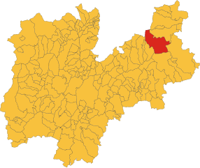
Тезеро (Tesero, Tesero)
%202018.svg)
- коммуна Италии
 Hiking in Тезеро
Tesero, located in the Fiemme Valley of the Trentino-Alto Adige region in northern Italy, is a great destination for hikers due to its stunning alpine scenery and a network of well-maintained trails. Here are some key points to consider for hiking in Tesero:
Trail Options
-
Alpine Trails: The area offers a variety of trails ranging from easy walks to challenging hikes. The surrounding Dolomites provide scenic routes with breathtaking views of mountains and valleys.
-
Lago di Tesero: A popular route for families, this trail takes you around the picturesque lake, which is perfect for a leisurely stroll, offering many spots for picnicking.
-
Cermis Mountain: Accessible from Tesero, Cermis offers various trails. The hike up to the top rewards you with beautiful panoramas. You can also take a cable car if you prefer a less strenuous ascent.
-
Val di Fiemme Trail: This is a longer trail that connects several villages in the valley, showcasing the beautiful natural landscape along the way.
-
Wildlife and Nature: Watch for local wildlife, including deer, chamois, and a variety of bird species. The flora is equally diverse, and you can enjoy seeing different wildflowers depending on the season.
Best Time to Hike
- Summer (June to September): This is the prime hiking season when trails are fully accessible, and weather conditions are generally mild.
- Fall (October): For those who enjoy autumn foliage, hiking in early to mid-October can be rewarding, but be cautious as weather can change rapidly.
Hiking Tips
-
Gear Up: Wear sturdy hiking boots and bring plenty of water and snacks. A good map or GPS device can also enhance your hiking experience.
-
Weather Awareness: The weather in the mountains can change quickly, so it’s wise to check forecasts and be prepared for varying conditions.
-
Respect Nature: Stick to marked trails to preserve the natural environment and avoid disturbing wildlife.
Local Amenities
Tesero offers various amenities for hikers, including accommodations (hotels, chalets), restaurants that serve local cuisine, and shops where you can purchase hiking gear and supplies.
Overall, hiking in Tesero is an exciting experience for both novice and experienced hikers, with the added charm of the breathtaking Italian Alps. Whether you're interested in a leisurely walk or a challenging trek, you'll find something to enjoy in this beautiful area.
- Страна:

- Почтовый код: 38038
- Телефонный код: 0462
- Код автомобильного номера: TN
- Координаты: 46° 17' 22" N, 11° 30' 41" E


- GPS треки (wikiloc): [Ссылка]
- Высота над уровнем моря: 1000 м m
- Площадь: 50.55 кв.км
- Население: 2940
- Веб сайт: http://www.comune.tesero.tn.it/
- Википедия русская: wiki(ru)
- Википедия английская: wiki(en)
- Википедия национальная: wiki(it)
- Хранилище Wikidata: Wikidata: Q327161
- Катеория в википедии: [Ссылка]
- код Freebase: [/m/0gb0_7]
- код GeoNames: Альт: [6538224]
- код VIAF: Альт: [235739515]
- ID отношения в OpenStreetMap: [47037]
- код TGN: [7005488]
- UN/LOCODE: [ITTSO]
- код ISTAT: 022196
- кадастровый код Италии: L147
Граничит с регионами:


Кавалезе
- коммуна Италии
Hiking in Кавалезе
Cavalese, located in the Fiemme Valley in the Trentino-Alto Adige region of northern Italy, is a popular destination for hiking enthusiasts. The area is known for its stunning natural landscapes, including the Dolomites, lush forests, and picturesque meadows. Here are some highlights and recommendations for hiking in Cavalese:...
- Страна:
- Почтовый код: 38033
- Телефонный код: 0462
- Код автомобильного номера: TN
- Координаты: 46° 17' 0" N, 11° 28' 0" E
- GPS треки (wikiloc): [Ссылка]
- Высота над уровнем моря: 1000 м m
- Площадь: 45.38 кв.км
- Население: 4075
- Веб сайт: [Ссылка]
Панкия
- коммуна Италии
Hiking in Панкия
Panchià is a picturesque village located in the Trentino-Alto Adige region of northern Italy, nestled in the Val di Fiemme. It offers a variety of hiking opportunities for outdoor enthusiasts, with trails that range from easy walks to more challenging hikes suitable for all skill levels. Here are some key points to consider when hiking in and around Panchià:...
- Страна:
- Почтовый код: 38030
- Телефонный код: 0462
- Код автомобильного номера: TN
- Координаты: 46° 17' 9" N, 11° 32' 31" E
- GPS треки (wikiloc): [Ссылка]
- Высота над уровнем моря: 981 м m
- Площадь: 20.21 кв.км
- Население: 837


Пьеве-Тезино
- коммуна Италии
Hiking in Пьеве-Тезино
Pieve Tesino is a charming village located in the Trentino region of northern Italy, surrounded by the stunning landscapes of the Italian Alps. It serves as an excellent base for hiking enthusiasts due to its access to numerous trails and natural beauty. Here are some key points to consider when hiking in this area:...
- Страна:
- Почтовый код: 38050
- Телефонный код: 0461
- Код автомобильного номера: TN
- Координаты: 46° 4' 0" N, 11° 37' 0" E
- GPS треки (wikiloc): [Ссылка]
- Высота над уровнем моря: 843 м m
- Площадь: 69.23 кв.км
- Население: 656
- Веб сайт: [Ссылка]

Предаццо
- коммуна Италии
Hiking in Предаццо
Predazzo is a beautiful town located in the Val di Fiemme in the Trentino region of northern Italy. It's a great destination for hiking enthusiasts, offering a variety of trails that cater to different skill levels, stunning landscapes, and rich biodiversity....
- Страна:
- Почтовый код: 38037
- Телефонный код: 0462
- Код автомобильного номера: TN
- Координаты: 46° 19' 0" N, 11° 36' 0" E
- GPS треки (wikiloc): [Ссылка]
- Высота над уровнем моря: 1018 м m
- Площадь: 109.97 кв.км
- Население: 4540
- Веб сайт: [Ссылка]


Варена
- коммуна Италии
Hiking in Варена
Varena is a beautiful village located in the Trentino region of northern Italy, nestled in the Val di Fiemme valley. It's an excellent destination for hiking enthusiasts, offering a variety of trails that cater to different skill levels and showcasing the stunning Dolomitic landscapes and majestic alpine scenery....
- Страна:
- Почтовый код: 38030
- Телефонный код: 0462
- Код автомобильного номера: TN
- Координаты: 46° 18' 18" N, 11° 27' 32" E
- GPS треки (wikiloc): [Ссылка]
- Высота над уровнем моря: 1175 м m
- Площадь: 23.07 кв.км
- Население: 841
- Веб сайт: [Ссылка]


Нова-Поненте
- коммуна Италии
Hiking in Нова-Поненте
Deutschnofen, known as "Naz-Sciaves" in Italian, is a charming village located in the South Tyrol region of northern Italy. Nestled in the stunning Dolomites, it offers a variety of hiking opportunities for enthusiasts of all levels. Here are some highlights of hiking in this beautiful area:...
- Страна:
- Почтовый код: 39050
- Телефонный код: 0471
- Код автомобильного номера: BZ
- Координаты: 46° 24' 51" N, 11° 25' 31" E
- GPS треки (wikiloc): [Ссылка]
- Высота над уровнем моря: 1357 м m
- Площадь: 112.49 кв.км
- Население: 3917
- Веб сайт: [Ссылка]