Таур (Thaur, Thaur)
 Hiking in Таур
Thaur, a small municipality located near Innsbruck in Tyrol, Austria, offers a variety of hiking opportunities set against the stunning backdrop of the Alps. The area is characterized by its beautiful landscapes, cultural heritage, and proximity to both gentle hills and more challenging alpine terrain, making it suitable for hikers of all skill levels.
Hiking Trails
-
Thaurer Alm: This is one of the most popular hiking destinations in the area. The trail to Thaurer Alm is relatively easy and suitable for families. Along the way, you’ll enjoy picturesque views of the surrounding mountains and the chance to refresh at the Alm with traditional Tyrolean food.
-
Greifenburg Castle: A moderately challenging hike takes you to the ruins of Greifenburg, where you can enjoy panoramic views of the Inn Valley and the surrounding peaks. The trail varies in difficulty, offering both easier and more challenging sections.
-
Nordkette Mountain Range: If you’re looking for more challenging hikes, the Nordkette Range, located nearby, offers a variety of trails, some leading to high-altitude paths with spectacular views of Innsbruck and the surrounding valleys.
-
Local Nature Trails: There are several marked nature trails around Thaur that provide insights into the local flora and fauna. These trails are generally easier and perfect for leisurely walks and enjoying the natural beauty.
Best Time to Hike
-
Spring (April to June): The weather is mild, and wildflowers are in bloom. However, some trails may still be snow-covered in early spring.
-
Summer (July to August): This is the peak season for hiking. The weather is warm and most trails are accessible. Be prepared for potential thunderstorms in the afternoons.
-
Autumn (September to October): The fall colors provide a stunning backdrop for hiking. The weather is generally stable, making it a great time for outdoor activities.
-
Winter (November to March): While hiking can be challenging due to snow, there are also opportunities for snowshoe hikes and winter trekking in the area.
Tips for Hiking in Thaur
-
Check Trail Conditions: Always check for the latest information on trail conditions, especially in shoulder seasons when weather can change rapidly.
-
Wear Proper Gear: Good hiking boots, weather-appropriate clothing, and a backpack with essentials (water, snacks, first-aid kit) are crucial for a safe hike.
-
Stay Hydrated: Bring plenty of water, especially on warmer days or longer hikes.
-
Respect Nature: Stick to marked trails to help preserve the natural environment and avoid damaging local wildlife habitats.
-
Inform Someone: Let someone know your planned route and expected return time, especially if you are hiking alone.
Hiking in Thaur offers not just physical activity but also a chance to connect with the stunning natural landscape and enjoy the Tyrolean culture. Whether you’re searching for an easy family walk or a strenuous mountain trek, Thaur has something to offer!
- Страна:

- Почтовый код: 6065
- Телефонный код: 05223
- Код автомобильного номера: IL
- Координаты: 47° 17' 42" N, 11° 28' 19" E


- GPS треки (wikiloc): [Ссылка]
- Высота над уровнем моря: 633 м m
- Площадь: 21.1 кв.км
- Население: 3979
- Веб сайт: http://www.thaur.tirol.gv.at/
- Википедия русская: wiki(ru)
- Википедия английская: wiki(en)
- Википедия национальная: wiki(de)
- Хранилище Wikidata: Wikidata: Q694309
- Катеория в википедии: [Ссылка]
- код Freebase: [/m/02w05k2]
- код GeoNames: Альт: [2763715]
- код VIAF: Альт: [151705850]
- код GND: Альт: [4129932-2]
- идентификатор местоположения ArchINFORM: [11151]
- код LCNAF: Альт: [nr89010077]
- код австрийского муниципалитета: [70358]
- код Цифрового атласа Римской империи: [17656]
- код Pleiades: [187584]
Граничит с регионами:

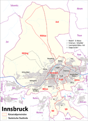
Инсбрук
- город, административный центр федеральной земли Тироль, Австрия
Hiking in Инсбрук
Innsbruck, located in the heart of the Austrian Alps, is a fantastic destination for hikers of all skill levels. Surrounded by stunning mountain ranges, including the Nordkette, Patscherkofel, and Axamer Lizum, there are numerous trails offering breathtaking views, diverse landscapes, and varying degrees of difficulty....
- Страна:
- Почтовый код: 6080; 6010–6040; 6020
- Телефонный код: 0512
- Код автомобильного номера: I
- Координаты: 47° 16' 0" N, 11° 23' 0" E
- GPS треки (wikiloc): [Ссылка]
- Высота над уровнем моря: 574 м m
- Площадь: 105 кв.км
- Население: 130894
- Веб сайт: [Ссылка]