Тиченго (Ticengo, Ticengo)
.svg)
- коммуна Италии
 Hiking in Тиченго
Ticengo is a quaint town located in the Lombardy region of Italy, and while it may not be as widely known as some larger destinations, it offers beautiful landscapes nearby that are ideal for hiking enthusiasts. Here are some tips and insights regarding hiking in and around Ticengo:
Local Trails
-
Nature Reserves and Parks: Explore nearby natural reserves, such as the Po River Park, which offers a variety of trails suitable for different skill levels. The park features a mix of wetlands, forests, and river paths.
-
Typical Routes: Look for routes that lead to scenic spots, like riverbanks or viewpoints overlooking the countryside. Shorter walks can also be found that cater to families and casual hikers.
Scenic Views
- The hiking trails in this region often provide stunning views of the Italian countryside, characterized by fields, orchards, and small villages. Don't forget your camera!
Preparation
-
Gear: Ensure you have appropriate hiking gear, such as good hiking shoes, weather-appropriate clothing, and a hat for sun protection.
-
Essentials: Bring along plenty of water, snacks, a map or GPS device, and a first-aid kit. Local trails may not have easy access to amenities.
-
Language: While Italian is the main language spoken, you may find that some locals can communicate in English. It helps to know a few basic Italian phrases.
Best Time to Hike
- The best times for hiking in Ticengo are typically in the spring (April to June) and fall (September to October) when temperatures are mild and the weather is generally pleasant.
Local Regulations
- Always check for local trail regulations, such as permitted hours, whether dogs are allowed, and any necessary permits for accessing certain areas.
Enjoying Local Culture
- After a hike, consider visiting local eateries to taste traditional Lombard cuisine. Exploring the town of Ticengo itself can also be a rewarding experience.
Safety Tips
- Always inform someone about your hiking plans, especially if you are going into lesser-known trails.
- It is advisable to hike in groups for safety and to stay on marked trails to preserve the natural environment.
Overall, Ticengo and its surroundings offer opportunities for hikers looking to experience the serene beauty of the Italian landscape while enjoying local culture and cuisine. Happy hiking!
- Страна:

- Почтовый код: 26010
- Телефонный код: 0374
- Код автомобильного номера: CR
- Координаты: 45° 22' 0" N, 9° 50' 0" E


- GPS треки (wikiloc): [Ссылка]
- Высота над уровнем моря: 76 м m
- Площадь: 7.98 кв.км
- Население: 443
- Веб сайт: http://www.comuneticengo.gov.it/
- Википедия русская: wiki(ru)
- Википедия английская: wiki(en)
- Википедия национальная: wiki(it)
- Хранилище Wikidata: Wikidata: Q42277
- Катеория в википедии: [Ссылка]
- код Freebase: [/m/0gj_71]
- код GeoNames: Альт: [6536582]
- ID отношения в OpenStreetMap: [44820]
- UN/LOCODE: [ITTIC]
- код ISTAT: 019104
- кадастровый код Италии: L164
Граничит с регионами:
Романенго
- коммуна Италии
Hiking in Романенго
Romanengo is a charming village located in the province of Cremona, Northern Italy. While the area is not widely known for extensive hiking trails compared to more mountainous regions of Italy, it does offer some opportunities for enjoyable walks and hikes in the surrounding countryside....
- Страна:
- Почтовый код: 26014
- Телефонный код: 0373
- Код автомобильного номера: CR
- Координаты: 45° 23' 0" N, 9° 47' 0" E
- GPS треки (wikiloc): [Ссылка]
- Высота над уровнем моря: 81 м m
- Площадь: 15.05 кв.км
- Население: 3071
- Веб сайт: [Ссылка]


Куминьяно-суль-Навильо
- коммуна Италии
Hiking in Куминьяно-суль-Навильо
Cumignano sul Naviglio is a small town located in the Lombardy region of Italy, near the Naviglio River. While it may not be as famous for hiking as some other Italian destinations, it offers a peaceful environment with charming landscapes that can still provide a pleasant experience for nature lovers and hikers....
- Страна:
- Почтовый код: 26020
- Телефонный код: 0374
- Код автомобильного номера: CR
- Координаты: 45° 21' 0" N, 9° 50' 0" E
- GPS треки (wikiloc): [Ссылка]
- Высота над уровнем моря: 73 м m
- Площадь: 6.77 кв.км
- Население: 448
- Веб сайт: [Ссылка]
Сальвирола
- коммуна Италии
Hiking in Сальвирола
Salvirola, though a small town in the Lombardy region of northern Italy, offers a picturesque backdrop for hiking enthusiasts. Surrounded by the beautiful landscapes of the Po Valley, it provides access to various trails that highlight the natural beauty and cultural sights of the area....
- Страна:
- Почтовый код: 26010
- Телефонный код: 0373
- Код автомобильного номера: CR
- Координаты: 45° 21' 0" N, 9° 47' 0" E
- GPS треки (wikiloc): [Ссылка]
- Высота над уровнем моря: 74 м m
- Площадь: 7.36 кв.км
- Население: 1163
- Веб сайт: [Ссылка]
Казалетто-ди-Сопра
- коммуна Италии
Hiking in Казалетто-ди-Сопра
Casaletto di Sopra is a charming area located in the Italian region of Lombardy, near Lake Como. It serves as a great base for hiking enthusiasts looking to explore the beautiful landscapes of the surrounding hills and mountains. Here’s some information to help you plan your hiking adventure in this picturesque region:...
- Страна:
- Почтовый код: 26014
- Телефонный код: 0373
- Код автомобильного номера: CR
- Координаты: 45° 25' 0" N, 9° 47' 0" E
- GPS треки (wikiloc): [Ссылка]
- Высота над уровнем моря: 87 м m
- Площадь: 8.66 кв.км
- Население: 557
- Веб сайт: [Ссылка]
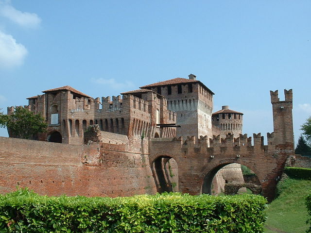

Сончино
- коммуна Италии
Hiking in Сончино
Soncino, located in the Lombardy region of northern Italy, is primarily known for its historical architecture, beautiful countryside, and the picturesque views of the surrounding areas. While it may not be as well-known as some of the more prominent hiking destinations in Lombardy, it does offer some opportunities for walking and hiking enthusiasts to explore the scenic landscapes....
- Страна:
- Почтовый код: 26029
- Телефонный код: 0374
- Код автомобильного номера: CR
- Координаты: 45° 24' 0" N, 9° 52' 0" E
- GPS треки (wikiloc): [Ссылка]
- Высота над уровнем моря: 89 м m
- Площадь: 45.32 кв.км
- Население: 7665
- Веб сайт: [Ссылка]