Куминьяно-суль-Навильо (Cumignano sul Naviglio, Cumignano sul Naviglio)
.svg)
- коммуна Италии
 Hiking in Куминьяно-суль-Навильо
Cumignano sul Naviglio is a small town located in the Lombardy region of Italy, near the Naviglio River. While it may not be as famous for hiking as some other Italian destinations, it offers a peaceful environment with charming landscapes that can still provide a pleasant experience for nature lovers and hikers.
Hiking Opportunities:
-
Naviglio River Trails: The area around the Naviglio River features scenic trails that are ideal for leisurely walks or more serious hikes. You can enjoy the tranquility of the riverbanks and the surrounding countryside, with plenty of opportunities to observe local wildlife.
-
Nearby Nature Areas: While Cumignano itself might not have extensive hiking trails, the nearby Parco del Mincio and Parco Agricolo Sud Milano offer a variety of paths that cater to different skill levels. These parks are rich in biodiversity and feature beautiful landscapes.
-
Central Lombardy Region: Cumignano is situated in a region that provides access to the larger hiking trails of the Italian Alps to the north, as well as the picturesque hills of Franciacorta and the Oglio River Park, which can be reached with a short drive.
Tips for Hiking in the Area:
- Prepare for Varying Terrain: The trails range from easy to moderate, so make sure to wear appropriate footwear and clothing.
- Check Local Maps: Before heading out, look for local maps that highlight trails and points of interest. The town may have information centers or local hiking clubs that can provide insights.
- Stay Hydrated: Always carry enough water, especially if you plan on hiking during the warmer months.
- Wildlife Watching: Bring binoculars if you’re interested in birdwatching or spotting other wildlife in the area.
Conclusion:
While not a major hiking destination, Cumignano sul Naviglio offers a serene environment with access to beautiful trails in the nearby region. It can be a great place for those looking to escape the hustle and bustle of larger tourist areas and enjoy simple, scenic hikes through the Italian countryside.
- Страна:

- Почтовый код: 26020
- Телефонный код: 0374
- Код автомобильного номера: CR
- Координаты: 45° 21' 0" N, 9° 50' 0" E


- GPS треки (wikiloc): [Ссылка]
- Высота над уровнем моря: 73 м m
- Площадь: 6.77 кв.км
- Население: 448
- Веб сайт: http://www.cumignano.gov.it
- Википедия русская: wiki(ru)
- Википедия английская: wiki(en)
- Википедия национальная: wiki(it)
- Хранилище Wikidata: Wikidata: Q42680
- Катеория в википедии: [Ссылка]
- код Freebase: [/m/0gjyws]
- код GeoNames: Альт: [6536573]
- ID отношения в OpenStreetMap: [44731]
- код ISTAT: 019039
- кадастровый код Италии: D203
Граничит с регионами:


Тиченго
- коммуна Италии
Hiking in Тиченго
Ticengo is a quaint town located in the Lombardy region of Italy, and while it may not be as widely known as some larger destinations, it offers beautiful landscapes nearby that are ideal for hiking enthusiasts. Here are some tips and insights regarding hiking in and around Ticengo:...
- Страна:
- Почтовый код: 26010
- Телефонный код: 0374
- Код автомобильного номера: CR
- Координаты: 45° 22' 0" N, 9° 50' 0" E
- GPS треки (wikiloc): [Ссылка]
- Высота над уровнем моря: 76 м m
- Площадь: 7.98 кв.км
- Население: 443
- Веб сайт: [Ссылка]
Триголо
- коммуна Италии
Hiking in Триголо
Trigolo is a small town located in the Lombardy region of Italy, and while it may not be widely known as a hiking destination, the region around it offers beautiful landscapes and trails for outdoor enthusiasts. Here are some aspects to consider if you're interested in hiking in and around Trigolo:...
- Страна:
- Почтовый код: 26018
- Телефонный код: 0374
- Код автомобильного номера: CR
- Координаты: 45° 19' 39" N, 9° 49' 2" E
- GPS треки (wikiloc): [Ссылка]
- Высота над уровнем моря: 70 м m
- Площадь: 16.06 кв.км
- Население: 1731
- Веб сайт: [Ссылка]


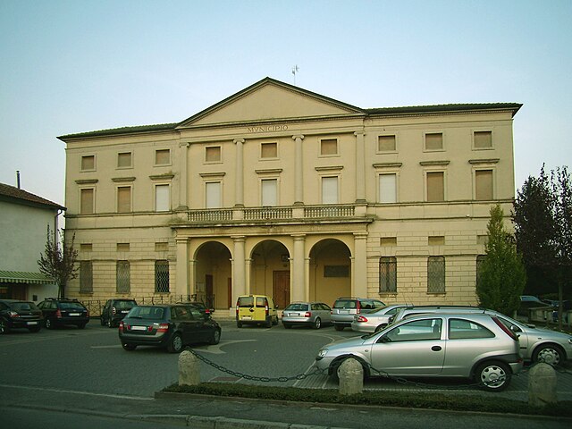
Сорезина
- коммуна Италии
Hiking in Сорезина
Soresina, located in the Lombardy region of Italy, is primarily known for its agricultural landscape and historical significance rather than traditional hiking trails. However, there are several options for enjoying the outdoors and exploring the surrounding areas....
- Страна:
- Почтовый код: 26015
- Телефонный код: 0374
- Код автомобильного номера: CR
- Координаты: 45° 17' 17" N, 9° 51' 31" E
- GPS треки (wikiloc): [Ссылка]
- Высота над уровнем моря: 45 м m
- Площадь: 28.57 кв.км
- Население: 8948
- Веб сайт: [Ссылка]
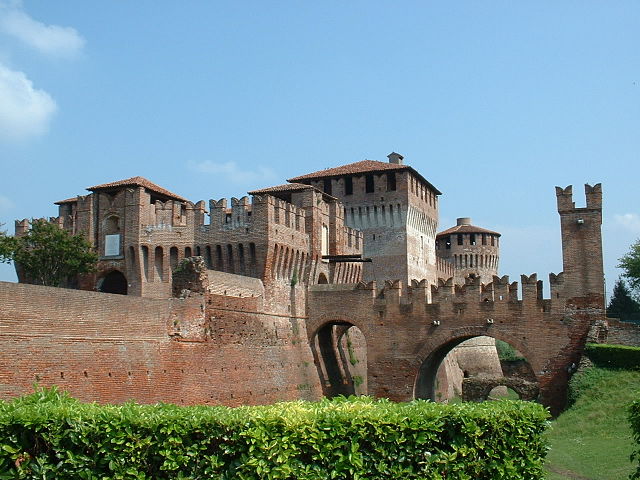

Сончино
- коммуна Италии
Hiking in Сончино
Soncino, located in the Lombardy region of northern Italy, is primarily known for its historical architecture, beautiful countryside, and the picturesque views of the surrounding areas. While it may not be as well-known as some of the more prominent hiking destinations in Lombardy, it does offer some opportunities for walking and hiking enthusiasts to explore the scenic landscapes....
- Страна:
- Почтовый код: 26029
- Телефонный код: 0374
- Код автомобильного номера: CR
- Координаты: 45° 24' 0" N, 9° 52' 0" E
- GPS треки (wikiloc): [Ссылка]
- Высота над уровнем моря: 89 м m
- Площадь: 45.32 кв.км
- Население: 7665
- Веб сайт: [Ссылка]

Дженивольта
- коммуна Италии
Hiking in Дженивольта
Genivolta, located in Italy, is surrounded by beautiful landscapes ideal for hiking. The area boasts rolling hills, picturesque views, and various trails catering to different experience levels....
- Страна:
- Почтовый код: 26020
- Телефонный код: 0374
- Код автомобильного номера: CR
- Координаты: 45° 20' 0" N, 9° 53' 0" E
- GPS треки (wikiloc): [Ссылка]
- Высота над уровнем моря: 70 м m
- Площадь: 18.57 кв.км
- Население: 1196
- Веб сайт: [Ссылка]