Топпенштедт (Toppenstedt, Toppenstedt)

 Hiking in Топпенштедт
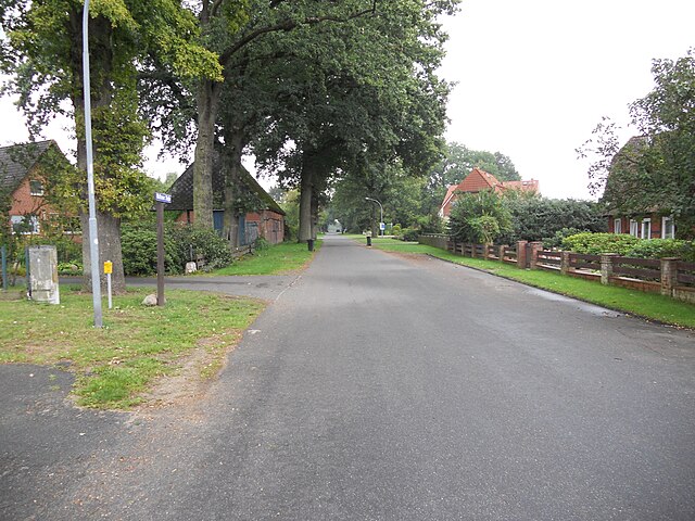
Toppenstedt is a small town located in Lower Saxony, Germany, and while it may not be as widely known for hiking as some larger regions, it offers a lovely environment for nature enthusiasts and hikers.
Hiking in Toppenstedt:
-
Scenic Trails: The area around Toppenstedt is characterized by picturesque landscapes, including forests, fields, and charming villages. You can find several well-marked walking paths that allow hikers to enjoy the natural beauty and tranquility of the region.
-
Nature Reserves: The nearby nature reserves provide opportunities for various hiking routes where you can observe local flora and fauna. The gentle terrain is suitable for both novice and seasoned hikers.
-
Regional Parks: Explore paths that connect to larger regional parks or natural areas in Lower Saxony. These parks often have longer trails that can be explored in day hikes or weekend excursions. The Lüneburg Heath (Lüneburger Heide) is one such area that can be accessed from Toppenstedt, known for its unique heath landscapes and wild ponies.
-
Local Culture: While hiking, you may encounter charming homes and traditional architecture, adding an interesting cultural dimension to your hikes. Stopping in local cafes or shops can provide a nice break and a chance to experience the local culture.
-
Accessibility: Toppenstedt is easily accessible by car or public transportation from larger towns nearby, making it a convenient starting point for day hikes.
Recommendations:
- Map and Guide: Always carry a map or use a hiking app. The local tourist information center can provide maps and information about recommended trails.
- Weather Preparation: Be prepared for changing weather, and wear appropriate hiking gear.
- Stay Hydrated: Carry enough water, especially if you plan to hike for several hours.
- Wildlife Awareness: Respect local wildlife and stay on marked paths to protect the environment.
Overall, hiking in Toppenstedt offers a peaceful escape into nature, perfect for those looking to explore the serene landscapes of Lower Saxony. Enjoy your hike!
- Страна:

- Почтовый код: 21442
- Телефонный код: 04173
- Код автомобильного номера: WL
- Координаты: 53° 16' 0" N, 10° 6' 0" E


- GPS треки (wikiloc): [Ссылка]
- Высота над уровнем моря: 35 м m
- Площадь: 29.09 кв.км
- Население: 2191
- Веб сайт: http://www.salzhausen.de/
- Википедия русская: wiki(ru)
- Википедия английская: wiki(en)
- Википедия национальная: wiki(de)
- Хранилище Wikidata: Wikidata: Q640065
- Катеория в википедии: [Ссылка]
- код Freebase: [/m/02ryf0w]
- код Freebase: [/m/02ryf0w]
- код GeoNames: Альт: [2821843]
- код GeoNames: Альт: [2821843]
- код VIAF: Альт: [308192037]
- код VIAF: Альт: [308192037]
- ID отношения в OpenStreetMap: [335213]
- ID отношения в OpenStreetMap: [335213]
- код GND: Альт: [1049995953]
- код GND: Альт: [1049995953]
- WOEID: [699663]
- WOEID: [699663]
- код TGN: [7067853]
- код TGN: [7067853]
- идентификатор муниципалитетов в Германии: 03353034
- идентификатор муниципалитетов в Германии: 03353034
Включает регионы:
Tangendorf
Hiking in Tangendorf
Tangendorf is a small village located near Toppenstedt in Lower Saxony, Germany, and while it may not be widely recognized as a hiking destination, it offers a charming setting for outdoor activities. The surrounding area features picturesque landscapes, including forests, fields, and gentle hills, making it suitable for hiking enthusiasts who enjoy a serene environment....
- Страна:
- Почтовый код: 21442
- Телефонный код: 04173
- Координаты: 53° 17' 40" N, 10° 5' 47" E
- GPS треки (wikiloc): [Ссылка]
- Высота над уровнем моря: 35 м m