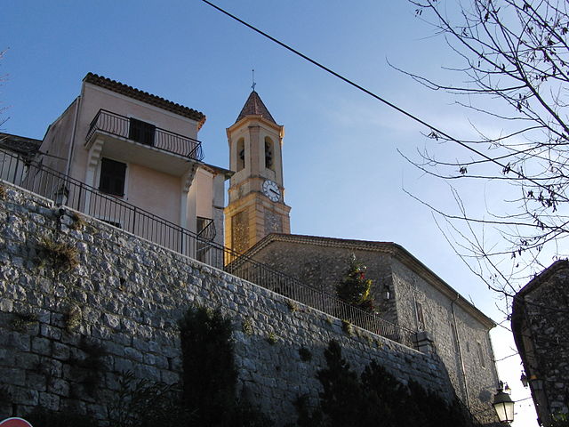
Турет-Леван (Tourrette-Levens, Tourrette-Levens)

- коммуна в департаменте Приморские Альпы, регион Прованс — Альпы — Лазурный Берег, Франция
 Hiking in Турет-Леван
Tourrette-Levens is a charming commune located in the Alpes-Maritimes region of southeastern France, not far from Nice. It offers a delightful mix of hiking opportunities, showcasing stunning Mediterranean landscapes, hills, and views over the surrounding areas.
Hiking Trails and Opportunities
-
Le Sentier du Loup:
- A picturesque trail that takes you through beautiful natural scenery. It provides a moderate hike suitable for various levels and allows you to appreciate the local flora and fauna.
-
Mont Chauve:
- A popular hiking destination offering panoramic views of the coastline and Nice. The ascent is more challenging, but the breathtaking vistas make it worthwhile.
-
The Villages Circuit:
- This route connects Tourrette-Levens with nearby villages. It’s a great way to experience the local culture and architecture while enjoying a pleasant hike.
-
Nature Reserves and Parks:
- Explore nearby nature reserves, which often have designated trails. These locales typically feature diverse wildlife and unique plant species.
Best Time to Hike
- Spring (April to June): Ideal for wildflowers and mild temperatures.
- Fall (September to October): Offers cooler weather and stunning autumn colors.
- Summer (July to August): Be prepared for high temperatures; start early to avoid the heat, and carry plenty of water.
Tips for Hiking in Tourrette-Levens
- Stay Hydrated: Always bring water, especially during warmer months.
- Wear Appropriate Footwear: Good hiking boots with grip are essential for varied terrain.
- Check Weather Conditions: Mountain weather can change rapidly; be prepared for sudden shifts.
- Respect Nature: Stick to marked trails to minimize your impact on the environment.
- Local Maps: Consider picking up local maps or guides, as trails can sometimes be less marked.
Conclusion
Tourrette-Levens offers a wonderful setting for hiking enthusiasts looking for scenic routes and a taste of the local culture. Whether you prefer an easy stroll or a more challenging hike, you can find a suitable trail in this beautiful region. Enjoy your time exploring the natural beauty and stunning views it has to offer!
- Страна:

- Почтовый код: 06690
- Координаты: 43° 47' 12" N, 7° 16' 33" E


- GPS треки (wikiloc): [Ссылка]
- Площадь: 16.5 кв.км
- Население: 4877
- Веб сайт: http://www.tourrette-levens.org/
- Википедия русская: wiki(ru)
- Википедия английская: wiki(en)
- Википедия национальная: wiki(fr)
- Хранилище Wikidata: Wikidata: Q1018274
- Катеория в википедии: [Ссылка]
- код Freebase: [/m/03m4z6m]
- код Freebase: [/m/03m4z6m]
- код GeoNames: Альт: [6425691]
- код GeoNames: Альт: [6425691]
- номер SIREN: [210601472]
- номер SIREN: [210601472]
- код VIAF: Альт: [123307088]
- код VIAF: Альт: [123307088]
- код тезауруса PACTOLS: [pcrtlkRkwyZjN8]
- код тезауруса PACTOLS: [pcrtlkRkwyZjN8]
- WOEID: [628968]
- WOEID: [628968]
- код муниципалитета INSEE: 06147
- код муниципалитета INSEE: 06147
Граничит с регионами:


Сен-Блез
- коммуна в департаменте Приморские Альпы, регион Прованс — Альпы — Лазурный Берег, Франция
Hiking in Сен-Блез
Saint-Blaise, situated in the Alpes-Maritimes region of France, offers a beautiful backdrop for hiking enthusiasts. Nestled near Nice and the Mediterranean coast, it provides not only stunning views but also a variety of trails suitable for different skill levels....
- Страна:
- Почтовый код: 06670
- Координаты: 43° 49' 18" N, 7° 14' 15" E
- GPS треки (wikiloc): [Ссылка]
- Площадь: 8.04 кв.км
- Население: 1013


Левенс
- коммуна в департаменте Приморские Альпы, регион Прованс — Альпы — Лазурный Берег, Франция
Hiking in Левенс
Levens, a small commune in the Alpes-Maritimes department in the Provence-Alpes-Côte d'Azur region of France, offers beautiful hiking opportunities surrounded by picturesque landscapes, including mountains and valleys. Here are some key highlights about hiking in and around Levens:...
- Страна:
- Почтовый код: 06670
- Координаты: 43° 51' 39" N, 7° 13' 28" E
- GPS треки (wikiloc): [Ссылка]
- Площадь: 29.85 кв.км
- Население: 4741

Кастанье
- коммуна в департаменте Приморские Альпы, регион Прованс — Альпы — Лазурный Берег, Франция
Hiking in Кастанье
Castagniers is a charming village located in the Alpes-Maritimes region of France, not far from Nice. It offers a mix of scenic views, cultural heritage, and well-marked hiking trails that cater to all levels of hikers....
- Страна:
- Почтовый код: 06670
- Координаты: 43° 47' 29" N, 7° 13' 54" E
- GPS треки (wikiloc): [Ссылка]
- Площадь: 7.52 кв.км
- Население: 1575
- Веб сайт: [Ссылка]

Аспремон
- коммуна в департаменте Приморские Альпы, регион Прованс — Альпы — Лазурный Берег, Франция
Hiking in Аспремон
Aspremont, located in the Alpes-Maritimes department in the Provence-Alpes-Côte d'Azur region of France, offers a variety of hiking opportunities with stunning views and a rich natural environment. Nestled in the foothills near Nice, this area provides a blend of beautiful landscape, historical sites, and a taste of local culture....
- Страна:
- Почтовый код: 06790
- Координаты: 43° 47' 0" N, 7° 14' 39" E
- GPS треки (wikiloc): [Ссылка]
- Площадь: 9.44 кв.км
- Население: 2139
- Веб сайт: [Ссылка]


Ницца
- коммуна в департаменте Приморские Альпы, регион Прованс — Альпы — Лазурный Берег, Франция
- Страна:
- Почтовый код: 06000
- Телефонный код: 493
- Координаты: 43° 42' 7" N, 7° 16' 6" E
- GPS треки (wikiloc): [Ссылка]
- Высота над уровнем моря: 10 м m
- Площадь: 71.92 кв.км
- Население: 342522
- Веб сайт: [Ссылка]


Бендежён
- коммуна в департаменте Приморские Альпы, регион Прованс — Альпы — Лазурный Берег, Франция
Hiking in Бендежён
Bendejun is a charming village located in the Alpes-Maritimes department in southeastern France, near Nice and the French Riviera. It's a great location for hiking enthusiasts who enjoy exploring the natural beauty of the region as well as its historical and cultural sites. Here are some points to consider when hiking in and around Bendejun:...
- Страна:
- Почтовый код: 06390
- Координаты: 43° 50' 8" N, 7° 17' 42" E
- GPS треки (wikiloc): [Ссылка]
- Площадь: 6.35 кв.км
- Население: 958


Сент-Андре-де-ла-Рош
- коммуна в департаменте Приморские Альпы, регион Прованс — Альпы — Лазурный Берег, Франция
Hiking in Сент-Андре-де-ла-Рош
Saint-André-de-la-Roche is a charming commune located in the Alpes-Maritimes department in the Provence-Alpes-Côte d'Azur region of France, just above Nice. The area is surrounded by beautiful natural landscapes, making it a great location for hiking enthusiasts....
- Страна:
- Почтовый код: 06730
- Координаты: 43° 44' 24" N, 7° 17' 16" E
- GPS треки (wikiloc): [Ссылка]
- Площадь: 2.86 кв.км
- Население: 5420

Кантарон
- коммуна в департаменте Приморские Альпы, регион Прованс — Альпы — Лазурный Берег, Франция
Hiking in Кантарон
Cantaron is a charming village located in the Alpes-Maritimes department of southeastern France, near Nice. It's a fantastic destination for hiking enthusiasts, offering a mix of scenic trails, beautiful landscapes, and a rich cultural experience. Here are some highlights regarding hiking in and around Cantaron:...
- Страна:
- Почтовый код: 06340
- Координаты: 43° 45' 42" N, 7° 19' 7" E
- GPS треки (wikiloc): [Ссылка]
- Площадь: 7.38 кв.км
- Население: 1337
- Веб сайт: [Ссылка]


Фаликон
- коммуна в департаменте Приморские Альпы, регион Прованс — Альпы — Лазурный Берег, Франция
Hiking in Фаликон
Falicon is a charming village located in the Alpes-Maritimes department in the Provence-Alpes-Côte d'Azur region of France, just northeast of Nice. It is known for its picturesque landscapes and beautiful views of the French Riviera. Hiking in and around Falicon offers a wonderful opportunity to explore nature, enjoy stunning vistas, and experience the local environment....
- Страна:
- Почтовый код: 06950
- Координаты: 43° 44' 56" N, 7° 16' 47" E
- GPS треки (wikiloc): [Ссылка]
- Площадь: 5.17 кв.км
- Население: 1974
- Веб сайт: [Ссылка]


Шатонёф-Вильвьей
- коммуна в департаменте Приморские Альпы, регион Прованс — Альпы — Лазурный Берег, Франция
Hiking in Шатонёф-Вильвьей
Châteauneuf-Villevieille is a picturesque village located in the Provence-Alpes-Côte d'Azur region of France, nestled in the hills of the Alpes-Maritimes. It offers a range of hiking opportunities that showcase the stunning natural landscapes, Mediterranean flora, and quaint views of the surrounding countryside....
- Страна:
- Почтовый код: 06390
- Координаты: 43° 48' 30" N, 7° 17' 47" E
- GPS треки (wikiloc): [Ссылка]
- Высота над уровнем моря: 650 м m
- Площадь: 8.38 кв.км
- Население: 913
- Веб сайт: [Ссылка]