
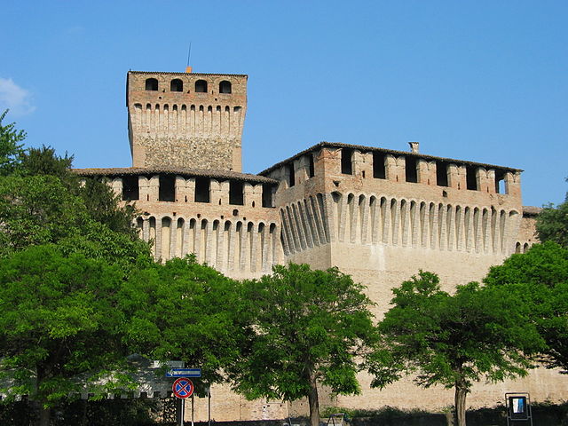
Траверсетоло (Traversetolo, Traversetolo)
.svg)
- коммуна Италии
 Hiking in Траверсетоло
Traversetolo is a picturesque municipality located in the Emilia-Romagna region of Italy, surrounded by beautiful landscapes, rolling hills, and a rich variety of outdoor activities, including hiking. Although it may not be as well-known as some other Italian hiking destinations, it offers some delightful trails that allow you to experience the local flora, fauna, and stunning views of the surrounding countryside.
Hiking Trails
-
Monte Penna: This is a popular hiking destination near Traversetolo. The trail to the summit offers stunning views of the surrounding hills and valleys. The hike generally takes a couple of hours, making it suitable for both beginner and intermediate hikers.
-
Parco dei Boschi di Carrega: Located a short drive from Traversetolo, this park features several marked trails that meander through the woods. The park is known for its biodiversity, offering a chance to spot various wildlife and plant species.
-
Strada dei Vini e dei Sapori: This scenic route not only allows for hiking but also introduces hikers to local wines and foods. You can combine your hiking experience with stops at local vineyards and farms.
-
Local Explorations: Smaller trails around Traversetolo can lead you to charming villages, historical sites, and hidden gems of nature. Exploring these paths offers a unique way to immerse yourself in the local culture.
Preparation and Tips
-
Equipment: Wear sturdy hiking boots and bring plenty of water, snacks, a map (or GPS), and a first-aid kit. Depending on the season, dress in layers to accommodate changing weather conditions.
-
Weather: The best time for hiking in the area is typically from late spring to early autumn. Summers can be warm, while winters may bring snow to the higher trails.
-
Local Guidance: Consider joining a local hiking group or hiring a guide if you are unfamiliar with the area. This can enhance your experience and ensure safety.
-
Respect Nature: Follow the "Leave No Trace" principles by staying on marked trails, properly disposing of waste, and respecting wildlife.
Traversetolo's serene landscapes and nearby attractions make it a lovely place for a hiking adventure in Italy. Whether you're looking for a day hike or a more extended exploration, you'll find a welcoming environment and beautiful scenery.
- Страна:

- Почтовый код: 43029
- Телефонный код: 0521
- Код автомобильного номера: PR
- Координаты: 44° 38' 24" N, 10° 22' 54" E


- GPS треки (wikiloc): [Ссылка]
- Высота над уровнем моря: 176 м m
- Площадь: 54.86 кв.км
- Население: 9474
- Веб сайт: http://www.comune.traversetolo.pr.it/
- Википедия русская: wiki(ru)
- Википедия английская: wiki(en)
- Википедия национальная: wiki(it)
- Хранилище Wikidata: Wikidata: Q100962
- Катеория в википедии: [Ссылка]
- код Freebase: [/m/0gkf31]
- код GeoNames: Альт: [6540413]
- код VIAF: Альт: [132230578]
- ID отношения в OpenStreetMap: [43365]
- код темы Quora: [Traversetolo]
- UN/LOCODE: [ITZVQ]
- код ISTAT: 034042
- кадастровый код Италии: L346
Граничит с регионами:


Лезиньяно-де-Баньи
- коммуна Италии
Hiking in Лезиньяно-де-Баньи
Lesignano de' Bagni is a small municipality located in the province of Parma, in the Emilia-Romagna region of northern Italy. It is known for its beautiful landscapes, rolling hills, and natural hot springs, which are often associated with spa tourism....
- Страна:
- Почтовый код: 43037
- Телефонный код: 0521
- Код автомобильного номера: PR
- Координаты: 44° 38' 35" N, 10° 17' 58" E
- GPS треки (wikiloc): [Ссылка]
- Высота над уровнем моря: 252 м m
- Площадь: 47.49 кв.км
- Население: 5005
- Веб сайт: [Ссылка]

Монтекьяруголо
- коммуна Италии
Hiking in Монтекьяруголо
Montechiarugolo, located in the Emilia-Romagna region of northern Italy, is known for its beautiful landscapes, rolling hills, and rich history. While it may not be as famous for hiking as some other regions in Italy, it offers several opportunities for outdoor activities and exploration....
- Страна:
- Почтовый код: 43022
- Телефонный код: 0521
- Код автомобильного номера: PR
- Координаты: 44° 41' 36" N, 10° 25' 21" E
- GPS треки (wikiloc): [Ссылка]
- Высота над уровнем моря: 128 м m
- Площадь: 48.2 кв.км
- Население: 10976
- Веб сайт: [Ссылка]


Невьяно-дельи-Ардуини
- коммуна Италии
Hiking in Невьяно-дельи-Ардуини
Neviano degli Arduini is a charming village located in the province of Parma, within the Emilia-Romagna region of Italy. Nestled in the Apennine Mountains, it offers a variety of hiking opportunities that highlight the natural beauty of the area, including forests, rolling hills, and scenic views....
- Страна:
- Почтовый код: 43024
- Телефонный код: 0521
- Код автомобильного номера: PR
- Координаты: 44° 35' 0" N, 10° 19' 0" E
- GPS треки (wikiloc): [Ссылка]
- Высота над уровнем моря: 517 м m
- Площадь: 105.96 кв.км
- Население: 3607
- Веб сайт: [Ссылка]


Каносса
- коммуна Италии
Hiking in Каносса
Canossa, located in the Apennine Mountains of Italy, is a region steeped in history and natural beauty, making it a wonderful destination for hiking enthusiasts. Here are some key points about hiking in Canossa:...
- Страна:
- Почтовый код: 42026
- Телефонный код: 0522
- Код автомобильного номера: RE
- Координаты: 44° 34' 25" N, 10° 27' 19" E
- GPS треки (wikiloc): [Ссылка]
- Высота над уровнем моря: 219 м m
- Площадь: 53.08 кв.км
- Население: 3762
- Веб сайт: [Ссылка]


Сан-Поло-д'Энца
- коммуна Италии
Hiking in Сан-Поло-д'Энца
San Polo d'Enza is a charming village located in the Emilia-Romagna region of Italy, nestled between the Apennine mountains and the Po Valley. It's a great starting point for hikers looking to explore the natural beauty of this area, which is characterized by rolling hills, lush forests, and scenic vistas....
- Страна:
- Почтовый код: 42020
- Телефонный код: 0522
- Код автомобильного номера: RE
- Координаты: 44° 38' 0" N, 10° 26' 0" E
- GPS треки (wikiloc): [Ссылка]
- Высота над уровнем моря: 174 м m
- Площадь: 32.29 кв.км
- Население: 6156
- Веб сайт: [Ссылка]


Парма
- коммуна Италии
Hiking in Парма
Parma, located in northern Italy, is not just known for its rich culinary heritage, but it also offers beautiful hiking opportunities in its surroundings. The region is characterized by rolling hills, lush landscapes, and a variety of trails suitable for different levels of hikers....
- Страна:
- Почтовый код: 43121–43126
- Телефонный код: 0521
- Код автомобильного номера: PR
- Координаты: 44° 48' 5" N, 10° 19' 41" E
- GPS треки (wikiloc): [Ссылка]
- Высота над уровнем моря: 55 м m
- Площадь: 260.6 кв.км
- Население: 194417
- Веб сайт: [Ссылка]