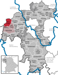
Трифенштайн (Triefenstein, Triefenstein)

 Hiking in Трифенштайн
Triefenstein, a quaint village located in the district of Main-Spessart in Bavaria, Germany, is surrounded by beautiful natural landscapes that make it an excellent spot for hiking enthusiasts. The region offers a variety of trails suitable for different skill levels, from leisurely walks to more challenging hikes.
Popular Hiking Trails:
-
Spessart Nature Park Trails: The nearby Spessart region is famous for its dense forests, rolling hills, and diverse wildlife. There are numerous trails that wind through this protected area, offering breathtaking views and the chance to experience the local flora and fauna.
-
Main Loop Trail: Following the Main River, this loop trail is perfect for those who enjoy scenic river views and a relatively flat landscape. The trail is great for families, and you can spot various outdoor activities along the riverbanks.
-
Historical Trails: Some trails around Triefenstein focus on the area's cultural and historical significance. These routes often pass by old churches, castles, and traditional Bavarian villages, providing insight into the local history.
Tips for Hiking in Triefenstein:
-
Check Trail Conditions: Always check the local weather and trail conditions before setting out, as paths can vary in difficulty due to weather changes.
-
Bring Adequate Gear: Depending on the time of year, proper footwear and clothing are essential. In cooler months, layering is advisable, and in warmer months, don’t forget sun protection and plenty of water.
-
Navigation Tools: While many trails are well-marked, having a map or a GPS device can help prevent getting lost, especially in less frequented areas.
-
Respect Nature: Stay on designated paths, take your trash with you, and respect wildlife. This helps preserve the beautiful environment for future hikers.
-
Local Regulations: Be aware of any local regulations regarding trail use, especially in nature reserves or protected areas.
Local Attractions:
After a day of hiking, consider exploring the village of Triefenstein itself. It has a charming atmosphere with local restaurants serving Bavarian cuisine. You may also find small shops offering regional products, making it a nice spot to relax and unwind after your hiking adventures.
Whether you're an experienced hiker or a beginner looking to enjoy the great outdoors, Triefenstein offers a wonderful experience in nature. Happy hiking!
- Страна:

- Почтовый код: 97855
- Телефонный код: 09395
- Код автомобильного номера: MSP
- Координаты: 49° 48' 0" N, 9° 36' 0" E


- GPS треки (wikiloc): [Ссылка]
- Высота над уровнем моря: 180 м m
- Площадь: 25.47 кв.км
- Население: 4332
- Веб сайт: https://www.markt-triefenstein.de/
- Википедия русская: wiki(ru)
- Википедия английская: wiki(en)
- Википедия национальная: wiki(de)
- Хранилище Wikidata: Wikidata: Q508851
- Катеория в википедии: [Ссылка]
- код Freebase: [/m/02q4my7]
- код GeoNames: Альт: [2821175]
- код VIAF: Альт: [143737897]
- ID отношения в OpenStreetMap: [335469]
- код GND: Альт: [4256720-8]
- идентификатор местоположения ArchINFORM: [8503]
- код LCNAF: Альт: [n88098039]
- UN/LOCODE: [DETFS]
- Bavarikon ID: [ODB_A00000442]
- идентификатор муниципалитетов в Германии: 09677154
- код региона Германии: 096770154154
Включает регионы:

Trennfeld
Hiking in Trennfeld
Trennfeld is a small municipality located in Bavaria, Germany, which offers a variety of beautiful hiking opportunities. Although it's not as widely known as some larger hiking destinations, it does provide access to scenic landscapes typical of the Franconian countryside....
- Страна:
- Почтовый код: 97855
- Телефонный код: 09395
- Координаты: 49° 47' 38" N, 9° 36' 57" E
- GPS треки (wikiloc): [Ссылка]
- Высота над уровнем моря: 149 м m
- Площадь: 10.07 кв.км
- Население: 1077
Rettersheim
Hiking in Rettersheim
Rettersheim is a small village located in Germany, situated in the picturesque landscape of Bavaria. While it may not be a widely recognized hiking destination, the surrounding area offers beautiful trails and paths that are perfect for hiking enthusiasts....
- Страна:
- Почтовый код: 97855
- Телефонный код: 09395
- Координаты: 49° 48' 0" N, 9° 35' 6" E
- GPS треки (wikiloc): [Ссылка]
- Высота над уровнем моря: 210 м m
- Население: 547
Homburg am Main
Hiking in Homburg am Main
Homburg am Main, located in Bavaria, Germany, offers a beautiful setting for hiking enthusiasts. Nestled along the banks of the Main River, this quaint town is surrounded by scenic landscapes, including forested hills, vineyards, and picturesque valleys....
- Страна:
- Почтовый код: 97855
- Телефонный код: 09395
- Координаты: 49° 47' 35" N, 9° 37' 12" E
- GPS треки (wikiloc): [Ссылка]
- Высота над уровнем моря: 176 м m
- Население: 1301
Lengfurt
Hiking in Lengfurt
Lengfurt is a charming village located in Bavaria, Germany, positioned along the banks of the Main River. It’s part of the picturesque landscape that offers several opportunities for hiking and enjoying nature. If you're planning to hike in and around Lengfurt, here are some aspects to consider:...
- Страна:
- Почтовый код: 97855
- Телефонный код: 09395
- Координаты: 49° 48' 36" N, 9° 36' 14" E
- GPS треки (wikiloc): [Ссылка]
- Высота над уровнем моря: 152 м m
- Население: 1609
Граничит с регионами:

Кройцвертайм
Hiking in Кройцвертайм
Kreuzwertheim is a picturesque town located at the confluence of the Main and Tauber rivers in Bavaria, Germany. The surrounding area offers various hiking opportunities, showcasing beautiful landscapes, vineyards, and charming villages....
- Страна:
- Почтовый код: 97892
- Телефонный код: 09342
- Код автомобильного номера: MSP
- Координаты: 49° 46' 0" N, 9° 31' 0" E
- GPS треки (wikiloc): [Ссылка]
- Высота над уровнем моря: 144 м m
- Площадь: 19.98 кв.км
- Население: 3813
- Веб сайт: [Ссылка]

Марктайденфельд
Hiking in Марктайденфельд
Marktheidenfeld is a charming town in Bavaria, Germany, located along the banks of the Main River. The surrounding area offers some beautiful hiking opportunities, particularly due to its picturesque landscapes and scenic routes. Here’s a brief overview of what you can expect when hiking in and around Marktheidenfeld:...
- Страна:
- Почтовый код: 97828
- Телефонный код: 0 93 91
- Координаты: 49° 51' 0" N, 9° 36' 0" E
- GPS треки (wikiloc): [Ссылка]
- Высота над уровнем моря: 162 м m
- Площадь: 37.54 кв.км
- Население: 10901
- Веб сайт: [Ссылка]

Эрленбах-Марктхайденфельд
Hiking in Эрленбах-Марктхайденфельд
Erlenbach bei Marktheidenfeld is a picturesque area located in the Franconia region of Bavaria, Germany. The serene landscape, with its rolling hills, dense forests, and riverside trails, offers a variety of hiking opportunities for all skill levels....
- Страна:
- Почтовый код: 97837
- Телефонный код: 09391
- Код автомобильного номера: MSP
- Координаты: 49° 49' 0" N, 9° 38' 0" E
- GPS треки (wikiloc): [Ссылка]
- Высота над уровнем моря: 208 м m
- Площадь: 15.33 кв.км
- Население: 2074
- Веб сайт: [Ссылка]


Хольцкирхен
Hiking in Хольцкирхен
Holzkirchen, located in Lower Franconia, Germany, is a charming village that offers a range of hiking opportunities in its picturesque surroundings. Here are some key points to consider for hiking in and around Holzkirchen:...
- Страна:
- Почтовый код: 97292
- Телефонный код: 09369
- Координаты: 49° 47' 0" N, 9° 41' 0" E
- GPS треки (wikiloc): [Ссылка]
- Высота над уровнем моря: 198 м m
- Площадь: 8.42 кв.км
- Население: 945
- Веб сайт: [Ссылка]

Ремлинген
Hiking in Ремлинген
Remlingen, located in Bavaria, Germany, is a charming small village that offers a variety of outdoor activities, including hiking. Nestled in the scenic landscapes of Southern Germany, it serves as a great starting point for exploring the natural beauty of the region. Here are some highlights and suggestions for hiking in and around Remlingen:...
- Страна:
- Почтовый код: 97280
- Телефонный код: 09369
- Координаты: 49° 48' 16" N, 9° 41' 39" E
- GPS треки (wikiloc): [Ссылка]
- Высота над уровнем моря: 261 м m
- Площадь: 20.44 кв.км
- Население: 1371
- Веб сайт: [Ссылка]


Вертхайм
- город в земле Баден-Вюртемберг (Германия)
Hiking in Вертхайм
Wertheim am Main is a beautiful town located at the confluence of the Main and Tauber rivers in Bavaria, Germany. The region is known for its picturesque landscapes, rich history, and a variety of outdoor activities, including hiking....
- Страна:
- Почтовый код: 97877
- Телефонный код: 09397; 09342
- Код автомобильного номера: TBB
- Координаты: 49° 45' 0" N, 9° 31' 0" E
- GPS треки (wikiloc): [Ссылка]
- Высота над уровнем моря: 145 м m
- Площадь: 138.63 кв.км
- Население: 23405
- Веб сайт: [Ссылка]