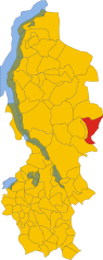
Ведезета (Vedeseta, Vedeseta)
.svg)
- коммуна Италии
 Hiking in Ведезета
Vedeseta is a picturesque village located in the province of Bergamo in Lombardy, Italy, known for its stunning natural landscapes and hiking opportunities. The area is surrounded by the Italian Alps and offers various trails suitable for different skill levels, making it an attractive destination for hikers.
Hiking Trails
-
Sentiero delle Orobie: This trail is part of a long-distance hike through the Orobie Alps. It offers breathtaking views of the mountains and valleys, with sections that vary in difficulty. Experienced hikers can tackle longer segments, while shorter sections can accommodate novices.
-
Local Forest Trails: There are numerous forest trails around Vedeseta that allow you to immerse yourself in nature. These trails often wind through lush beech and fir forests, providing opportunities for wildlife spotting.
-
Panorama Trails: Trails like the ones leading to nearby viewpoints or mountain ridges, such as Monte Alben or Pizzo della Presolana, are popular for their panoramic vistas. These hikes can be more challenging but are worthwhile for the breathtaking scenery.
Preparation
- Gear: Make sure to wear appropriate hiking boots, dress in layers suitable for changing weather, and carry a good backpack with essentials like water, snacks, a first-aid kit, and a map or GPS device.
- Weather Considerations: The weather can change rapidly in the mountains, so check forecasts before setting out. Late spring to early fall is usually the best time for hiking in this region.
- Guided Tours: If you're unfamiliar with the area, consider joining a guided tour to make the most of your experience and ensure safety.
Local Attractions
Aside from hiking, Vedeseta offers charming architecture, traditional Italian cuisine, and cultural sites. You can explore local churches, historic buildings, and sample regional dishes in the village eateries.
Safety Tips
- Always inform someone about your hiking plans.
- Follow trail markers and stay on designated paths.
- Be mindful of wildlife and local regulations.
With its stunning landscapes and variety of trails, hiking in Vedeseta can be a rewarding experience for nature lovers and adventurers alike! Enjoy your time exploring this beautiful part of Italy!
- Страна:

- Почтовый код: 24010
- Телефонный код: 0345
- Код автомобильного номера: BG
- Координаты: 45° 53' 27" N, 9° 32' 23" E


- GPS треки (wikiloc): [Ссылка]
- Высота над уровнем моря: 820 м m
- Площадь: 19.29 кв.км
- Население: 205
- Веб сайт: http://www.comune.vedeseta.bg.it/
- Википедия русская: wiki(ru)
- Википедия английская: wiki(en)
- Википедия национальная: wiki(it)
- Хранилище Wikidata: Wikidata: Q101721
- Галерея изображений в википедии: [Ссылка]
- Катеория в википедии: [Ссылка]
- код Freebase: [/m/0gjfnl]
- код GeoNames: Альт: [6540601]
- ID отношения в OpenStreetMap: [46371]
- код TGN: [1047336]
- код ISTAT: 016230
- кадастровый код Италии: L707
Граничит с регионами:


Брумано
- коммуна Италии
Hiking in Брумано
Brumano is a picturesque town located in the Lombardy region of Italy, nestled in the Bergamo Alps. It offers a variety of hiking opportunities that cater to different skill levels, making it a great destination for outdoor enthusiasts....
- Страна:
- Почтовый код: 24037
- Телефонный код: 035
- Код автомобильного номера: BG
- Координаты: 45° 51' 0" N, 9° 30' 0" E
- GPS треки (wikiloc): [Ссылка]
- Высота над уровнем моря: 911 м m
- Площадь: 8.14 кв.км
- Население: 119
- Веб сайт: [Ссылка]


Кассильо
- коммуна Италии
Hiking in Кассильо
Cassiglio is a picturesque village located in the province of Bergamo, in the Lombardy region of Italy. It lies in the heart of the Italian Alps, making it a fantastic destination for hiking enthusiasts. Here are some key points about hiking in and around Cassiglio:...
- Страна:
- Почтовый код: 24010
- Телефонный код: 0345
- Код автомобильного номера: BG
- Координаты: 45° 58' 0" N, 9° 36' 44" E
- GPS треки (wikiloc): [Ссылка]
- Высота над уровнем моря: 602 м m
- Площадь: 13.68 кв.км
- Население: 110
- Веб сайт: [Ссылка]


Фуипьяно-Валле-Иманья
- коммуна Италии
Hiking in Фуипьяно-Валле-Иманья
Fuipiano Valle Imagna is a picturesque area located in the Lombardy region of Italy, surrounded by the stunning natural beauty of the Italian Alps. This region is known for its serene landscapes, lush greenery, and traditional Italian villages, making it a wonderful destination for hikers of all skill levels....
- Страна:
- Почтовый код: 24030
- Телефонный код: 035
- Код автомобильного номера: BG
- Координаты: 45° 51' 0" N, 9° 32' 0" E
- GPS треки (wikiloc): [Ссылка]
- Высота над уровнем моря: 1019 м m
- Площадь: 4.28 кв.км
- Население: 211
- Веб сайт: [Ссылка]


Таледжо
- коммуна Италии
Hiking in Таледжо
Taleggio is a picturesque valley located in the Bergamo province of Lombardy, Italy. It is renowned for its stunning landscapes, rich history, and traditional agriculture, including the famous Taleggio cheese. Hiking in this region offers a variety of trails, ranging from easy walks to more challenging routes, catering to different skill levels. Here are some highlights and tips for hiking in Taleggio:...
- Страна:
- Почтовый код: 24010
- Телефонный код: 0345
- Код автомобильного номера: BG
- Координаты: 45° 54' 0" N, 9° 34' 0" E
- GPS треки (wikiloc): [Ссылка]
- Высота над уровнем моря: 758 м m
- Площадь: 46.59 кв.км
- Население: 552
- Веб сайт: [Ссылка]


Вальторта
- коммуна Италии
Hiking in Вальторта
Valtorta is a beautiful area in Lombardy, Italy, particularly popular for hiking enthusiasts looking for stunning alpine landscapes. Nestled in the Bergamasque Alps, Valtorta offers a variety of trails that range in difficulty, making it a suitable destination for both beginners and experienced hikers....
- Страна:
- Почтовый код: 24010
- Телефонный код: 0345
- Код автомобильного номера: BG
- Координаты: 45° 58' 39" N, 9° 32' 5" E
- GPS треки (wikiloc): [Ссылка]
- Высота над уровнем моря: 935 м m
- Площадь: 30.9 кв.км
- Население: 270
- Веб сайт: [Ссылка]


Барцио
- коммуна Италии
Hiking in Барцио
Barzio is a charming town located in the Lombardy region of Italy, nestled in the heart of the Italian Alps. It is popular for its beautiful landscapes, abundant hiking trails, and outdoor activities. Here are some key points to consider when hiking in Barzio:...
- Страна:
- Почтовый код: 23816
- Телефонный код: 0341
- Код автомобильного номера: LC
- Координаты: 45° 57' 0" N, 9° 28' 0" E
- GPS треки (wikiloc): [Ссылка]
- Высота над уровнем моря: 769 м m
- Площадь: 21.35 кв.км
- Население: 1338
- Веб сайт: [Ссылка]

Моджо
- коммуна Италии
Hiking in Моджо
Moggio is a charming village located in the Lombardy region of Italy, specifically within the province of Lecco. Nestled in the heart of the Italian Alps near Lake Como, it offers numerous opportunities for hiking enthusiasts of all levels....
- Страна:
- Почтовый код: 23817
- Телефонный код: 0341
- Код автомобильного номера: LC
- Координаты: 45° 55' 57" N, 9° 29' 10" E
- GPS треки (wikiloc): [Ссылка]
- Высота над уровнем моря: 890 м m
- Площадь: 13.43 кв.км
- Население: 491
- Веб сайт: [Ссылка]


Мортероне
- коммуна Италии
Hiking in Мортероне
Morterone, located in the Lombardy region of Italy, is a small mountain village nestled in the foothills of the Grigna massif. It's a fantastic destination for hikers looking to explore the natural beauty of the Italian Alps, offering a range of trails suitable for various skill levels....
- Страна:
- Почтовый код: 23811
- Телефонный код: 0341
- Код автомобильного номера: LC
- Координаты: 45° 52' 26" N, 9° 28' 58" E
- GPS треки (wikiloc): [Ссылка]
- Высота над уровнем моря: 1070 м m
- Площадь: 13.71 кв.км
- Население: 35
- Веб сайт: [Ссылка]