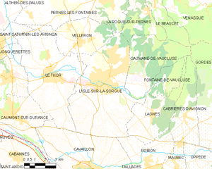
Веллерон (Velleron, Velleron)

- коммуна во Франции
 Hiking in Веллерон
Velleron is a charming village located in the Provence region of France, not far from the picturesque town of L’Isle-sur-la-Sorgue. While Velleron itself may not be a major hiking destination, it offers beautiful landscapes and opportunities for outdoor activities in the surrounding areas.
Hiking Opportunities Around Velleron:
-
Provence Countryside:
- The region around Velleron is characterized by its rolling hills, vineyards, and traditional lavender fields. You can take leisurely walks or more challenging hikes through the gorgeous countryside.
-
Luberon Regional Nature Park:
- Just a short drive from Velleron, the Luberon Park boasts a variety of hiking trails with differing levels of difficulty. Popular routes include the trails around the villages of Gordes and Roussillon, showcasing stunning views and unique ochre cliffs.
-
Sentier des Ocres:
- Located in Roussillon, this trail leads you through a landscape filled with striking ochre formations and colorful vistas. It’s a relatively easy walk and is suitable for families.
-
ISle-sur-la-Sorgue:
- The nearby town has beautiful waterways and paths along the Sorgue River. Short walks or picnics along the river can be enjoyed, and there's a chance to spot local wildlife.
-
Gorges de la Nesque:
- A little further afield, this dramatic gorge offers more challenging hikes with spectacular views. Trails in this area can be more adventurous, often recommended for those with some hiking experience.
Hiking Tips:
- Weather and Timing: The best times to hike in the region are during the spring and fall when temperatures are milder. Summer can be hot, and proper hydration is essential.
- Local Maps: Consider picking up local hiking maps or brochures at the tourist office in Velleron or nearby towns for detailed trail information.
- Footwear: Wear comfortable hiking shoes, as trails can be uneven and rocky.
- Respect Nature: Always stay on marked trails, respect the local flora and fauna, and carry out any litter.
Conclusion:
Hiking near Velleron allows you to immerse yourself in the picturesque landscapes of Provence. Whether it's a leisurely stroll through the countryside or exploring more rugged terrain, you have various options to make the most of your hiking experience in this beautiful region.
- Страна:

- Почтовый код: 84740
- Координаты: 43° 57' 27" N, 5° 1' 46" E


- GPS треки (wikiloc): [Ссылка]
- Площадь: 16.39 кв.км
- Население: 2943
- Веб сайт: http://www.velleron.eu
- Википедия русская: wiki(ru)
- Википедия английская: wiki(en)
- Википедия национальная: wiki(fr)
- Хранилище Wikidata: Wikidata: Q672387
- Катеория в википедии: [Ссылка]
- код Freebase: [/m/02vmmtf]
- код GeoNames: Альт: [2970187]
- номер SIREN: [218401420]
- код BNF: [152781225]
- код VIAF: Альт: [127946105]
- код GND: Альт: [4280277-5]
- код LCNAF: Альт: [n88080753]
- код муниципалитета INSEE: 84142
Граничит с регионами:


Сен-Сатюрнен-лез-Авиньон
- коммуна во Франции
- Страна:
- Почтовый код: 84450
- Координаты: 43° 57' 24" N, 4° 55' 49" E
- GPS треки (wikiloc): [Ссылка]
- Площадь: 6.25 кв.км
- Население: 4819
- Веб сайт: [Ссылка]


Перн-ле-Фонтен
- коммуна во Франции
Hiking in Перн-ле-Фонтен
Pernes-les-Fontaines, located in the Vaucluse department in the Provence region of France, offers a variety of hiking opportunities. The area is characterized by its stunning natural landscapes, picturesque scenery, and rich cultural heritage. Here are some highlights for hiking in and around Pernes-les-Fontaines:...
- Страна:
- Почтовый код: 84210
- Координаты: 43° 59' 52" N, 5° 3' 33" E
- GPS треки (wikiloc): [Ссылка]
- Площадь: 51.12 кв.км
- Население: 9556
- Веб сайт: [Ссылка]
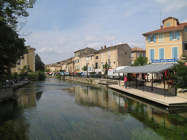
Л'Иль-сюр-ла-Сорг
- коммуна во Франции
Hiking in Л'Иль-сюр-ла-Сорг
L'Isle-sur-la-Sorgue is a picturesque town located in the Provence-Alpes-Côte d'Azur region of France, renowned for its beautiful canals, charming antique shops, and vibrant markets. While it is mostly known for its cultural and historical significance, it also offers various opportunities for hiking and enjoying the natural landscape....
- Страна:
- Почтовый код: 84800
- Координаты: 43° 55' 10" N, 5° 3' 5" E
- GPS треки (wikiloc): [Ссылка]
- Высота над уровнем моря: 246 м m
- Площадь: 44.57 кв.км
- Население: 19483
- Веб сайт: [Ссылка]


Ле-Тор
- коммуна во Франции
- Страна:
- Почтовый код: 84250
- Координаты: 43° 55' 45" N, 4° 59' 40" E
- GPS треки (wikiloc): [Ссылка]
- Площадь: 35.53 кв.км
- Население: 8879
- Веб сайт: [Ссылка]