Перн-ле-Фонтен (Pernes-les-Fontaines, Pernes-les-Fontaines)

- коммуна во Франции
 Hiking in Перн-ле-Фонтен
Pernes-les-Fontaines, located in the Vaucluse department in the Provence region of France, offers a variety of hiking opportunities. The area is characterized by its stunning natural landscapes, picturesque scenery, and rich cultural heritage. Here are some highlights for hiking in and around Pernes-les-Fontaines:
Trail Options
-
GR Trails: The region is part of the extensive Grande Randonnée (GR) network, which features long-distance trails. Hiking along these paths provides a deeper exploration of the Provence landscape, including vineyards, olive groves, and historical sites.
-
Local Nature Trails: There are several local trails that take you through the area’s unique environment. You can find loops that feature natural springs, which give the town its name, as well as beautiful views of the surrounding countryside.
-
Near Mont Ventoux: The iconic Mont Ventoux is accessible from Pernes-les-Fontaines and offers more challenging hikes. The ascent provides rewarding views, especially appreciated by hikers looking for a bit more strenuous routes.
Scenic Highlights
- Fontaines: As the town is known for its fountains, many trails can lead you to beautiful water features and natural springs.
- Vineyards and Olive Groves: Hiking in this region often means strolling through fields of lavender, vineyards, and ancient olive trees, especially breathtaking in the spring and summer months.
- Historic Sites: Some trails will take you to nearby historic sites and charming villages, enriching your hike with cultural insights.
Practical Tips
- Best Time to Hike: Spring (April to June) and fall (September to October) are generally the best seasons for hiking in this area, as the weather is milder.
- Equipment: Proper footwear and hydration are crucial, especially if you plan to hike longer trails. Sunscreen and hats are advisable during the hotter months.
- Local Guidance: Consider consulting local tourism offices or guides for maps and recommended hiking routes to tailor your experience according to your skill level and interests.
Conclusion
Hiking in Pernes-les-Fontaines can be a delightful experience, blending nature, culture, and history. Whether you're a casual walker or a serious hiker, the variety of trails and the stunning scenery make it a great destination for outdoor enthusiasts. Remember to respect the natural environment and follow local guidelines while enjoying your hikes.
- Страна:

- Почтовый код: 84210
- Координаты: 43° 59' 52" N, 5° 3' 33" E


- GPS треки (wikiloc): [Ссылка]
- Площадь: 51.12 кв.км
- Население: 9556
- Веб сайт: http://www.ville-pernes-les-fontaines.fr
- Википедия русская: wiki(ru)
- Википедия английская: wiki(en)
- Википедия национальная: wiki(fr)
- Хранилище Wikidata: Wikidata: Q472574
- Катеория в википедии: [Ссылка]
- код Freebase: [/m/02vmmp_]
- код GeoNames: Альт: [2987945]
- номер SIREN: [218400885]
- код BNF: [152780686]
- код VIAF: Альт: [245121526]
- ID отношения в OpenStreetMap: [181284]
- код GND: Альт: [4300794-6]
- код LCNAF: Альт: [n2014010624]
- код тезауруса PACTOLS: [pcrtQJtpfTIROM]
- место в MusicBrainz: [367b378f-fe60-42a7-80aa-bf7dee4cd26a]
- код муниципалитета INSEE: 84088
Граничит с регионами:

Карпантра
- коммуна во Франции
Hiking in Карпантра
Carpentras, located in the Vaucluse department of the Provence-Alpes-Côte d'Azur region in southeastern France, offers a variety of hiking opportunities amidst stunning landscapes. Here are some highlights:...
- Страна:
- Почтовый код: 84200
- Координаты: 44° 3' 18" N, 5° 2' 53" E
- GPS треки (wikiloc): [Ссылка]
- Высота над уровнем моря: 95 м m
- Площадь: 37.92 кв.км
- Население: 28699
- Веб сайт: [Ссылка]


Альтан-де-Палю
- коммуна во Франции
- Страна:
- Почтовый код: 84210
- Код автомобильного номера: 84
- Координаты: 44° 0' 17" N, 4° 57' 30" E
- GPS треки (wikiloc): [Ссылка]
- Площадь: 6.4 кв.км
- Население: 2749
- Веб сайт: [Ссылка]


Мазан
- коммуна во Франции
Hiking in Мазан
Mazan, located in the Vaucluse department in the Provence-Alpes-Côte d'Azur region of France, offers a charming backdrop for hiking enthusiasts. The area is characterized by picturesque landscapes, including vineyards, oak forests, and stunning views of the Mont Ventoux mountain....
- Страна:
- Почтовый код: 84380
- Координаты: 44° 3' 24" N, 5° 7' 41" E
- GPS треки (wikiloc): [Ссылка]
- Площадь: 37.92 кв.км
- Население: 5842


Монтё
- коммуна во Франции
Hiking in Монтё
Monteux, located in the Vaucluse department of the Provence-Alpes-Côte d'Azur region in southern France, is known for its picturesque landscapes and outdoor activities, including hiking. The area is characterized by its beautiful natural surroundings, including vineyards, olive groves, and nearby hills....
- Страна:
- Почтовый код: 84170
- Координаты: 44° 2' 8" N, 4° 59' 50" E
- GPS треки (wikiloc): [Ссылка]
- Площадь: 39.02 кв.км
- Население: 12671
- Веб сайт: [Ссылка]


Сен-Сатюрнен-лез-Авиньон
- коммуна во Франции
- Страна:
- Почтовый код: 84450
- Координаты: 43° 57' 24" N, 4° 55' 49" E
- GPS треки (wikiloc): [Ссылка]
- Площадь: 6.25 кв.км
- Население: 4819
- Веб сайт: [Ссылка]


Ла-Рок-сюр-Перн
- коммуна во Франции
Hiking in Ла-Рок-сюр-Перн
La Roque-sur-Pernes is a picturesque village located in the Vaucluse department of the Provence-Alpes-Côte d'Azur region in France. The area is known for its stunning landscapes, rich history, and scenic hiking trails. Here are some key highlights and considerations for hiking in and around La Roque-sur-Pernes:...
- Страна:
- Почтовый код: 84210
- Координаты: 43° 58' 44" N, 5° 6' 31" E
- GPS треки (wikiloc): [Ссылка]
- Площадь: 11.03 кв.км
- Население: 417
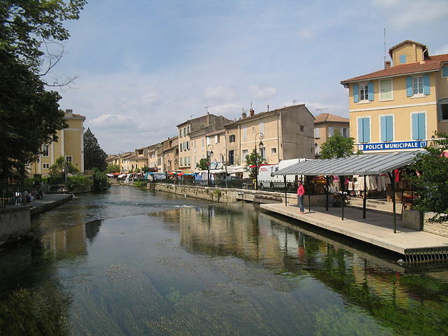
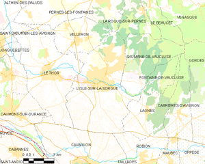
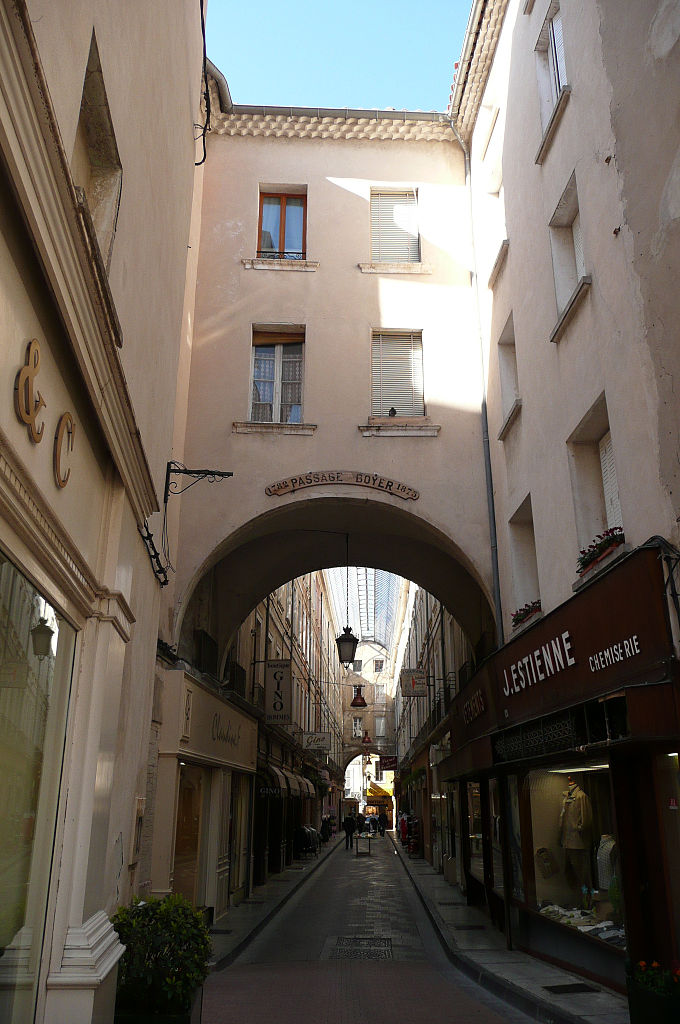
Л'Иль-сюр-ла-Сорг
- коммуна во Франции
Hiking in Л'Иль-сюр-ла-Сорг
L'Isle-sur-la-Sorgue is a picturesque town located in the Provence-Alpes-Côte d'Azur region of France, renowned for its beautiful canals, charming antique shops, and vibrant markets. While it is mostly known for its cultural and historical significance, it also offers various opportunities for hiking and enjoying the natural landscape....
- Страна:
- Почтовый код: 84800
- Координаты: 43° 55' 10" N, 5° 3' 5" E
- GPS треки (wikiloc): [Ссылка]
- Высота над уровнем моря: 246 м m
- Площадь: 44.57 кв.км
- Население: 19483
- Веб сайт: [Ссылка]


Сен-Дидье
Hiking in Сен-Дидье
Saint-Didier is a charming village located in the Vaucluse department of the Provence-Alpes-Côte d'Azur region in southeastern France. It is an excellent base for hiking enthusiasts due to its picturesque landscapes, rich history, and proximity to several natural attractions....
- Страна:
- Почтовый код: 84210
- Координаты: 44° 0' 22" N, 5° 6' 34" E
- GPS треки (wikiloc): [Ссылка]
- Площадь: 3.62 кв.км
- Население: 2136


Антрег-сюр-ла-Сорг
- коммуна во Франции
- Страна:
- Почтовый код: 84320
- Координаты: 44° 0' 11" N, 4° 55' 36" E
- GPS треки (wikiloc): [Ссылка]
- Высота над уровнем моря: 29 м m
- Площадь: 16.57 кв.км
- Население: 8399
- Веб сайт: [Ссылка]

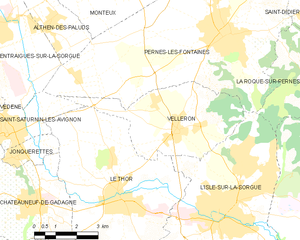
Веллерон
- коммуна во Франции
Hiking in Веллерон
Velleron is a charming village located in the Provence region of France, not far from the picturesque town of L’Isle-sur-la-Sorgue. While Velleron itself may not be a major hiking destination, it offers beautiful landscapes and opportunities for outdoor activities in the surrounding areas....
- Страна:
- Почтовый код: 84740
- Координаты: 43° 57' 27" N, 5° 1' 46" E
- GPS треки (wikiloc): [Ссылка]
- Площадь: 16.39 кв.км
- Население: 2943
- Веб сайт: [Ссылка]