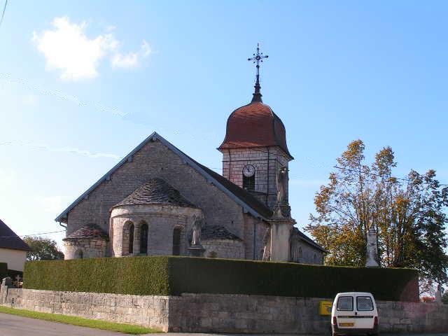
Villers-Chief (Villers-Chief)

- коммуна во Франции
 Hiking in Villers-Chief
Villers-Chief is a charming area located in the Walloon region of Belgium, known for its scenic landscapes and outdoor activities, including hiking. If you’re considering hiking in Villers-Chief, here are some key points and recommendations to enhance your experience:
Key Features:
-
Scenic Trails: The region offers a variety of hiking trails that wind through lush forests, rolling hills, and lovely countryside. You can find both easy and challenging routes, suitable for all levels of hikers.
-
Nature and Wildlife: As you hike, keep an eye out for local flora and fauna. The area is rich in biodiversity, and you may spot various bird species, small mammals, and interesting plant life.
-
Historic Sites: Some trails might lead you to historical landmarks or sites of cultural significance within the region. This adds an educational aspect to your hike.
Hiking Tips:
- Trail Maps: Before setting out, make sure to obtain a map of the trails, which can often be found at local tourism offices or online. This will help you navigate the routes effectively.
- Weather Preparedness: The weather can change rapidly, so check the forecast before you go and dress in layers to stay comfortable.
- Hydration and Snacks: Always carry enough water and light snacks to keep your energy level up during your hike.
- Footwear: Wear sturdy hiking boots to provide support and protection, especially on uneven terrain.
- Leave No Trace: Respect the environment by sticking to marked trails, taking your litter with you, and being mindful of wildlife.
Local Resources:
- Guided Tours: If you prefer a structured experience, consider joining a local guided hiking tour. This can provide additional insights into the area's history and ecology.
- Visitor Information Centers: Check in with local visitor centers for more specific information regarding current trail conditions or any temporary closures.
Make sure to enjoy the beauty and tranquility that hiking in Villers-Chief offers. Happy hiking!
- Страна:

- Почтовый код: 25530
- Координаты: 47° 13' 36" N, 6° 26' 24" E


- GPS треки (wikiloc): [Ссылка]
- Площадь: 7.83 кв.км
- Население: 120
- Википедия английская: wiki(en)
- Википедия национальная: wiki(fr)
- Хранилище Wikidata: Wikidata: Q907276
- Катеория в википедии: [Ссылка]
- код Freebase: [/m/03mhfcj]
- код GeoNames: Альт: [6430055]
- номер SIREN: [212506232]
- код BNF: [152528498]
- код муниципалитета INSEE: 25623
Граничит с регионами:


Épenouse
- коммуна во Франции
Hiking in Épenouse
Épenouse is a charming commune located in the Jura department of eastern France. It offers a variety of hiking opportunities for both novice and experienced hikers, surrounded by stunning natural landscapes, including forests, rolling hills, and picturesque views of the Jura Mountains....
- Страна:
- Почтовый код: 25530
- Координаты: 47° 12' 52" N, 6° 24' 6" E
- GPS треки (wikiloc): [Ссылка]
- Площадь: 5.75 кв.км
- Население: 147


Villers-la-Combe
- коммуна во Франции
Hiking in Villers-la-Combe
Villers-la-Combe is a picturesque village located in the Côte-d'Or department of France, known for its charming landscapes and natural beauty, making it an excellent spot for hiking enthusiasts. The surrounding areas are characterized by rolling hills, forests, and vineyards, providing a variety of trails for different skill levels....
- Страна:
- Почтовый код: 25510
- Координаты: 47° 14' 7" N, 6° 27' 23" E
- GPS треки (wikiloc): [Ссылка]
- Площадь: 5.88 кв.км
- Население: 50

Eysson
Hiking in Eysson
Eysson is not a well-known hiking destination, and it may not be a recognized region or park in widely known hiking literature or resources. However, if you're mentioning a specific or local area named Eysson, I would recommend looking into local hiking trails, nature reserves, or conservation areas nearby....
- Страна:
- Почтовый код: 25530
- Координаты: 47° 12' 0" N, 6° 25' 49" E
- GPS треки (wikiloc): [Ссылка]
- Площадь: 6.01 кв.км
- Население: 114


Germéfontaine
- коммуна во Франции
Hiking in Germéfontaine
Germéfontaine is a beautiful destination for hiking, located in France. Nestled in the Vosges region, it offers stunning natural landscapes and a variety of trails suitable for different skill levels. Here are some highlights and tips for hiking in Germéfontaine:...
- Страна:
- Почтовый код: 25510
- Координаты: 47° 13' 30" N, 6° 28' 2" E
- GPS треки (wikiloc): [Ссылка]
- Площадь: 11.16 кв.км
- Население: 135


Domprel
- коммуна во Франции
Hiking in Domprel
It seems there may be a misunderstanding or a potential misspelling, as there is no widely recognized hiking destination called "Domprel." If you're referring to a specific area or region, could you please provide more details or clarify the name?...
- Страна:
- Почтовый код: 25510
- Координаты: 47° 12' 2" N, 6° 28' 9" E
- GPS треки (wikiloc): [Ссылка]
- Площадь: 9.4 кв.км
- Население: 168


Bremondans
- коммуна во Франции
Hiking in Bremondans
Bremondans is a charming small commune located in the Doubs department in the Bourgogne-Franche-Comté region of eastern France. Though not as widely known as some of the larger towns and cities, it offers several options for hiking and enjoying the natural beauty of the surrounding area....
- Страна:
- Почтовый код: 25530
- Координаты: 47° 13' 52" N, 6° 23' 52" E
- GPS треки (wikiloc): [Ссылка]
- Площадь: 7.22 кв.км
- Население: 85


Vellerot-lès-Vercel
- коммуна во Франции
Hiking in Vellerot-lès-Vercel
Vellerot-lès-Vercel is a picturesque village located in the Doubs department of the Bourgogne-Franche-Comté region in eastern France. While it may not be as well-known as some larger hiking destinations, it offers scenic landscapes and a variety of hiking opportunities for those looking to explore the natural beauty of this area....
- Страна:
- Почтовый код: 25530
- Координаты: 47° 14' 37" N, 6° 26' 49" E
- GPS треки (wikiloc): [Ссылка]
- Площадь: 4.57 кв.км
- Население: 59