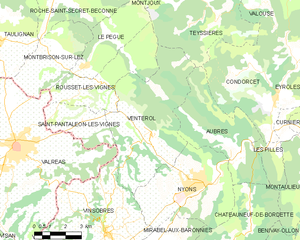
Vinsobres (Vinsobres)

- коммуна во Франции
 Hiking in Vinsobres
Vinsobres is a picturesque village located in the Provence region of southeastern France, nestled in the foothills of the Baronnies mountains. This charming area offers a variety of hiking opportunities suitable for different skill levels, making it a great destination for both casual walkers and experienced hikers.
Hiking Trails:
-
Local Trails: There are several marked hiking trails around Vinsobres that provide stunning views of the surrounding vineyards, olive groves, and the picturesque landscape of Provence. Many trails range from easy strolls to more challenging hikes that may involve some elevation gain.
-
Baronnies Regional Natural Park: Just a short distance from Vinsobres, this park features numerous trails that explore its diverse ecosystems, including forests, mountains, and river valleys. The park is known for its rich biodiversity and beautiful scenery, ideal for nature lovers.
-
GR Trails: The Grande Randonnée (GR) trails, which are long-distance footpaths in France, also traverse this area. These trails provide a more extended hiking experience if you're looking to cover more ground.
Things to Consider:
- Season: The best times to hike in Vinsobres are during the spring and fall when the weather is mild, and the scenery is particularly beautiful.
- Weather: Always check the local weather conditions before heading out, as temperatures can vary significantly, especially in higher elevations.
- Preparation: Bring sufficient water, snacks, and a map or GPS device, as some trails may not be well-marked. It can also be helpful to wear sturdy hiking boots.
- Local Tips: Engaging with local hiking groups or guides can enhance your experience, providing insights into the area’s flora, fauna, and history.
Attractions Nearby:
After a day of hiking, you can explore the charming village of Vinsobres itself, visit local wineries to taste the region's famed wines, or enjoy authentic Provencal cuisine at local restaurants.
Overall, hiking in Vinsobres offers a delightful combination of scenic beauty, cultural experiences, and outdoor adventure. Enjoy your time in this beautiful region!
- Страна:

- Почтовый код: 26110
- Координаты: 44° 20' 1" N, 5° 3' 40" E


- GPS треки (wikiloc): [Ссылка]
- Площадь: 35.42 кв.км
- Население: 1171
- Веб сайт: http://www.vinsobres-mairie.fr
- Википедия английская: wiki(en)
- Википедия национальная: wiki(fr)
- Хранилище Wikidata: Wikidata: Q180245
- Катеория в википедии: [Ссылка]
- код Freebase: [/m/03mgkyw]
- код GeoNames: Альт: [6430274]
- номер SIREN: [212603773]
- код BNF: [15253237v]
- код муниципалитета INSEE: 26377
Граничит с регионами:


Визан
Hiking in Визан
Visan, a charming commune located in the Vaucluse department in the Provence-Alpes-Côte d'Azur region of France, offers a delightful setting for hiking enthusiasts. The region is known for its picturesque landscapes, historic villages, and diverse flora and fauna....
- Страна:
- Почтовый код: 84820
- Координаты: 44° 18' 53" N, 4° 57' 2" E
- GPS треки (wikiloc): [Ссылка]
- Площадь: 41.07 кв.км
- Население: 1961
- Веб сайт: [Ссылка]


Ньон
- коммуна во Франции
Hiking in Ньон
Nyons is a charming town located in the Vaucluse department of the Provence-Alpes-Côte d'Azur region in southeastern France. It's known for its picturesque landscapes, olive groves, and vibrant markets, making it a wonderful destination for hikers of all skill levels. Here are some key points about hiking in and around Nyons:...
- Страна:
- Почтовый код: 26110
- Координаты: 44° 21' 39" N, 5° 8' 26" E
- GPS треки (wikiloc): [Ссылка]
- Площадь: 23.45 кв.км
- Население: 6690
- Веб сайт: [Ссылка]

Venterol
Hiking in Venterol
Venterol is a charming village in the Drôme department of southeastern France, known for its beautiful landscapes and proximity to the natural beauty of the Rhône-Alpes region. Hiking in and around Venterol offers a variety of trails that cater to different skill levels, from leisurely walks to more challenging hikes....
- Страна:
- Почтовый код: 26110
- Координаты: 44° 23' 21" N, 5° 5' 57" E
- GPS треки (wikiloc): [Ссылка]
- Площадь: 31.69 кв.км
- Население: 702


Saint-Maurice-sur-Eygues
- коммуна во Франции
Hiking in Saint-Maurice-sur-Eygues
Saint-Maurice-sur-Eygues is a charming village located in the Drôme department of the Auvergne-Rhône-Alpes region in southeastern France. The region offers beautiful landscapes, diverse flora and fauna, and a variety of hiking opportunities that cater to different skill levels....
- Страна:
- Почтовый код: 26110
- Координаты: 44° 17' 54" N, 5° 0' 39" E
- GPS треки (wikiloc): [Ссылка]
- Площадь: 8.82 кв.км
- Население: 760
- Веб сайт: [Ссылка]


Вальреа
- коммуна во Франции
Hiking in Вальреа
Valréas, located in the Vaucluse department of the Provence-Alpes-Côte d'Azur region in southeastern France, is nestled in a scenic area characterized by its picturesque vineyards, olive groves, and rolling hills. While it's primarily known for its charming medieval architecture and nearby wine production, it also offers various hiking opportunities for outdoor enthusiasts....
- Страна:
- Почтовый код: 84600
- Координаты: 44° 23' 3" N, 4° 59' 25" E
- GPS треки (wikiloc): [Ссылка]
- Площадь: 57.97 кв.км
- Население: 9492
- Веб сайт: [Ссылка]


Вильдьё
Hiking in Вильдьё
Villedieu, located in the Vaucluse department of the Provence-Alpes-Côte d'Azur region in southeastern France, offers some wonderful hiking opportunities amidst its scenic landscapes. The area is characterized by its rolling hills, vineyards, and proximity to the Ventoux mountain range. Here are some highlights of hiking in and around Villedieu:...
- Страна:
- Почтовый код: 84110
- Координаты: 44° 17' 2" N, 5° 2' 5" E
- GPS треки (wikiloc): [Ссылка]
- Площадь: 11.38 кв.км
- Население: 521

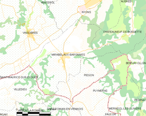
Mirabel-aux-Baronnies
Hiking in Mirabel-aux-Baronnies
Mirabel-aux-Baronnies, located in the Vaucluse department of the Provence-Alpes-Côte d'Azur region in southeastern France, offers a wonderful array of hiking opportunities that showcase the natural beauty and diverse landscapes of the area. Here are some things to know about hiking in and around Mirabel-aux-Baronnies:...
- Страна:
- Почтовый код: 26110
- Координаты: 44° 18' 39" N, 5° 5' 57" E
- GPS треки (wikiloc): [Ссылка]
- Площадь: 22.56 кв.км
- Население: 1569