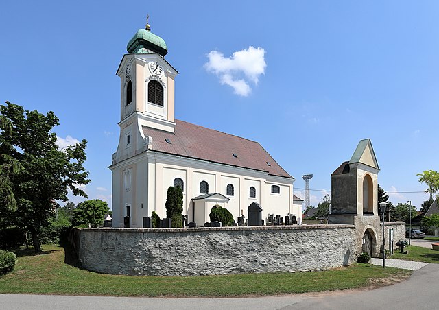
Вайкендорф (Weikendorf, Weikendorf)
 Hiking in Вайкендорф
Weikendorf, located in Lower Austria, offers a variety of landscapes and hiking opportunities for outdoor enthusiasts. The area is characterized by its picturesque countryside, rolling hills, and lush greenery, making it a great destination for both novice and experienced hikers. Here are some highlights and tips for hiking in Weikendorf:
Hiking Trails
-
Local Trails: Weikendorf has several marked trails that vary in difficulty. These paths often take you through charming forests, past fields, and along scenic viewpoints.
-
Nature Reserves: The nearby natural reserves and parks can provide extended hiking options, allowing you to explore diverse ecosystems and observe local wildlife.
-
Regional Connections: You can also connect through regional trails that link Weikendorf with surrounding towns and villages, perfect for longer hikes if you're feeling adventurous.
Hiking Tips
- Trail Maps: Make sure to have a current trail map or a hiking app since trail signs can vary.
- Weather Conditions: Always check the weather forecast before you head out and dress accordingly. Conditions can change rapidly in the outdoors.
- Footwear: Wear sturdy, comfortable hiking boots to manage the terrain effectively.
- Hydration and Snacks: Carry enough water and snacks, especially for longer hikes.
Local Attractions
After hiking, consider exploring local attractions in Weikendorf, such as quaint village architecture and cultural sites. You might also find small cafes or restaurants where you can enjoy a meal or a drink to recharge.
Whether you’re looking for a relaxing stroll or a challenging trek, Weikendorf provides a beautiful setting for a memorable hiking experience. Always remember to respect nature and follow Leave No Trace principles when hiking.
- Страна:

- Почтовый код: 2253
- Телефонный код: 02282
- Код автомобильного номера: GF
- Координаты: 48° 21' 0" N, 16° 46' 0" E


- GPS треки (wikiloc): [Ссылка]
- Высота над уровнем моря: 152 м m
- Площадь: 46.3 кв.км
- Население: 2029
- Веб сайт: http://www.gdeweikendorf.at
- Википедия русская: wiki(ru)
- Википедия английская: wiki(en)
- Википедия национальная: wiki(de)
- Хранилище Wikidata: Wikidata: Q686346
- Катеория в википедии: [Ссылка]
- код Freebase: [/m/02qtyf_]
- код GeoNames: Альт: [2761723]
- код VIAF: Альт: [245814282]
- код австрийского муниципалитета: [30860]
Граничит с регионами:

Гензерндорф
Hiking in Гензерндорф
Gänserndorf, located in Lower Austria, offers a variety of hiking opportunities that allow you to experience the beautiful landscapes of the region. While it may not be as well-known as some larger national parks or mountainous areas, there are still plenty of trails and natural sights to explore in and around Gänserndorf....
- Страна:
- Почтовый код: 2230
- Телефонный код: 02282
- Код автомобильного номера: GF
- Координаты: 48° 20' 26" N, 16° 43' 3" E
- GPS треки (wikiloc): [Ссылка]
- Высота над уровнем моря: 167 м m
- Площадь: 30.56 кв.км
- Население: 11404
- Веб сайт: [Ссылка]


Ангерн-ан-дер-Марх
Hiking in Ангерн-ан-дер-Марх
Angern an der March is a charming town located in Lower Austria, close to the border with Slovakia, and offers a wealth of natural beauty and opportunities for hiking. While the town itself is small, the surrounding countryside features picturesque landscapes, making it an appealing destination for outdoor enthusiasts. Here are some key points to consider for hiking in and around Angern an der March:...
- Страна:
- Почтовый код: 2261
- Телефонный код: 02283
- Код автомобильного номера: GF
- Координаты: 48° 23' 0" N, 16° 50' 0" E
- GPS треки (wikiloc): [Ссылка]
- Высота над уровнем моря: 154 м m
- Площадь: 38.13 кв.км
- Население: 3384
- Веб сайт: [Ссылка]
Унтерзибенбрунн
Hiking in Унтерзибенбрунн
Untersiebenbrunn is a charming village located in Austria, specifically in the Lower Austria region. While it may not be as widely known as other hiking destinations, it provides a variety of opportunities for outdoor enthusiasts to enjoy nature and the local landscape....
- Страна:
- Почтовый код: 2284
- Телефонный код: 02286
- Код автомобильного номера: GF
- Координаты: 48° 15' 0" N, 16° 45' 0" E
- GPS треки (wikiloc): [Ссылка]
- Высота над уровнем моря: 158 м m
- Площадь: 30.49 кв.км
- Население: 1736
- Веб сайт: [Ссылка]

Вайден-ан-дер-Марх
Hiking in Вайден-ан-дер-Марх
Weiden an der March is a charming village located in Austria, near the border with Slovakia. It is surrounded by beautiful natural landscapes that offer great opportunities for hiking and outdoor activities. Here are some highlights for hiking in and around Weiden an der March:...
- Страна:
- Почтовый код: 2295
- Телефонный код: 02284
- Код автомобильного номера: GF
- Координаты: 48° 18' 0" N, 16° 49' 0" E
- GPS треки (wikiloc): [Ссылка]
- Высота над уровнем моря: 162 м m
- Площадь: 55.8 кв.км
- Население: 991
- Веб сайт: [Ссылка]

Проттес
Hiking in Проттес
Prottes, a quaint village located in the northeastern part of Austria, offers a range of charming hiking opportunities amidst picturesque landscapes. While not as widely known as other hiking destinations, it provides a unique experience for those looking to explore the natural beauty of the region....
- Страна:
- Почтовый код: 2242
- Телефонный код: 02282
- Код автомобильного номера: GF
- Координаты: 48° 23' 0" N, 16° 44' 0" E
- GPS треки (wikiloc): [Ссылка]
- Высота над уровнем моря: 162 м m
- Площадь: 13.7 кв.км
- Население: 1436
- Веб сайт: [Ссылка]

Оберзибенбрунн
Hiking in Оберзибенбрунн
Obersiebenbrunn is a small village in Austria, located in the northeastern part of the country, close to the border with Hungary. While it may not be a major hiking destination like some of Austria's more famous alpine regions, it offers some opportunities for outdoor enthusiasts looking for a more tranquil experience away from crowded tourist areas....
- Страна:
- Почтовый код: 2283
- Телефонный код: 02286
- Код автомобильного номера: GF
- Координаты: 48° 15' 54" N, 16° 42' 27" E
- GPS треки (wikiloc): [Ссылка]
- Высота над уровнем моря: 151 м m
- Площадь: 26.93 кв.км
- Население: 1708
- Веб сайт: [Ссылка]