
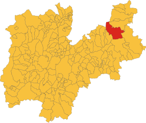
Нова-Леванте (Welschnofen, Nova Levante)
.svg)
- коммуна Италии
 Hiking in Нова-Леванте
Welschnofen, located in the South Tyrol region of Italy, is a beautiful destination for hiking enthusiasts. Nestled in the Dolomites, this charming village offers a range of trails suited for all levels of hikers, from beginners to experienced adventurers. Here are some highlights of hiking in Welschnofen:
Scenic Trails
-
Rosengarten Area: This area boasts some of the most stunning views in the Dolomites. Trails here offer breathtaking panoramas of the iconic Rosengarten massif.
-
Latemar: The Latemar mountain range features several well-marked trails, including easy walks around the lagoons and more challenging hikes that lead to higher altitudes.
-
High Altitude Trails: The area provides access to high-altitude paths that offer stunning views and the opportunity to see unique alpine flora and fauna.
Difficulty Levels
-
Easy Trails: Shorter, well-marked paths, such as the trail around Lake Carezza, are perfect for families or less experienced hikers.
-
Moderate to Difficult Trails: More skilled hikers can tackle routes leading to mountain huts or summits, such as the ascent to the peaks in the Latemar range.
Seasonal Hiking
- Summer: This is the most popular time for hiking, with wildflowers in bloom and ideal weather conditions.
- Autumn: Hiking in the fall can provide a magical atmosphere with colorful foliage and fewer crowds.
- Winter: While many trails are covered in snow, winter hiking and snowshoeing options are available, offering a completely different experience.
Additional Tips
- Weather: The weather can change rapidly in the mountains, so it’s important to check forecasts and come prepared with appropriate gear.
- Safety: Always inform someone of your plans and consider hiking with a buddy. Carry a map or GPS device, and make sure to have enough water and snacks.
- Guided Tours: If you're new to the area or want to learn more about the local nature and culture, consider joining a guided hiking tour.
Local Amenities
Welschnofen itself has good infrastructure for hikers, including accommodation options, restaurants, and shops. After a day on the trails, you can enjoy local South Tyrolean cuisine and relax in the picturesque village.
Overall, Welschnofen and its surroundings offer an unforgettable hiking experience in one of Italy's most beautiful settings.
- Страна:

- Почтовый код: 39056
- Телефонный код: 0471
- Код автомобильного номера: BZ
- Координаты: 46° 25' 44" N, 11° 32' 22" E


- GPS треки (wikiloc): [Ссылка]
- Высота над уровнем моря: 1182 м m
- Площадь: 51.1 кв.км
- Население: 1976
- Веб сайт: http://www.gemeinde.welschnofen.bz.it
- Википедия русская: wiki(ru)
- Википедия английская: wiki(en)
- Википедия национальная: wiki(it)
- Хранилище Wikidata: Wikidata: Q433287
- Галерея изображений в википедии: [Ссылка]
- Катеория в википедии: [Ссылка]
- код Freebase: [/m/0g9hl3]
- код GeoNames: Альт: [6535913]
- код VIAF: Альт: [236394026]
- ID отношения в OpenStreetMap: [47164]
- код GND: Альт: [4107959-0]
- код TGN: [7050362]
- код ISTAT: 021058
- кадастровый код Италии: F949
Граничит с регионами:

Предаццо
- коммуна Италии
Hiking in Предаццо
Predazzo is a beautiful town located in the Val di Fiemme in the Trentino region of northern Italy. It's a great destination for hiking enthusiasts, offering a variety of trails that cater to different skill levels, stunning landscapes, and rich biodiversity....
- Страна:
- Почтовый код: 38037
- Телефонный код: 0462
- Код автомобильного номера: TN
- Координаты: 46° 19' 0" N, 11° 36' 0" E
- GPS треки (wikiloc): [Ссылка]
- Высота над уровнем моря: 1018 м m
- Площадь: 109.97 кв.км
- Население: 4540
- Веб сайт: [Ссылка]


Корнедо-алл'Изарко
- коммуна Италии
Hiking in Корнедо-алл'Изарко
Karneid, located in South Tyrol, Italy, offers beautiful hiking opportunities amidst stunning mountain landscapes. The region is known for its diverse trails that range from easy walks to challenging treks, making it suitable for hikers of all skill levels....
- Страна:
- Почтовый код: 39053
- Телефонный код: 0471
- Код автомобильного номера: BZ
- Координаты: 46° 30' 0" N, 11° 24' 0" E
- GPS треки (wikiloc): [Ссылка]
- Высота над уровнем моря: 510 м m
- Площадь: 40.61 кв.км
- Население: 3391
- Веб сайт: [Ссылка]


Нова-Поненте
- коммуна Италии
Hiking in Нова-Поненте
Deutschnofen, known as "Naz-Sciaves" in Italian, is a charming village located in the South Tyrol region of northern Italy. Nestled in the stunning Dolomites, it offers a variety of hiking opportunities for enthusiasts of all levels. Here are some highlights of hiking in this beautiful area:...
- Страна:
- Почтовый код: 39050
- Телефонный код: 0471
- Код автомобильного номера: BZ
- Координаты: 46° 24' 51" N, 11° 25' 31" E
- GPS треки (wikiloc): [Ссылка]
- Высота над уровнем моря: 1357 м m
- Площадь: 112.49 кв.км
- Население: 3917
- Веб сайт: [Ссылка]
Тирес
- коммуна в Италии
Hiking in Тирес
Tiers (or Tires) is a charming village located in the Dolomites of South Tyrol, Italy, and offers an abundance of hiking opportunities. Here are some highlights about hiking in that area:...
- Страна:
- Почтовый код: 39050
- Телефонный код: 0471
- Код автомобильного номера: BZ
- Координаты: 46° 28' 5" N, 11° 31' 37" E
- GPS треки (wikiloc): [Ссылка]
- Высота над уровнем моря: 1028 м m
- Площадь: 42.18 кв.км
- Население: 987
- Веб сайт: [Ссылка]


Моэна
- коммуна Италии
Hiking in Моэна
Moena, a picturesque village located in the Trentino region of northern Italy, serves as a gateway to the breathtaking landscapes of the Dolomites. It's a fantastic location for hiking enthusiasts of all levels, offering a variety of trails that showcase the region's stunning natural beauty—from lush valleys to majestic mountain peaks....
- Страна:
- Почтовый код: 38035
- Телефонный код: 0462
- Код автомобильного номера: TN
- Координаты: 46° 22' 37" N, 11° 39' 34" E
- GPS треки (wikiloc): [Ссылка]
- Высота над уровнем моря: 1148 м m
- Площадь: 82.6 кв.км
- Население: 2622
- Веб сайт: [Ссылка]