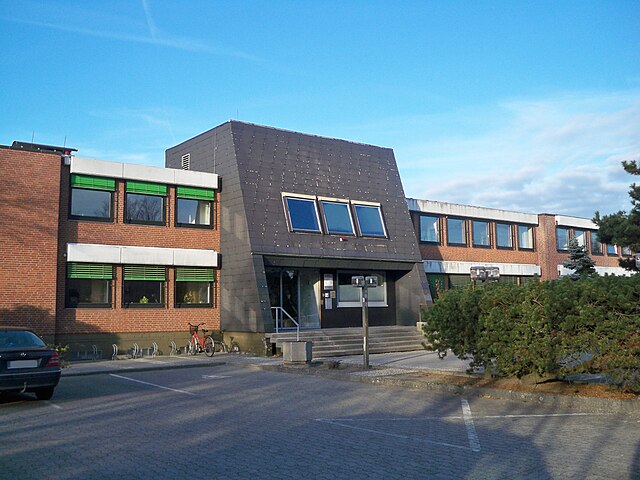
Wesendorf (Samtgemeinde Wesendorf)

 Hiking in Wesendorf
Wesendorf, located in the Samtgemeinde of Wesendorf in Lower Saxony, Germany, offers a serene environment for hiking enthusiasts. The area is characterized by its picturesque landscapes, featuring a mix of forests, open fields, and small lakes, making it ideal for both leisurely walks and more vigorous hikes.
Main Hiking Trails
- Wesendorf Rundweg: This circular trail around the village highlights the local flora and fauna, taking you through scenic countryside and providing opportunities to spot wildlife.
- Lößnitzweg: A slightly longer route that ventures into the surrounding woodlands, perfect for those looking to experience nature on a deeper level.
What to Expect
- Nature: The region is relatively flat, which makes for easy hiking and is accessible for hikers of all skill levels. The presence of forests adds a peaceful ambiance and shade on sunny days.
- Wildlife: Expect to see a variety of birds and small mammals, and potentially some unique plant species along the trails.
- Cultural Stops: While hiking, take the opportunity to visit historical landmarks in the village, such as traditional half-timbered houses and local churches.
Tips for Hiking in Wesendorf
- Best Time to Hike: Late spring to early autumn is ideal, as the weather is mild, and the landscape is lush and vibrant.
- Preparation: Wear suitable hiking footwear and carry water and snacks. A local map can be helpful, though many trails are well-marked.
- Check Weather Conditions: Always check the weather forecast before heading out, as conditions can change rapidly.
Additional Activities
In addition to hiking, the area may offer opportunities for cycling, birdwatching, and photography, making it a great destination for nature lovers.
If you're planning to hike in Wesendorf, embrace the peaceful surroundings and enjoy the beauty of the Lower Saxony countryside!
- Страна:

- Код автомобильного номера: GF
- Координаты: 52° 35' 36" N, 10° 32' 6" E


- GPS треки (wikiloc): [Ссылка]
- Площадь: 209.04 кв.км
- Население: 14422
- Веб сайт: http://www.wesendorf.de/
- Википедия английская: wiki(en)
- Википедия национальная: wiki(de)
- Хранилище Wikidata: Wikidata: Q531335
- Катеория в википедии: [Ссылка]
- код Freebase: [/m/0kw6pw]
- код Freebase: [/m/0kw6pw]
- код VIAF: Альт: [249401685]
- код VIAF: Альт: [249401685]
- ID отношения в OpenStreetMap: [1384918]
- ID отношения в OpenStreetMap: [1384918]
- код GND: Альт: [4618152-0]
- код GND: Альт: [4618152-0]
- код Historical Gazetteer: [object_153298]
- код Historical Gazetteer: [object_153298]
- код региона Германии: 031515407
- код региона Германии: 031515407
Включает регионы:

Везендорф
Hiking in Везендорф
Wesendorf, a charming village located in Lower Saxony, Germany, offers a variety of hiking opportunities for both beginners and more experienced hikers. Its picturesque landscapes, including lush forests, meadows, and quaint countryside, make it an excellent destination for outdoor enthusiasts....
- Страна:
- Почтовый код: 29392
- Телефонный код: 05376
- Код автомобильного номера: GF
- Координаты: 52° 36' 0" N, 10° 32' 0" E
- GPS треки (wikiloc): [Ссылка]
- Высота над уровнем моря: 59 м m
- Площадь: 31.23 кв.км
- Население: 5229
- Веб сайт: [Ссылка]
Вагенхоф
Hiking in Вагенхоф
Wagenhoff, a small and picturesque area in Germany, is an excellent destination for hiking enthusiasts. While it may not be as well-known as some other hiking hotspots, it offers a variety of trails that cater to different experience levels, from leisurely walks to more challenging hikes....
- Страна:
- Почтовый код: 38559
- Телефонный код: 05376
- Код автомобильного номера: GF
- Координаты: 52° 32' 0" N, 10° 31' 0" E
- GPS треки (wikiloc): [Ссылка]
- Высота над уровнем моря: 59 м m
- Площадь: 4.32 кв.км
- Население: 1197

Варенхольц
Hiking in Варенхольц
Wahrenholz is a small town located in Lower Saxony, Germany, surrounded by beautiful countryside and natural landscapes, making it a pleasant option for hiking enthusiasts. While Wahrenholz itself may not have extensive hiking trails specifically within the town, you can explore the surrounding areas that offer various hiking opportunities. Here are some key points to consider when hiking in and around Wahrenholz:...
- Страна:
- Почтовый код: 29399
- Телефонный код: 05835
- Код автомобильного номера: GF
- Координаты: 52° 37' 0" N, 10° 36' 0" E
- GPS треки (wikiloc): [Ссылка]
- Высота над уровнем моря: 55 м m
- Площадь: 58 кв.км
- Население: 3596
Уммерн
Hiking in Уммерн
Ummern is a scenic area that offers a variety of hiking opportunities for outdoor enthusiasts. Here are some key points to consider when planning a hike in Ummern:...
- Страна:
- Почтовый код: 29369
- Телефонный код: 05083
- Код автомобильного номера: GF
- Координаты: 52° 35' 28" N, 10° 25' 55" E
- GPS треки (wikiloc): [Ссылка]
- Высота над уровнем моря: 54 м m
- Площадь: 40.32 кв.км
- Население: 1587

Шёневёрде
Hiking in Шёневёрде
Schönewörde, a quaint village in Germany, is not as commonly known for hiking as some larger national parks or well-established hiking areas, but it can offer some lovely outdoor experiences, especially if you're looking to enjoy the peaceful countryside and natural surroundings....
- Страна:
- Почтовый код: 29396
- Телефонный код: 05835
- Код автомобильного номера: GF
- Координаты: 52° 38' 0" N, 10° 38' 0" E
- GPS треки (wikiloc): [Ссылка]
- Высота над уровнем моря: 63 м m
- Площадь: 17.73 кв.км
- Население: 927

Грос-Эзинген
Hiking in Грос-Эзинген
Groß Oesingen is a picturesque village located in the Lower Saxony region of Germany. While it may not be as widely known as some of the larger hiking areas in Germany, it offers beautiful natural landscapes and scenic trails that can provide an enjoyable experience for hikers of all levels....
- Страна:
- Почтовый код: 29393
- Телефонный код: 05838
- Код автомобильного номера: GF
- Координаты: 52° 39' 0" N, 10° 29' 0" E
- GPS треки (wikiloc): [Ссылка]
- Высота над уровнем моря: 74 м m
- Площадь: 57.44 кв.км
- Население: 1895
- Веб сайт: [Ссылка]
Граничит с регионами:

Гифхорн
- город в земле Нижняя Саксония (Германия)
Hiking in Гифхорн
Gifhorn is a charming town in Lower Saxony, Germany, surrounded by natural beauty and offers a range of hiking opportunities. Here are some highlights about hiking in and around Gifhorn:...
- Страна:
- Почтовый код: 38518
- Телефонный код: 05371
- Код автомобильного номера: GF
- Координаты: 52° 29' 19" N, 10° 32' 47" E
- GPS треки (wikiloc): [Ссылка]
- Высота над уровнем моря: 53 м m
- Площадь: 104.86 кв.км
- Население: 42019
- Веб сайт: [Ссылка]
Броме
Hiking in Броме
Brome, located in the Samtgemeinde of Brome in Lower Saxony, Germany, offers a blend of natural beauty and quite a few well-maintained hiking routes. The area is characterized by picturesque landscapes, forests, and agricultural fields, making it a great destination for outdoor enthusiasts....
- Страна:
- Код автомобильного номера: GF
- Координаты: 52° 35' 56" N, 10° 55' 59" E
- GPS треки (wikiloc): [Ссылка]
- Площадь: 203.87 кв.км
- Население: 17018
- Веб сайт: [Ссылка]

Hankensbüttel
Hiking in Hankensbüttel
Hankensbüttel, located in the Samtgemeinde of Lower Saxony, Germany, is surrounded by picturesque nature that offers various hiking opportunities. Here are some highlights for hiking in this area:...
- Страна:
- Код автомобильного номера: GF
- Координаты: 52° 43' 0" N, 10° 35' 0" E
- GPS треки (wikiloc): [Ссылка]
- Площадь: 290.27 кв.км
- Население: 9096
- Веб сайт: [Ссылка]

Meinersen
Hiking in Meinersen
Meinersen, located in Lower Saxony, Germany, is a charming area that offers a variety of hiking opportunities, especially for those who appreciate serene landscapes and the outdoors. Here’s what you can expect when hiking in this region:...
- Страна:
- Код автомобильного номера: GF
- Координаты: 52° 28' 0" N, 10° 22' 0" E
- GPS треки (wikiloc): [Ссылка]
- Площадь: 173.09 кв.км
- Население: 20515
- Веб сайт: [Ссылка]

Зассенбург
Hiking in Зассенбург
Sassenburg, located in Lower Saxony, Germany, is surrounded by natural beauty and offers various opportunities for hiking enthusiasts. While not as widely known as some other hiking regions, it has its own charm and scenic landscapes....
- Страна:
- Почтовый код: 38524
- Телефонный код: 05379; 05378; 05371
- Код автомобильного номера: GF
- Координаты: 52° 31' 0" N, 10° 38' 0" E
- GPS треки (wikiloc): [Ссылка]
- Высота над уровнем моря: 68 м m
- Площадь: 88.4 кв.км
- Население: 12460
- Веб сайт: [Ссылка]