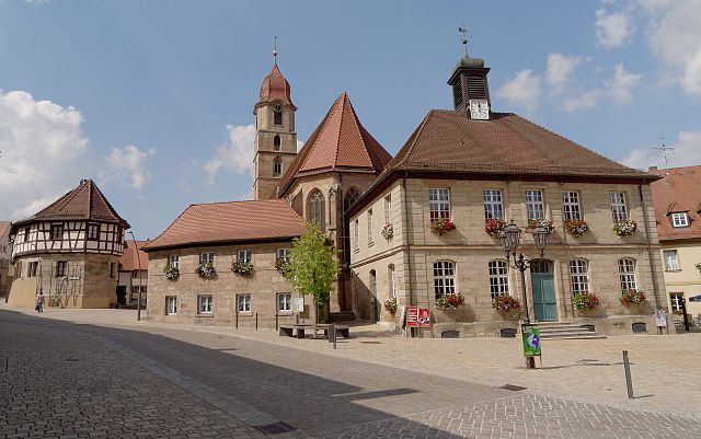
Вильхермсдорф (Wilhermsdorf, Wilhermsdorf)

 Hiking in Вильхермсдорф
Wilhermsdorf, located in Bavaria, Germany, is a charming village offering access to several scenic hiking trails and beautiful natural landscapes. Here are some key points about hiking in Wilhermsdorf:
Trails and Nature
-
Diverse Terrain: The area around Wilhermsdorf features a mix of forests, fields, and hills, providing a variety of hiking experiences. You can expect both gentle walks as well as more challenging trails.
-
Local Routes: Some popular routes include paths that take you through the picturesque Franconian countryside, with opportunities to explore local flora and fauna.
-
Scenic Views: The higher parts of the trails often offer panoramic views of the surrounding landscapes, including rolling hills and distant mountains.
-
Nearby Nature Reserves: Explore nearby nature reserves for a more untouched experience with nature. Nature lovers can observe various bird species and other wildlife along these trails.
Recommendations
-
Start in the Village: Before heading out, it’s a good idea to stroll through Wilhermsdorf, enjoying its quaint charm. The local history can often give hikers deeper appreciation for the trails.
-
Map and Navigation: Make sure to have a good map or GPS app for hiking. Local trails might not always be well-marked.
-
Weather Considerations: Bavaria has variable weather conditions; it’s wise to check the forecast and dress appropriately in layers for both warmth and breathability.
-
Safety and Preparedness: Always carry sufficient water, snacks, and a first aid kit. If venturing into more remote areas, let someone know your plans.
Local Amenities
-
Lodging: If you plan on an extended hiking trip, look for nearby guesthouses or hotels in Wilhermsdorf for accommodation.
-
Dining: After your hike, enjoy local Bavarian cuisine at nearby eateries, which can provide a perfect end to your day outdoors.
Hiking Events
Keep an eye out for local hiking events or guided tours which might be organized in the area. These can enhance your experience and offer insights from local experts.
If you’re considering hiking in Wilhermsdorf, you’ll find it’s a beautiful region blending nature and local culture, perfect for day hikes or longer excursions. Enjoy your adventure!
- Страна:

- Почтовый код: 91452
- Телефонный код: 09102
- Координаты: 49° 29' 11" N, 10° 43' 5" E


- GPS треки (wikiloc): [Ссылка]
- Высота над уровнем моря: 322 м m
- Площадь: 26.64 кв.км
- Население: 3937
- Веб сайт: http://www.markt-wilhermsdorf.de
- Википедия русская: wiki(ru)
- Википедия английская: wiki(en)
- Википедия национальная: wiki(de)
- Хранилище Wikidata: Wikidata: Q541454
- Катеория в википедии: [Ссылка]
- код Freebase: [/m/02q38pn]
- код GeoNames: Альт: [2808649]
- код BNF: [13337392q]
- код VIAF: Альт: [167771334]
- ID отношения в OpenStreetMap: [1016403]
- код GND: Альт: [4108873-6]
- идентификатор местоположения ArchINFORM: [13349]
- WOEID: [706650]
- код TGN: [7083578]
- код Historical Gazetteer: [WILOR1JN59IL]
- Bavarikon ID: [ODB_A00000110]
- идентификатор муниципалитетов в Германии: 09573133
Граничит с регионами:

Лангенценн
- город в Германии, в земле Бавария
Hiking in Лангенценн
Langenzenn, located in Bavaria, Germany, offers a charming experience for hiking enthusiasts. The area is characterized by its picturesque landscapes, rolling hills, lush forests, and quaint rural scenery. Here are some highlights and tips for hiking in Langenzenn:...
- Страна:
- Почтовый код: 90579
- Телефонный код: 09101
- Координаты: 49° 29' 40" N, 10° 47' 41" E
- GPS треки (wikiloc): [Ссылка]
- Высота над уровнем моря: 313 м m
- Площадь: 46.31 кв.км
- Население: 8193
- Веб сайт: [Ссылка]


Дитенхофен
Hiking in Дитенхофен
Dietenhofen, located in Bavaria, Germany, is a great destination for hiking enthusiasts. The region boasts beautiful landscapes, charming villages, and a variety of trails suitable for different skill levels. Here are some key points to consider when hiking in and around Dietenhofen:...
- Страна:
- Почтовый код: 90599
- Телефонный код: 09824
- Код автомобильного номера: AN
- Координаты: 49° 24' 0" N, 10° 41' 24" E
- GPS треки (wikiloc): [Ссылка]
- Высота над уровнем моря: 353 м m
- Площадь: 63.96 кв.км
- Население: 4260
- Веб сайт: [Ссылка]