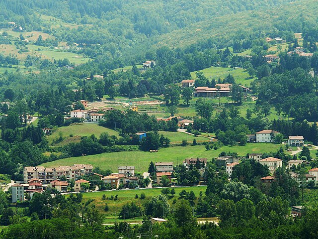
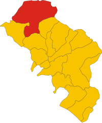
Цери (Zeri, Zeri)
.svg)
- коммуна Италии
 Hiking in Цери
Zeri is a beautiful area located in the Tuscany region of Italy, known for its stunning landscapes, rich biodiversity, and serene environment. It lies in the province of Massa-Carrara and is a great destination for hikers seeking both natural beauty and cultural experiences.
Hiking Trails
-
Monte Giovo: One of the most popular hikes in the area, Monte Giovo offers various trails with panoramic views of the Apuan Alps and the surrounding valleys. The ascent can be challenging but is rewarding for its breathtaking vistas.
-
Casentino Forests: The nearby Casentino Forests, Monte Falterona, and Campigna National Park provide numerous trails. You can hike through dense woodlands, visit ancient monasteries, and enjoy the local fauna and flora.
-
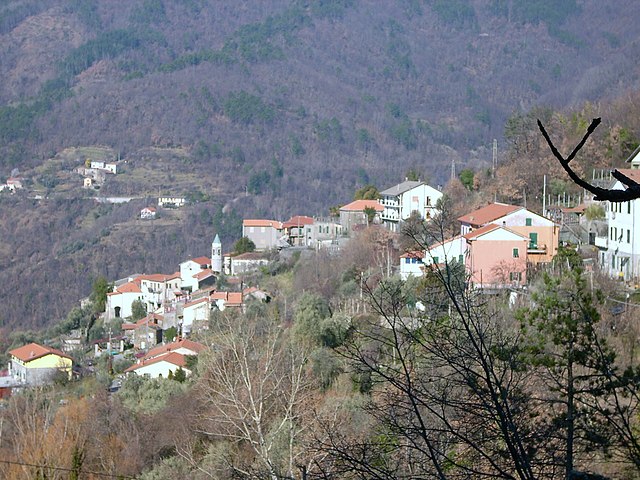
Local Villages: Many hiking trails connect the small villages in and around Zeri. Exploring these paths allows you to immerse yourself in local culture and history. You may pass through charming towns like Salvamania and the historic sites they feature.
Best Time to Hike
- Spring and Fall: The best times to hike in Zeri are during the spring (April to June) and fall (September to October) when the weather is mild, and the landscapes are vibrant with wildflowers or autumn colors.
Preparation and Tips
-
Wear proper hiking gear: Good boots, breathable clothing, and a waterproof jacket are essential. The weather can change quickly, especially in mountainous areas.
-
Stay Hydrated: Bring plenty of water, especially if you’re hiking during warmer months.
-
Navigation: While many trails are marked, having a map or a GPS device is wise. Consider downloading offline maps in case of poor reception.
-
Respect Nature: Follow Leave No Trace principles. Make sure to stay on trails and pack out what you bring in.
Local Insights
Zeri is relatively less touristy compared to other areas in Tuscany, providing a tranquil hiking experience. The local cuisine in the region is also a great reward after a day of hiking; be sure to enjoy some traditional dishes at local trattorias.
Overall, hiking in Zeri is an excellent option for those looking to explore off-the-beaten-path locations in Italy while enjoying the majestic landscapes and rich cultural heritage.
- Страна:

- Почтовый код: 54029
- Телефонный код: 0187
- Код автомобильного номера: MS
- Координаты: 44° 21' 0" N, 9° 46' 0" E


- GPS треки (wikiloc): [Ссылка]
- Высота над уровнем моря: 708 м m
- Площадь: 73.66 кв.км
- Население: 1057
- Веб сайт: http://www.comune.zeri.ms.it/
- Википедия русская: wiki(ru)
- Википедия английская: wiki(en)
- Википедия национальная: wiki(it)
- Хранилище Wikidata: Wikidata: Q52244
- Катеория в википедии: [Ссылка]
- код Freebase: [/m/0fy03q]
- код GeoNames: Альт: [3163884]
- ID отношения в OpenStreetMap: [43014]
- код ISTAT: 045017
- кадастровый код Италии: M169
Граничит с регионами:

Альбарето
- коммуна Италии
Hiking in Альбарето
Albareto is a charming village located in the province of Parma in the Emilia-Romagna region of northern Italy. It's surrounded by beautiful landscapes, making it a great destination for hiking enthusiasts. The area is characterized by rolling hills, dense forests, and panoramic views, offering various trails suitable for different skill levels....
- Страна:
- Почтовый код: 43051
- Телефонный код: 0525
- Код автомобильного номера: PR
- Координаты: 44° 26' 49" N, 9° 42' 8" E
- GPS треки (wikiloc): [Ссылка]
- Высота над уровнем моря: 512 м m
- Площадь: 104.11 кв.км
- Население: 2160
- Веб сайт: [Ссылка]

Циньяго
- коммуна Италии
Hiking in Циньяго
Zignago, located in the province of La Spezia in the Liguria region of Italy, is a lesser-known area that offers beautiful landscapes and several hiking opportunities. It is situated near the famous Cinque Terre National Park, making it a great starting point for those looking to explore a more secluded side of the Italian Riviera....
- Страна:
- Почтовый код: 19020
- Телефонный код: 0187
- Код автомобильного номера: SP
- Координаты: 44° 16' 39" N, 9° 44' 41" E
- GPS треки (wikiloc): [Ссылка]
- Высота над уровнем моря: 632 м m
- Площадь: 28.7 кв.км
- Население: 515
- Веб сайт: [Ссылка]

Роккетта-ди-Вара
- коммуна Италии
Hiking in Роккетта-ди-Вара
Rocchetta di Vara is a charming village located in the Liguria region of Italy, nestled in the hills of the Val di Vara. This area is known for its picturesque landscapes, lush greenery, and diverse hiking trails that appeal to all levels of hikers....
- Страна:
- Почтовый код: 19020
- Телефонный код: 0187
- Код автомобильного номера: SP
- Координаты: 44° 15' 4" N, 9° 45' 26" E
- GPS треки (wikiloc): [Ссылка]
- Высота над уровнем моря: 220 м m
- Площадь: 32.66 кв.км
- Население: 701
- Веб сайт: [Ссылка]


Сеста-Годано
- коммуна Италии
Hiking in Сеста-Годано
Sesta Godano is a charming village located in the heart of the Ligurian region of Italy, surrounded by the beautiful landscapes of the Ligurian Apennines. It offers a variety of hiking opportunities for all levels, making it an excellent destination for outdoor enthusiasts....
- Страна:
- Почтовый код: 19020
- Телефонный код: 0187
- Код автомобильного номера: SP
- Координаты: 44° 17' 37" N, 9° 40' 32" E
- GPS треки (wikiloc): [Ссылка]
- Высота над уровнем моря: 242 м m
- Площадь: 67.78 кв.км
- Население: 1339
- Веб сайт: [Ссылка]


Мулаццо
- коммуна Италии
Hiking in Мулаццо
Mulazzo is a charming village located in the province of Massa-Carrara in Tuscany, Italy. It is situated in the Apuan Alps, which offers stunning landscapes and a variety of hiking opportunities. Here’s an overview of what you might expect when hiking in this beautiful area:...
- Страна:
- Почтовый код: 54026
- Телефонный код: 0187
- Код автомобильного номера: MS
- Координаты: 44° 19' 1" N, 9° 53' 26" E
- GPS треки (wikiloc): [Ссылка]
- Высота над уровнем моря: 351 м m
- Площадь: 62.51 кв.км
- Население: 2425
- Веб сайт: [Ссылка]
Понтремоли
- коммуна Италии
Hiking in Понтремоли
Pontremoli, a charming town in the Lunigiana region of Tuscany, Italy, offers a variety of hiking opportunities for outdoor enthusiasts. Nestled in the Apennine Mountains, it is surrounded by stunning natural landscapes, rich history, and vibrant culture. Here are some key points to consider for hiking in and around Pontremoli:...
- Страна:
- Почтовый код: 54027
- Телефонный код: 0187
- Код автомобильного номера: MS
- Координаты: 44° 22' 34" N, 9° 52' 48" E
- GPS треки (wikiloc): [Ссылка]
- Высота над уровнем моря: 236 м m
- Площадь: 182.48 кв.км
- Население: 7193
- Веб сайт: [Ссылка]