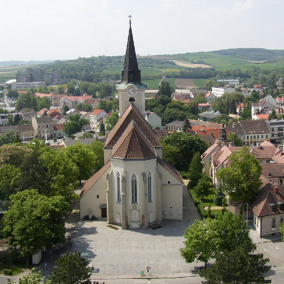
Цирсдорф (Ziersdorf, Ziersdorf)
 Hiking in Цирсдорф
Ziersdorf, located in Lower Austria, is known for its beautiful countryside and scenic landscapes, making it a great destination for hiking enthusiasts. Here are some key points to consider when planning a hiking trip in Ziersdorf:
-
Trails and Routes: There are several marked hiking trails in and around Ziersdorf that cater to different skill levels. These trails often pass through forests, vineyards, and rolling hills, offering stunning views of the region.
-
Duration and Difficulty: Depending on your fitness level and time availability, you can find both short loops and longer hikes. Most trails are well-marked and range from easy to moderate difficulty, making them accessible for both beginners and experienced hikers.
-
Nature and Wildlife: Ziersdorf's natural environment is home to diverse flora and fauna. Keep an eye out for local wildlife, including various bird species and other animals that inhabit the forests and fields.
-
Seasonal Considerations: Spring and fall are particularly pleasant times to hike in Ziersdorf, with mild weather and beautiful foliage. Summers can be warm, so it’s important to carry enough water and sun protection. Winter hikes can also be enjoyable, but always check trail conditions before heading out.
-
Local Amenities: If you plan to spend a day hiking, you can find local inns and restaurants in Ziersdorf for a meal or refreshments after your hike. This is a great opportunity to enjoy regional cuisine.
-
Safety Tips: Always inform someone about your hiking plans, carry a map or use a hiking app, and make sure to wear suitable footwear. Additionally, be aware of the weather conditions and prepare accordingly.
Before you go, it's a good idea to check local resources, such as visitor centers or hiking clubs, for updated information on trails and any events or guided hikes that may be available. Enjoy your hiking adventure in Ziersdorf!
- Страна:

- Почтовый код: 3710
- Телефонный код: 02956
- Код автомобильного номера: HL
- Координаты: 48° 32' 0" N, 15° 56' 0" E


- GPS треки (wikiloc): [Ссылка]
- Высота над уровнем моря: 230 м m
- Площадь: 48.72 кв.км
- Население: 3446
- Веб сайт: http://www.ziersdorf.at
- Википедия русская: wiki(ru)
- Википедия английская: wiki(en)
- Википедия национальная: wiki(de)
- Хранилище Wikidata: Wikidata: Q199201
- Катеория в википедии: [Ссылка]
- код Freebase: [/m/02qx7vl]
- код GeoNames: Альт: [7872894]
- код VIAF: Альт: [242268434]
- идентификатор местоположения ArchINFORM: [9953]
- код TGN: [1026260]
- код австрийского муниципалитета: [31053]
Граничит с регионами:
Холлабрунн
Hiking in Холлабрунн
Hollabrunn is a town located in Lower Austria, surrounded by beautiful landscapes, which makes it a great place for hiking enthusiasts. The region offers a variety of trails suitable for different skill levels, ranging from leisurely walks to more challenging hikes....
- Страна:
- Почтовый код: 2020
- Телефонный код: 02952
- Код автомобильного номера: HL
- Координаты: 48° 34' 0" N, 16° 5' 0" E
- GPS треки (wikiloc): [Ссылка]
- Высота над уровнем моря: 236 м m
- Площадь: 152.38 кв.км
- Население: 11681
- Веб сайт: [Ссылка]

Зитцендорф-ан-дер-Шмида
Hiking in Зитцендорф-ан-дер-Шмида
Sitzendorf an der Schmida is a picturesque village located in the Lower Austria region of Austria. The surrounding countryside offers a delightful range of hiking opportunities, making it a great destination for outdoor enthusiasts....
- Страна:
- Почтовый код: 3714
- Телефонный код: 02959
- Код автомобильного номера: HL
- Координаты: 48° 35' 59" N, 15° 56' 24" E
- GPS треки (wikiloc): [Ссылка]
- Высота над уровнем моря: 244 м m
- Площадь: 61.85 кв.км
- Население: 2162
- Веб сайт: [Ссылка]

Гросриденталь
Hiking in Гросриденталь
Großriedenthal, located in the Lower Austria region, is a picturesque area that offers a variety of hiking opportunities amidst beautiful natural scenery. The region features rolling hills, vineyards, and rich agricultural landscapes, making it an ideal choice for both leisurely walks and more adventurous hikes....
- Страна:
- Телефонный код: 02279
- Код автомобильного номера: TU
- Координаты: 48° 29' 0" N, 15° 52' 0" E
- GPS треки (wikiloc): [Ссылка]
- Высота над уровнем моря: 277 м m
- Площадь: 18.83 кв.км
- Население: 899
- Веб сайт: [Ссылка]

Хельденберг
Hiking in Хельденберг
Heldenberg, located in Lower Austria, is a fantastic hiking destination that offers a mix of beautiful landscapes, historical sites, and outdoor activities. Here are some key details you should know about hiking in Heldenberg:...
- Страна:
- Телефонный код: 02956
- Код автомобильного номера: HL
- Координаты: 48° 30' 0" N, 15° 57' 0" E
- GPS треки (wikiloc): [Ссылка]
- Высота над уровнем моря: 238 м m
- Площадь: 27.37 кв.км
- Население: 1270
- Веб сайт: [Ссылка]

Хоэнварт-Мюльбах-ам-Манхартсберг
Hiking in Хоэнварт-Мюльбах-ам-Манхартсберг
Hohenwarth-Mühlbach am Manhartsberg is a picturesque area in Austria that offers a variety of hiking opportunities, set amidst beautiful natural landscapes. The region is characterized by rolling hills, vineyards, and serene countryside, making it an ideal spot for both casual walkers and experienced hikers....
- Страна:
- Телефонный код: 02957
- Код автомобильного номера: HL
- Координаты: 48° 30' 0" N, 15° 49' 0" E
- GPS треки (wikiloc): [Ссылка]
- Высота над уровнем моря: 365 м m
- Площадь: 43.59 кв.км
- Население: 1304
- Веб сайт: [Ссылка]


Равельсбах
Hiking in Равельсбах
Ravelsbach, located in Austria, offers a beautiful and scenic environment for hikers. Nestled in the northeastern part of Lower Austria, this area is part of the broader landscape known for its rolling hills, vineyards, and charming villages, making it an attractive destination for outdoor enthusiasts....
- Страна:
- Почтовый код: 3720
- Телефонный код: 02958
- Код автомобильного номера: HL
- Координаты: 48° 33' 0" N, 15° 51' 0" E
- GPS треки (wikiloc): [Ссылка]
- Высота над уровнем моря: 265 м m
- Площадь: 26.37 кв.км
- Население: 1580
- Веб сайт: [Ссылка]