Циллис-Райшен (Zillis-Reischen, Zillis-Reischen)

 Hiking in Циллис-Райшен
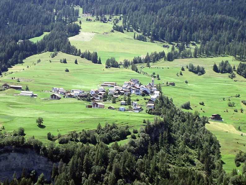
Zillis-Reischen is a charming municipality in the Surselva region of Switzerland, known for its stunning landscapes and rich cultural heritage, making it a great destination for hiking enthusiasts. The area is surrounded by the beautiful Alps, offering a variety of trails suitable for different skill levels, from leisurely walks to more challenging hikes.
Hiking Trails
-
Reischen to Zillis Trail: This is a relatively easy hike that allows you to enjoy picturesque views of the valley, with opportunities to witness local flora and fauna. The trail connects the two villages through beautiful meadows and forests.
-
Alp Dado: For a more moderate trek, you can hike towards Alp Dado, where you will be rewarded with panoramic views of the surrounding peaks. This trail can be combined with a visit to nearby Alpine pastures for a taste of local agriculture.
-
Muntogna di Piz Dado: This route is more challenging and is suited for those with good fitness levels. The trail leads upwards to higher altitudes, providing breathtaking views of the Surselva region and its mountain ranges.
-
Cultural Hikes: The area is rich in culture, so you might consider hikes that not only focus on nature but also pass by historical landmarks or engage with the local community. Look for trails that lead to ancient churches or sites of historical interest.
Best Time to Hike
The best time for hiking in Zillis-Reischen is during spring through autumn (May to October), when the weather is mild and the trails are generally accessible. In winter, the area is popular for snowshoeing and winter sports, but make sure to check local conditions if you plan to hike in snowy weather.
Tips for Hiking in Zillis-Reischen
- Maps and Guides: Ensure you have a good hiking map or trail guide, as some trails may not be well-marked.
- Weather Preparedness: The weather can change quickly in the mountains, so be prepared for various conditions. Dress in layers and bring rain gear if necessary.
- Hydration and Nutrition: Carry enough water and snacks, especially for longer hikes.
- Leave No Trace: Help preserve the natural beauty of the area by following Leave No Trace principles and respecting local wildlife.
Enjoy your hiking adventures in Zillis-Reischen – it's a place where nature's beauty meets rich cultural experiences!
- Страна:

- Почтовый код: 7432
- Телефонный код: 081
- Код автомобильного номера: GR
- Координаты: 46° 37' 59" N, 9° 25' 59" E


- GPS треки (wikiloc): [Ссылка]
- Высота над уровнем моря: 945 м m
- Площадь: 24.48 кв.км
- Население: 388
- Веб сайт: http://www.zillis-reischen.ch
- Википедия русская: wiki(ru)
- Википедия английская: wiki(en)
- Википедия национальная: wiki(de)
- Хранилище Wikidata: Wikidata: Q64890
- Катеория в википедии: [Ссылка]
- Карты в википедии: [Ссылка]
- код Freebase: [/m/026g1rn]
- код GeoNames: Альт: [7287637]
- код VIAF: Альт: [170383748]
- ID отношения в OpenStreetMap: [1684211]
- идентификатор HDS: [45874]
- код швейцарского муниципалитета: [3712]
- код NKC: [ge934768]
- код Pleiades: [187632]
Включает регионы:

Wikidata: Q27943319
Hiking in Wikidata: Q27943319
It seems you've referenced a specific entity ID (Q27943319) from Wikidata, but I don’t have direct access to external databases to provide specific details about that entity. However, if you can give me the name or details of the location you are referring to, I’d be happy to help with information about hiking in that area—such as trails, difficulty levels, highlights, and tips!...
- Страна:
- Координаты: 46° 38' 2" N, 9° 26' 39" E
- GPS треки (wikiloc): [Ссылка]
- Высота над уровнем моря: 942 м m

Wikidata: Q27955065
Hiking in Wikidata: Q27955065
It appears that "Q27955065" refers to a concept or entity in a structured data format like Wikidata. Unfortunately, it doesn’t specify any particular location for hiking. However, if you provide a name of a specific place, region, or park, I can definitely give you information about hiking opportunities there!...
- Страна:
- Координаты: 46° 38' 26" N, 9° 27' 6" E
- GPS треки (wikiloc): [Ссылка]
- Высота над уровнем моря: 1017 м m
Граничит с регионами:


Муттен
Hiking in Муттен
Mutten is a small, picturesque village in the Swiss Graubünden region, renowned for its stunning natural beauty and peace. For hiking enthusiasts, it offers various trails that cater to different skill levels, showcasing breathtaking alpine landscapes, lush meadows, and stunning vistas....
- Страна:
- Почтовый код: 7431
- Телефонный код: 081
- Код автомобильного номера: GR
- Координаты: 46° 40' 16" N, 9° 29' 32" E
- GPS треки (wikiloc): [Ссылка]
- Высота над уровнем моря: 1708 м m
- Площадь: 9.30 кв.км
- Население: 61
- Веб сайт: [Ссылка]


Зильс-им-Домлешг
Hiking in Зильс-им-Домлешг
Sils im Domleschg is a picturesque village located in the Graubünden region of Switzerland, known for its stunning natural landscapes and outdoor activities, including hiking. Here are some highlights and considerations for hiking in this area:...
- Страна:
- Почтовый код: 7411
- Телефонный код: 081
- Код автомобильного номера: GR
- Координаты: 46° 42' 0" N, 9° 26' 59" E
- GPS треки (wikiloc): [Ссылка]
- Высота над уровнем моря: 1199 м m
- Площадь: 9.28 кв.км
- Население: 930
- Веб сайт: [Ссылка]


Донат
Hiking in Донат
Hiking in Donat, Switzerland, offers a unique experience, as it's situated in the scenic Graubünden region. The area is known for its stunning alpine landscapes, diverse flora and fauna, and charming mountain villages....
- Страна:
- Почтовый код: 7433
- Телефонный код: 081
- Код автомобильного номера: GR
- Координаты: 46° 27' 59" N, 9° 27' 59" E
- GPS треки (wikiloc): [Ссылка]
- Высота над уровнем моря: 1037 м m
- Площадь: 4.67 кв.км
- Население: 211
- Веб сайт: [Ссылка]

Штирва
Hiking in Штирва
Stierva, a picturesque village located in the heart of the Swiss Alps, offers a stunning array of hiking opportunities for outdoor enthusiasts. Nestled within the Graubünden region, Stierva is known for its breathtaking landscapes, diverse terrain, and rich natural beauty. Here are some key points to consider when hiking in and around Stierva:...
- Страна:
- Почтовый код: 7459
- Телефонный код: 081
- Код автомобильного номера: GR
- Координаты: 46° 38' 59" N, 9° 32' 0" E
- GPS треки (wikiloc): [Ссылка]
- Высота над уровнем моря: 1375 м m
- Площадь: 10.56 кв.км
- Веб сайт: [Ссылка]


Ронгеллен
Hiking in Ронгеллен
Rongellen is a beautiful area nestled in nature, ideal for hiking enthusiasts. Located in Switzerland, it offers a mix of scenic trails, diverse landscapes, and varying levels of difficulty suitable for hikers of all skill levels....
- Страна:
- Почтовый код: 7430
- Телефонный код: 081
- Код автомобильного номера: GR
- Координаты: 46° 40' 26" N, 9° 26' 26" E
- GPS треки (wikiloc): [Ссылка]
- Высота над уровнем моря: 1074 м m
- Площадь: 2.02 кв.км
- Население: 53
- Веб сайт: [Ссылка]


Лон
Hiking in Лон
Lohn is a picturesque village in the Graubünden region of Switzerland, known for its stunning alpine scenery and outdoor recreational opportunities. It lies at an elevation of about 1,300 meters, making it an excellent base for various hiking trails that cater to different skill levels....
- Страна:
- Почтовый код: 7433
- Телефонный код: 081
- Код автомобильного номера: GR
- Координаты: 46° 39' 5" N, 9° 25' 39" E
- GPS треки (wikiloc): [Ссылка]
- Высота над уровнем моря: 1817 м m
- Площадь: 8.17 кв.км
- Население: 42
- Веб сайт: [Ссылка]


Залуф
Hiking in Залуф
Salouf is a picturesque village located in the Swiss canton of Graubünden, nestled in the scenic Surselva region. The area is renowned for its stunning landscapes, beautiful alpine meadows, and an array of hiking trails suitable for all levels of hikers. Here are some highlights and tips for hiking in Salouf:...
- Страна:
- Почтовый код: 7462
- Телефонный код: 081
- Код автомобильного номера: GR
- Координаты: 46° 37' 27" N, 9° 34' 32" E
- GPS треки (wikiloc): [Ссылка]
- Высота над уровнем моря: 2109 м m
- Площадь: 31.49 кв.км
- Веб сайт: [Ссылка]