Зильс-им-Домлешг (Sils im Domleschg, Sils im Domleschg)

 Hiking in Зильс-им-Домлешг
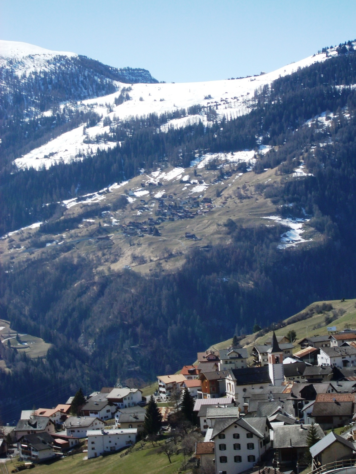
Sils im Domleschg is a picturesque village located in the Graubünden region of Switzerland, known for its stunning natural landscapes and outdoor activities, including hiking. Here are some highlights and considerations for hiking in this area:
Trails and Routes
-
Scenic Views: The area offers diverse hiking trails that showcase the breathtaking Swiss Alps, lush forests, and charming alpine meadows. Trails often provide panoramic views of the surrounding mountains.
-
Variety of Difficulty Levels: Hikes range from easy walks suitable for families to more challenging treks for experienced hikers. Look for marked trails that suit your fitness level and experience.
-
Popular Routes:
- Hiking in the Domleschg Valley: This region features well-maintained paths that pass through charming villages and past historical sites, allowing you to immerse yourself in local culture and history.
- Piz Beverin: For those seeking a challenge, trails leading to higher peaks like Piz Beverin enable you to experience the stunning alpine terrain.
Best Time to Hike
- Summer (June to September): This is the prime hiking season when trails are fully accessible, and weather conditions are generally favorable. Prepare for warm days and cooler evenings.
- Autumn (October): Early October can be a beautiful time to hike as the leaves change colors, but be cautious of weather changes and early snowfalls.
Equipment and Preparation
- Footwear: Good hiking boots are essential for comfort and safety on rocky and uneven terrain.
- Weather Gear: Always check the weather forecast before heading out. Carry layers, as temperatures can change rapidly in the mountains.
- Navigation: While trails are usually well-marked, having a map or GPS device can enhance safety and help with navigation.
- Water and Snacks: Bring enough water and energy-rich snacks to keep you fueled throughout your hike.
Local Amenities
- Accommodations: Sils im Domleschg has various options, from traditional Swiss chalets to modern hotels, making it suitable for multi-day hikes.
- Guided Tours: Consider joining a guided hiking tour for added safety and insights into the local geology, flora, and fauna.
Conservation
Always follow Leave No Trace principles to protect the natural environment. Stick to marked trails, pack out what you pack in, and respect wildlife and plants.
Hiking in Sils im Domleschg can be a rewarding experience for nature lovers, offering a blend of adventure, beauty, and cultural discovery. Whether you're a seasoned hiker or just starting out, the region has something to offer everyone. Happy hiking!
- Страна:

- Почтовый код: 7411
- Телефонный код: 081
- Код автомобильного номера: GR
- Координаты: 46° 42' 0" N, 9° 26' 59" E


- GPS треки (wikiloc): [Ссылка]
- Высота над уровнем моря: 1199 м m
- Площадь: 9.28 кв.км
- Население: 930
- Веб сайт: http://www.sils-id.ch
- Википедия русская: wiki(ru)
- Википедия английская: wiki(en)
- Википедия национальная: wiki(de)
- Хранилище Wikidata: Wikidata: Q65069
- Катеория в википедии: [Ссылка]
- код Freebase: [/m/026g2s9]
- код GeoNames: Альт: [7287172]
- код VIAF: Альт: [237442599]
- ID отношения в OpenStreetMap: [1684168]
- код GND: Альт: [4499040-6]
- идентификатор местоположения ArchINFORM: [11177]
- идентификатор HDS: [1480]
- код швейцарского муниципалитета: [3640]
Граничит с регионами:


Шаранс
Hiking in Шаранс
Scharans is a picturesque village located in the Graubünden region of Switzerland, known for its stunning landscapes and variety of hiking opportunities. Here are some highlights and tips for hiking in and around Scharans:...
- Страна:
- Почтовый код: 7412
- Телефонный код: 081
- Код автомобильного номера: GR
- Координаты: 46° 43' 5" N, 9° 27' 32" E
- GPS треки (wikiloc): [Ссылка]
- Высота над уровнем моря: 1253 м m
- Площадь: 1459 кв.км
- Население: 807
- Веб сайт: [Ссылка]

Вац
- коммуна в кантоне Граубюнден (Швейцария)
Hiking in Вац
Vaz Obervaz, also known simply as Vaz, is a charming municipality located in the Grisons (Graubünden) region of Switzerland. It's a great destination for hiking enthusiasts due to its stunning landscapes, diverse trails, and access to the surrounding mountains....
- Страна:
- Почтовый код: 7082
- Телефонный код: 081
- Код автомобильного номера: GR
- Координаты: 46° 42' 59" N, 9° 33' 0" E
- GPS треки (wikiloc): [Ссылка]
- Высота над уровнем моря: 1300 м m
- Площадь: 42.51 кв.км
- Население: 2630
- Веб сайт: [Ссылка]


Фюрстенау
Hiking in Фюрстенау
Fürstenau, located in the Swiss canton of Graubünden, is a charming village that offers a range of beautiful hiking opportunities amidst the stunning landscapes of the Swiss Alps. Here’s what you need to know about hiking in this area:...
- Страна:
- Почтовый код: 7414
- Телефонный код: 081
- Код автомобильного номера: GR
- Координаты: 46° 42' 59" N, 9° 26' 0" E
- GPS треки (wikiloc): [Ссылка]
- Высота над уровнем моря: 650 м m
- Площадь: 1.32 кв.км
- Население: 349
- Веб сайт: [Ссылка]


Циллис-Райшен
Hiking in Циллис-Райшен
Zillis-Reischen is a charming municipality in the Surselva region of Switzerland, known for its stunning landscapes and rich cultural heritage, making it a great destination for hiking enthusiasts. The area is surrounded by the beautiful Alps, offering a variety of trails suitable for different skill levels, from leisurely walks to more challenging hikes....
- Страна:
- Почтовый код: 7432
- Телефонный код: 081
- Код автомобильного номера: GR
- Координаты: 46° 37' 59" N, 9° 25' 59" E
- GPS треки (wikiloc): [Ссылка]
- Высота над уровнем моря: 945 м m
- Площадь: 24.48 кв.км
- Население: 388
- Веб сайт: [Ссылка]


Муттен
Hiking in Муттен
Mutten is a small, picturesque village in the Swiss Graubünden region, renowned for its stunning natural beauty and peace. For hiking enthusiasts, it offers various trails that cater to different skill levels, showcasing breathtaking alpine landscapes, lush meadows, and stunning vistas....
- Страна:
- Почтовый код: 7431
- Телефонный код: 081
- Код автомобильного номера: GR
- Координаты: 46° 40' 16" N, 9° 29' 32" E
- GPS треки (wikiloc): [Ссылка]
- Высота над уровнем моря: 1708 м m
- Площадь: 9.30 кв.км
- Население: 61
- Веб сайт: [Ссылка]


Ронгеллен
Hiking in Ронгеллен
Rongellen is a beautiful area nestled in nature, ideal for hiking enthusiasts. Located in Switzerland, it offers a mix of scenic trails, diverse landscapes, and varying levels of difficulty suitable for hikers of all skill levels....
- Страна:
- Почтовый код: 7430
- Телефонный код: 081
- Код автомобильного номера: GR
- Координаты: 46° 40' 26" N, 9° 26' 26" E
- GPS треки (wikiloc): [Ссылка]
- Высота над уровнем моря: 1074 м m
- Площадь: 2.02 кв.км
- Население: 53
- Веб сайт: [Ссылка]


Тузис
Hiking in Тузис
Thusis, located in the canton of Graubünden in Switzerland, is a great destination for hikers. It sits at the confluence of the Rhine and Hinterrhein rivers and offers stunning views of the surrounding mountains and valleys....
- Страна:
- Почтовый код: 7430
- Телефонный код: 081
- Код автомобильного номера: GR
- Координаты: 46° 41' 19" N, 9° 25' 58" E
- GPS треки (wikiloc): [Ссылка]
- Высота над уровнем моря: 805 м m
- Площадь: 6.81 кв.км
- Население: 3138
- Веб сайт: [Ссылка]