canton of Auneuil (canton d'Auneuil)
- canton of France (until March 2015)
- Country:

- Capital: Auneuil
- Coordinates: 49° 22' 10" N, 2° 0' 8" E


- GPS tracks (wikiloc): [Link]
- Wikidata storage: Wikidata: Q621789
- INSEE canton code: [6002]
Includes regions:


Auteuil
- commune in Oise, France
- Country:

- Postal Code: 60390
- Coordinates: 49° 20' 29" N, 2° 5' 13" E


- GPS tracks (wikiloc): [Link]
- Area: 11.92 sq km
- Population: 573


Berneuil-en-Bray
- commune in Oise, France
- Country:

- Postal Code: 60390
- Coordinates: 49° 20' 56" N, 2° 3' 57" E


- GPS tracks (wikiloc): [Link]
- Area: 15.15 sq km
- Population: 786


Beaumont-les-Nonains
- commune in Oise, France
- Country:

- Postal Code: 60390
- Coordinates: 49° 19' 40" N, 2° 0' 29" E


- GPS tracks (wikiloc): [Link]
- Area: 9.53 sq km
- Population: 344


La Houssoye
- commune in Oise, France
- Country:

- Postal Code: 60390
- Coordinates: 49° 21' 16" N, 1° 56' 32" E


- GPS tracks (wikiloc): [Link]
- Area: 6.5 sq km
- Population: 609


Le Mesnil-Théribus
- commune in Oise, France
- Country:

- Postal Code: 60240
- Coordinates: 49° 18' 3" N, 1° 59' 14" E


- GPS tracks (wikiloc): [Link]
- Area: 6.61 sq km
- Population: 800


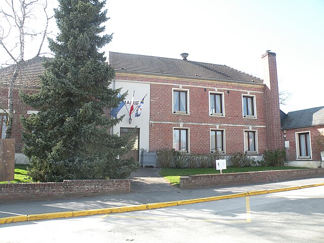
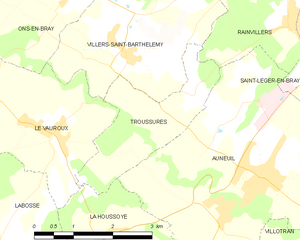
Troussures
- former commune in Oise, France
- Country:

- Postal Code: 60390
- Coordinates: 49° 23' 21" N, 1° 58' 21" E


- GPS tracks (wikiloc): [Link]
- Area: 5.18 sq km
- Population: 185


Villers-Saint-Barthélemy
- commune in Oise, France
- Country:

- Postal Code: 60650
- Coordinates: 49° 23' 53" N, 1° 56' 52" E


- GPS tracks (wikiloc): [Link]
- Area: 9.9 sq km
- Population: 507


Villotran
- commune in Oise, France
- Country:

- Postal Code: 60390
- Coordinates: 49° 20' 45" N, 2° 0' 58" E


- GPS tracks (wikiloc): [Link]
- Area: 5.18 sq km
- Population: 284


Rainvillers
- commune in Oise, France
- Country:

- Postal Code: 60650
- Coordinates: 49° 24' 22" N, 2° 0' 28" E


- GPS tracks (wikiloc): [Link]
- Area: 6.5 sq km
- Population: 890


Porcheux
- commune in Oise, France
- Country:

- Postal Code: 60390
- Coordinates: 49° 19' 56" N, 1° 55' 30" E


- GPS tracks (wikiloc): [Link]
- Area: 4.71 sq km
- Population: 571


Saint-Germain-la-Poterie
- commune in Oise, France
- Country:

- Postal Code: 60650
- Coordinates: 49° 26' 44" N, 1° 58' 57" E


- GPS tracks (wikiloc): [Link]
- Area: 6.02 sq km
- Population: 429


Saint-Paul
- commune in Oise, France
- Country:

- Postal Code: 60650
- Coordinates: 49° 25' 45" N, 2° 0' 25" E


- GPS tracks (wikiloc): [Link]
- Area: 9.52 sq km
- Population: 1536


Saint-Léger-en-Bray
- commune in Oise, France
- Country:

- Postal Code: 60155
- Coordinates: 49° 23' 27" N, 2° 1' 36" E


- GPS tracks (wikiloc): [Link]
- Area: 4.43 sq km
- Population: 356


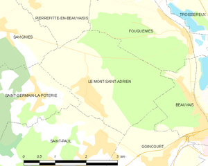
Le Mont-Saint-Adrien
- commune in Oise, France
- Country:

- Postal Code: 60650
- Coordinates: 49° 26' 47" N, 2° 0' 16" E


- GPS tracks (wikiloc): [Link]
- Area: 7.74 sq km
- Population: 642


Auneuil
- former commune in Oise, France
- Country:

- Postal Code: 60390
- Coordinates: 49° 22' 12" N, 1° 59' 49" E


- GPS tracks (wikiloc): [Link]
- Area: 22.15 sq km
- Population: 2774


Frocourt
- commune in Oise, France
- Country:

- Postal Code: 60000
- Coordinates: 49° 22' 59" N, 2° 5' 3" E


- GPS tracks (wikiloc): [Link]
- Area: 6.44 sq km
- Population: 521


Jouy-sous-Thelle
- commune in Oise, France
- Country:

- Postal Code: 60240
- Coordinates: 49° 19' 2" N, 1° 58' 12" E


- GPS tracks (wikiloc): [Link]
- Area: 12.78 sq km
- Population: 1041


Ons-en-Bray
- commune in Oise, France
- Country:

- Postal Code: 60650
- Coordinates: 49° 24' 59" N, 1° 55' 23" E


- GPS tracks (wikiloc): [Link]
- Area: 13.95 sq km
- Population: 1405


Valdampierre
- commune in Oise, France
- Country:

- Postal Code: 60790
- Coordinates: 49° 18' 11" N, 2° 3' 8" E


- GPS tracks (wikiloc): [Link]
- Area: 8.67 sq km
- Population: 947


La Neuville-Garnier
- commune in Oise, France
- Country:

- Postal Code: 60390
- Coordinates: 49° 19' 57" N, 2° 2' 24" E


- GPS tracks (wikiloc): [Link]
- Area: 7.85 sq km
- Population: 259