canton of Le Mas-d'Agenais (canton du Mas-d'Agenais)
- canton of France
- Country:

- Capital: Le Mas-d'Agenais
- Coordinates: 44° 24' 0" N, 0° 13' 0" E


- GPS tracks (wikiloc): [Link]
- Wikidata storage: Wikidata: Q1725824
- INSEE canton code: [4720]
Includes regions:


Samazan
- commune in Lot-et-Garonne, France
- Country:
- Postal Code: 47250
- Coordinates: 44° 26' 2" N, 0° 6' 44" E
- GPS tracks (wikiloc): [Link]
- Area: 17.25 sq km
- Population: 855
- Web site: [Link]

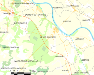
Le Mas-d'Agenais
- commune in Lot-et-Garonne, France
- Country:
- Postal Code: 47430
- Coordinates: 44° 24' 39" N, 0° 13' 2" E
- GPS tracks (wikiloc): [Link]
- Area: 21.18 sq km
- Population: 1489
- Web site: [Link]

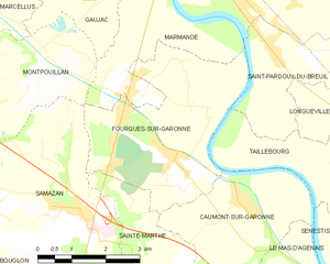
Fourques-sur-Garonne
- commune in Lot-et-Garonne, France
- Country:
- Postal Code: 47200
- Coordinates: 44° 26' 55" N, 0° 9' 30" E
- GPS tracks (wikiloc): [Link]
- Area: 13.96 sq km
- Population: 1298
- Web site: [Link]
Lagruère
- commune in Lot-et-Garonne, France
- Country:
- Postal Code: 47400
- Coordinates: 44° 23' 39" N, 0° 14' 58" E
- GPS tracks (wikiloc): [Link]
- Area: 9.86 sq km
- Population: 370
- Web site: [Link]


Villeton
- commune in Lot-et-Garonne, France
- Country:
- Postal Code: 47400
- Coordinates: 44° 21' 44" N, 0° 16' 18" E
- GPS tracks (wikiloc): [Link]
- Area: 10.24 sq km
- Population: 460

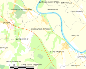
Caumont-sur-Garonne
- commune in Lot-et-Garonne, France
- Country:
- Postal Code: 47430
- Coordinates: 44° 26' 20" N, 0° 10' 52" E
- GPS tracks (wikiloc): [Link]
- Area: 11.61 sq km
- Population: 677
Calonges
- commune in Lot-et-Garonne, France
- Country:
- Postal Code: 47430
- Coordinates: 44° 22' 26" N, 0° 14' 27" E
- GPS tracks (wikiloc): [Link]
- Area: 15.99 sq km
- Population: 625
- Web site: [Link]
Sénestis
- commune in Lot-et-Garonne, France
- Country:
- Postal Code: 47430
- Coordinates: 44° 25' 19" N, 0° 13' 51" E
- GPS tracks (wikiloc): [Link]
- Area: 11.31 sq km
- Population: 207


Sainte-Marthe
- commune in Lot-et-Garonne, France
- Country:
- Postal Code: 47430
- Coordinates: 44° 24' 51" N, 0° 8' 56" E
- GPS tracks (wikiloc): [Link]
- Area: 9.65 sq km
- Population: 579
- Web site: [Link]