Marsac-sur-l'Isle (Marsac-sur-l'Isle)

- commune in Dordogne, France
- Country:

- Postal Code: 24430
- Coordinates: 45° 11' 6" N, 0° 39' 41" E


- GPS tracks (wikiloc): [Link]
- AboveSeaLevel: 83 м m
- Area: 10.05 sq km
- Population: 3131
- Web site: http://www.marsac.org/
- Wikipedia en: wiki(en)
- Wikipedia: wiki(fr)
- Wikidata storage: Wikidata: Q1076670
- Wikipedia Commons Category: [Link]
- Freebase ID: [/m/03mg6x_]
- Freebase ID: [/m/03mg6x_]
- GeoNames ID: Alt: [6616168]
- GeoNames ID: Alt: [6616168]
- SIREN number: [212402564]
- SIREN number: [212402564]
- BnF ID: [152519030]
- BnF ID: [152519030]
- VIAF ID: Alt: [171066773]
- VIAF ID: Alt: [171066773]
- Library of Congress authority ID: Alt: [no2011074106]
- Library of Congress authority ID: Alt: [no2011074106]
- INSEE municipality code: 24256
- INSEE municipality code: 24256
Shares border with regions:


Annesse-et-Beaulieu
- commune in Dordogne, France
- Country:
- Postal Code: 24430
- Coordinates: 45° 10' 27" N, 0° 35' 28" E
- GPS tracks (wikiloc): [Link]
- Area: 12.12 sq km
- Population: 1481

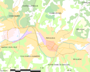
Périgueux
- commune in Dordogne, France
- Country:
- Postal Code: 24000
- Coordinates: 45° 11' 3" N, 0° 43' 5" E
- GPS tracks (wikiloc): [Link]
- AboveSeaLevel: 101 м m
- Area: 9.82 sq km
- Population: 29829
- Web site: [Link]


Coulounieix-Chamiers
- commune in Dordogne, France
- Country:
- Postal Code: 24660
- Coordinates: 45° 11' 11" N, 0° 41' 29" E
- GPS tracks (wikiloc): [Link]
- Area: 21.7 sq km
- Population: 8108
- Web site: [Link]


Chancelade
- commune in Dordogne, France
- Country:
- Postal Code: 24650
- Coordinates: 45° 12' 20" N, 0° 39' 56" E
- GPS tracks (wikiloc): [Link]
- Area: 16.23 sq km
- Population: 4298
- Web site: [Link]