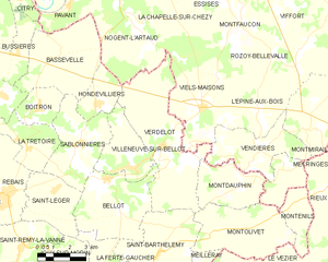
Nogent-l'Artaud (Nogent-l'Artaud)
- commune in Aisne, France
- Country:

- Postal Code: 02310
- Coordinates: 48° 57' 54" N, 3° 19' 25" E


- GPS tracks (wikiloc): [Link]
- Area: 23.99 sq km
- Population: 2201
- Web site: http://nogent-lartaud.fr/
- Wikipedia en: wiki(en)
- Wikipedia: wiki(fr)
- Wikidata storage: Wikidata: Q872235
- Wikipedia Commons Category: [Link]
- Freebase ID: [/m/03m7nwg]
- Freebase ID: [/m/03m7nwg]
- GeoNames ID: Alt: [6425107]
- GeoNames ID: Alt: [6425107]
- SIREN number: [210205324]
- SIREN number: [210205324]
- VIAF ID: Alt: [316741936]
- VIAF ID: Alt: [316741936]
- archINFORM location ID: [6776]
- archINFORM location ID: [6776]
- Library of Congress authority ID: Alt: [nr97011456]
- Library of Congress authority ID: Alt: [nr97011456]
- PACTOLS thesaurus ID: [pcrtbbYsBu0la4]
- PACTOLS thesaurus ID: [pcrtbbYsBu0la4]
- INSEE municipality code: 02555
- INSEE municipality code: 02555
Shares border with regions:

Pavant
- commune in Aisne, France
- Country:
- Postal Code: 02310
- Coordinates: 48° 57' 12" N, 3° 17' 5" E
- GPS tracks (wikiloc): [Link]
- Area: 5.43 sq km
- Population: 792

Verdelot
- commune in Seine-et-Marne, France
- Country:
- Postal Code: 77510
- Coordinates: 48° 52' 30" N, 3° 21' 57" E
- GPS tracks (wikiloc): [Link]
- Area: 25.6 sq km
- Population: 692


Hondevilliers
- commune in Seine-et-Marne, France
- Country:
- Postal Code: 77510
- Coordinates: 48° 53' 58" N, 3° 18' 35" E
- GPS tracks (wikiloc): [Link]
- Area: 5.53 sq km
- Population: 253

Saulchery
- commune in Aisne, France
- Country:
- Postal Code: 02310
- Coordinates: 48° 58' 28" N, 3° 18' 26" E
- GPS tracks (wikiloc): [Link]
- Area: 2.63 sq km
- Population: 719

Charly-sur-Marne
- commune in Aisne, France
- Country:
- Postal Code: 02310
- Coordinates: 48° 58' 38" N, 3° 17' 7" E
- GPS tracks (wikiloc): [Link]
- Area: 20.52 sq km
- Population: 2657
- Web site: [Link]

La Chapelle-sur-Chézy
- commune in Aisne, France
- Country:
- Postal Code: 02570
- Coordinates: 48° 56' 44" N, 3° 22' 38" E
- GPS tracks (wikiloc): [Link]
- Area: 7.9 sq km
- Population: 282

Chézy-sur-Marne
- commune in Aisne, France
- Country:
- Postal Code: 02570
- Coordinates: 48° 59' 16" N, 3° 22' 2" E
- GPS tracks (wikiloc): [Link]
- Area: 22.43 sq km
- Population: 1335
- Web site: [Link]

Viels-Maisons
- commune in Aisne, France
- Country:
- Postal Code: 02540
- Coordinates: 48° 53' 48" N, 3° 23' 50" E
- GPS tracks (wikiloc): [Link]
- Area: 21.44 sq km
- Population: 1179

Romeny-sur-Marne
- commune in Aisne, France
- Country:
- Postal Code: 02310
- Coordinates: 48° 58' 35" N, 3° 20' 11" E
- GPS tracks (wikiloc): [Link]
- Area: 4.23 sq km
- Population: 496


Bassevelle
- commune in Seine-et-Marne, France
- Country:
- Postal Code: 77750
- Coordinates: 48° 55' 29" N, 3° 16' 34" E
- GPS tracks (wikiloc): [Link]
- Area: 17.46 sq km
- Population: 339
- Web site: [Link]