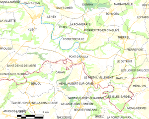
Pont-d'Ouilly (Pont-d'Ouilly)
- commune in Calvados, France
- Country:

- Postal Code: 14690
- Coordinates: 48° 52' 26" N, 0° 24' 31" E


- GPS tracks (wikiloc): [Link]
- AboveSeaLevel: 200 м m
- Area: 19.5 sq km
- Population: 1038
- Wikipedia en: wiki(en)
- Wikipedia: wiki(fr)
- Wikidata storage: Wikidata: Q626339
- Wikipedia Commons Category: [Link]
- Freebase ID: [/m/031r5m]
- Freebase ID: [/m/031r5m]
- GeoNames ID: Alt: [6615927]
- GeoNames ID: Alt: [6615927]
- SIREN number: [211407648]
- SIREN number: [211407648]
- BnF ID: [15248171r]
- BnF ID: [15248171r]
- VIAF ID: Alt: [244764943]
- VIAF ID: Alt: [244764943]
- INSEE municipality code: 14764
- INSEE municipality code: 14764
Shares border with regions:


Cossesseville
- commune in Calvados, France
- Country:

- Postal Code: 14690
- Coordinates: 48° 53' 45" N, 0° 25' 10" E


- GPS tracks (wikiloc): [Link]
- Area: 4.74 sq km
- Population: 97


Tréprel
- commune in Calvados, France
- Country:

- Postal Code: 14690
- Coordinates: 48° 53' 51" N, 0° 20' 48" E


- GPS tracks (wikiloc): [Link]
- Area: 5.4 sq km
- Population: 104


Saint-Denis-de-Méré
- commune in Calvados, France
- Country:

- Postal Code: 14110
- Coordinates: 48° 52' 12" N, 0° 30' 58" E


- GPS tracks (wikiloc): [Link]
- Area: 11.37 sq km
- Population: 841
- Web site: [Link]


Clécy
- commune in Calvados, France
- Country:

- Postal Code: 14570
- Coordinates: 48° 54' 58" N, 0° 28' 59" E


- GPS tracks (wikiloc): [Link]
- Area: 24.63 sq km
- Population: 1243
- Web site: [Link]

Cahan
- commune in Orne, France
- Country:

- Postal Code: 61430
- Coordinates: 48° 51' 32" N, 0° 26' 36" E


- GPS tracks (wikiloc): [Link]
- Area: 5.87 sq km
- Population: 179


Le Mesnil-Villement
- commune in Calvados, France
- Country:

- Postal Code: 14690
- Coordinates: 48° 51' 11" N, 0° 22' 14" E


- GPS tracks (wikiloc): [Link]
- Area: 3.55 sq km
- Population: 301


Ménil-Hubert-sur-Orne
- commune in Orne, France
- Country:

- Postal Code: 61430
- Coordinates: 48° 51' 9" N, 0° 24' 47" E


- GPS tracks (wikiloc): [Link]
- Area: 10.68 sq km
- Population: 478


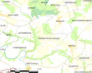
Pierrefitte-en-Cinglais
- commune in Calvados, France
- Country:

- Postal Code: 14690
- Coordinates: 48° 54' 11" N, 0° 23' 17" E


- GPS tracks (wikiloc): [Link]
- Area: 10.72 sq km
- Population: 259


Le Détroit
- commune in Calvados, France
- Country:

- Postal Code: 14690
- Coordinates: 48° 52' 1" N, 0° 21' 0" E


- GPS tracks (wikiloc): [Link]
- Area: 5.52 sq km
- Population: 89
