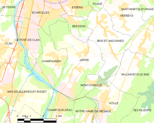
Эшироль (Échirolles, Échirolles)

- коммуна во Франции
 Hiking in Эшироль
Échirolles is a suburb of Grenoble, located in the Auvergne-Rhône-Alpes region of France. It's surrounded by stunning natural landscapes, making it a great base for hiking enthusiasts. Here are some highlights and suggestions for hiking in and around Échirolles:
Local Areas for Hiking:
-
Vercors Regional Natural Park: Just a short drive or public transport ride from Échirolles, the Vercors mountains offer a variety of trails suitable for hikers of all experience levels. You can find everything from gentle walks to challenging hikes with breathtaking views.
-
Chartreuse Mountains: Located to the east of Échirolles, the Chartreuse range is known for its dramatic limestone cliffs and lush forests. There are numerous trails, including paths that lead to panoramic viewpoints and historical sites.
-
Belledone Range: This mountain range is also accessible from Échirolles and features more rugged terrain with higher altitude hikes. The trails often lead to picturesque alpine lakes and stunning mountain vistas.
Notable Hikes:
- Col de l’Arc: A moderately challenging hike that offers fantastic views of the surrounding mountains and valleys.
- Lac de Crop: A beautiful hike that leads you to a stunning alpine lake, perfect for a picnic or a refreshing break.
- Les Crêtes de la Chartreuse: A higher difficulty hike that rewards you with spectacular panoramas, particularly at sunrise or sunset.
Tips for Hiking in Échirolles:
- Prepare Accordingly: Depending on the season, make sure to check the weather, wear appropriate footwear, and carry enough water and snacks.
- Trail Maps and Guidance: Utilize local maps and guidebooks to navigate the trails. Mobile apps for hiking can also provide valuable insights and GPS navigation.
- Transportation: Consider using public transport or carpooling to reach trailheads, as parking can get busy on weekends.
- Respect Nature: Remember to follow Leave No Trace principles, respecting wildlife and keeping the trails clean.
Seasonal Considerations:
- Spring and Summer: Ideal for hiking, with blooming wildflowers and accessible trails.
- Autumn: Offers beautiful fall foliage, making hikes especially picturesque.
- Winter: Some trails may be suitable for snowshoeing or winter hikes, but be sure to check local conditions and safety measures.
Whether you're looking for a leisurely stroll or a challenging trek, Échirolles provides a great access point to some of the best hiking scenery in the French Alps. Enjoy your hiking adventure!
- Страна:

- Почтовый код: 38130
- Координаты: 45° 8' 34" N, 5° 43' 4" E


- GPS треки (wikiloc): [Ссылка]
- Площадь: 7.86 кв.км
- Население: 35648
- Веб сайт: http://www.ville-echirolles.fr
- Википедия русская: wiki(ru)
- Википедия английская: wiki(en)
- Википедия национальная: wiki(fr)
- Хранилище Wikidata: Wikidata: Q211134
- Катеория в википедии: [Ссылка]
- код Freebase: [/m/08sf4n]
- код Freebase: [/m/08sf4n]
- код GeoNames: Альт: [6433192]
- код GeoNames: Альт: [6433192]
- номер SIREN: [213801517]
- номер SIREN: [213801517]
- код BNF: [15257973m]
- код BNF: [15257973m]
- код VIAF: Альт: [152583665]
- код VIAF: Альт: [152583665]
- код GND: Альт: [4240404-6]
- код GND: Альт: [4240404-6]
- код LCNAF: Альт: [n91121318]
- код LCNAF: Альт: [n91121318]
- место в MusicBrainz: [66c24039-c08a-4ba4-bcd6-caff26a64bc3]
- место в MusicBrainz: [66c24039-c08a-4ba4-bcd6-caff26a64bc3]
- WOEID: [12660749]
- WOEID: [12660749]
- код темы Quora: [Échirolles]
- код темы Quora: [Échirolles]
- код SUDOC: [029463858]
- код SUDOC: [029463858]
- код муниципалитета INSEE: 38151
- код муниципалитета INSEE: 38151
Граничит с регионами:


Эбенс
- коммуна во Франции
Hiking in Эбенс
Eybens, located near Grenoble in the Auvergne-Rhône-Alpes region of France, offers a mix of urban and natural landscapes, making it a great base for hiking enthusiasts. Here are some aspects of hiking in and around Eybens:...
- Страна:
- Почтовый код: 38320
- Координаты: 45° 8' 55" N, 5° 45' 1" E
- GPS треки (wikiloc): [Ссылка]
- Площадь: 4.5 кв.км
- Население: 10259
- Веб сайт: [Ссылка]


Брессон
- коммуна во Франции
Hiking in Брессон
Bresson is a charming commune located in the Isère department of the Auvergne-Rhône-Alpes region in southeastern France. It's situated near the city of Grenoble and offers access to a variety of hiking opportunities in the surrounding mountainous terrain, including the Vercors and Chartreuse ranges....
- Страна:
- Почтовый код: 38320
- Координаты: 45° 8' 11" N, 5° 44' 58" E
- GPS треки (wikiloc): [Ссылка]
- Площадь: 2.78 кв.км
- Население: 684
- Веб сайт: [Ссылка]


Шампанье
- коммуна во Франции
Hiking in Шампанье
Champagnier is a charming commune located near Grenoble, France, nestled in the picturesque Isère department. The area features stunning natural landscapes, making it a great destination for hiking enthusiasts of various skill levels. Here are some highlights and tips for hiking in Champagnier:...
- Страна:
- Почтовый код: 38800
- Координаты: 45° 6' 44" N, 5° 43' 46" E
- GPS треки (wikiloc): [Ссылка]
- Площадь: 6.61 кв.км
- Население: 1239
- Веб сайт: [Ссылка]


Гренобль
- коммуна Франции
Hiking in Гренобль
Grenoble, situated at the foot of the French Alps, is an excellent base for hiking enthusiasts. The surrounding mountains and natural landscapes offer a diverse range of trails suitable for all experience levels, from leisurely walks to challenging hikes. Here are some key highlights and recommendations for hiking in the Grenoble area:...
- Страна:
- Почтовый код: 38100; 38000
- Телефонный код: 476
- Координаты: 45° 11' 13" N, 5° 43' 35" E
- GPS треки (wikiloc): [Ссылка]
- Высота над уровнем моря: 212 м m
- Площадь: 18.13 кв.км
- Население: 160649
- Веб сайт: [Ссылка]
Жарри
- коммуна во Франции
Hiking in Жарри
Jarrie, located in the Isère department of the Auvergne-Rhône-Alpes region in France, offers a range of hiking opportunities that are perfect for outdoor enthusiasts. Nestled at the foot of the Vercors Massif, the area is characterized by stunning alpine landscapes, diverse ecosystems, and beautiful views of the surrounding mountains....
- Страна:
- Почтовый код: 38560
- Координаты: 45° 5' 49" N, 5° 44' 33" E
- GPS треки (wikiloc): [Ссылка]
- Площадь: 13.26 кв.км
- Население: 3749
- Веб сайт: [Ссылка]


Сесен
Hiking in Сесен
Seyssins is a picturesque town located near Grenoble in the Auvergne-Rhône-Alpes region of France. It serves as a great base for hiking enthusiasts, offering access to a variety of trails with stunning views of the surrounding mountains and valleys....
- Страна:
- Почтовый код: 38180
- Координаты: 45° 9' 22" N, 5° 40' 47" E
- GPS треки (wikiloc): [Ссылка]
- Площадь: 8 кв.км
- Население: 7213
- Веб сайт: [Ссылка]


Пон-де-Кле
- коммуна во Франции
Hiking in Пон-де-Кле
Le Pont-de-Claix is a charming town located near Grenoble in the Auvergne-Rhône-Alpes region of France. Nestled at the foothills of the French Alps, it offers a variety of hiking opportunities suitable for different skill levels. Here are some highlights and tips for hiking in and around Le Pont-de-Claix:...
- Страна:
- Почтовый код: 38800
- Координаты: 45° 7' 23" N, 5° 41' 53" E
- GPS треки (wikiloc): [Ссылка]
- Площадь: 5.6 кв.км
- Население: 10818
- Веб сайт: [Ссылка]