
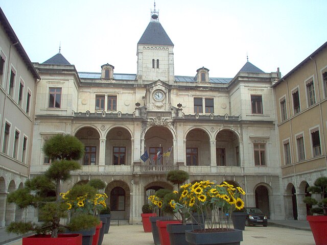
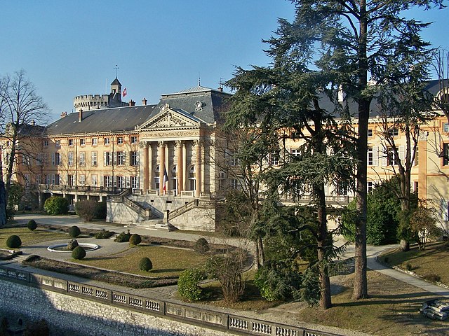
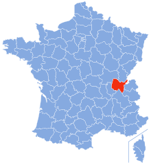
Изер (Isère, Isère)


- департамент Франции
 Hiking in Изер
Isère, located in the Auvergne-Rhône-Alpes region of France, offers some of the most beautiful and diverse hiking opportunities in the French Alps. Known for its stunning mountain scenery, charming villages, and rich cultural heritage, Isère is a fantastic destination for hikers of all levels. Here are some highlights of hiking in Isère:
1.
Isère features a variety of landscapes, ranging from lush valleys and rolling hills to impressive mountain peaks and alpine meadows. The Vercors and Chartreuse ranges are particularly popular, with rugged limestone cliffs and breathtaking vistas.
2.
- Vercors Regional Natural Park: This park is an incredible hiking destination, known for its dramatic limestone plateaus and deep gorges. There are many trails, including the famous GR91, offering routes through stunning landscapes and opportunities to spot wildlife.
- Chartreuse Mountains: Renowned for their natural beauty and the Chartreuse monastery, this area has numerous trails, such as the GR9, which offers panoramic views of the surrounding peaks.
3.
- La Meije: This majestic peak is part of the Écrins National Park and offers challenging hikes for experienced mountaineers. The surroundings are spectacular, with glaciers and high-altitude trails.
- Belledonne Range: Known for its rugged terrain and technical climbs, hikers can enjoy both moderate and challenging routes, with stunning views of the surrounding Alps.
4.
Isère boasts a well-marked network of hiking trails (GR and PR), catering to all skill levels. Popular trails include:
- The GR5, which traverses the Alps and offers stunning views of the entire region.
- The Chamrousse and Col de la Sarenne trails for more moderate hikes.
5.
After a day's hiking, you can explore charming towns like Grenoble, which is great for enjoying local cuisine and culture. The scenic village of Lans-en-Vercors serves as a great base for hikers looking to explore the surrounding area.
6.
The best times for hiking in Isère are from late spring to early autumn (May to October). However, certain high-altitude trails may be covered in snow until late June, so it's essential to check trail conditions before setting out.
7.
As with any hiking endeavor, it's crucial to prepare adequately. Ensure you have appropriate gear, check the weather conditions, stay hydrated, and inform someone of your hiking plans. Always consider your fitness level when choosing trails.
Conclusion
Hiking in Isère is a rewarding experience, with a mix of natural beauty, cultural sights, and adventure. Whether you're looking for leisurely walks, challenging climbs, or breathtaking views, Isère has something to offer for everyone.
- Страна:

- Столица: Гренобль
- Координаты: 45° 20' 0" N, 5° 30' 0" E


- GPS треки (wikiloc): [Ссылка]
- Высота над уровнем моря: 846 м m
- Площадь: 7431 кв.км
- Население: 1251060
- Веб сайт: http://www.isere.pref.gouv.fr/
- Википедия русская: wiki(ru)
- Википедия английская: wiki(en)
- Википедия национальная: wiki(fr)
- Хранилище Wikidata: Wikidata: Q12559
- Галерея изображений в википедии: [Ссылка]
- Катеория в википедии: [Ссылка]
- код Freebase: [/m/0mgr_]
- код GeoNames: Альт: [3012715]
- номер SIREN: [223800012]
- код BNF: [119417674]
- код VIAF: Альт: [263181452]
- ID отношения в OpenStreetMap: [7437]
- код GND: Альт: [4109156-5]
- идентификатор местоположения ArchINFORM: [2726]
- код LCNAF: Альт: [n81022474]
- место в MusicBrainz: [8410f113-a331-4db5-b869-9875c15a023b]
- код TGN: [7002955]
- код в энциклопедии «Британника онлайн»: [place/Isere]
- код в Большой каталанской энциклопедии: [0033976]
- код канала YouTube: [UCtDk8_0fQyBMPyzUsy3Px-Q]
- код NUTS: [FR714]
- код BabelNet: [00047593n]
- код департамента Франции INSEE: [38]
- код места в Foursquare: [5b8a6274a795bd0037a44e4a]
- ISO 3166-2: FR-38
Включает регионы:


Ла-Валетт
Hiking in Ла-Валетт
La Valette, located in the stunning landscape of Malta, offers a unique hiking experience characterized by its rich history and scenic views. Here are some points to consider when planning a hike in La Valette:...
- Страна:
- Почтовый код: 38350
- Координаты: 44° 56' 31" N, 5° 51' 23" E
- GPS треки (wikiloc): [Ссылка]
- Высота над уровнем моря: 850 м m
- Площадь: 7.87 кв.км
- Население: 73


Л’Иль-д’Або
- коммуна во Франции
Hiking in Л’Иль-д’Або
L'Isle-d'Abeau, located in the Auvergne-Rhône-Alpes region of France, is surrounded by a variety of landscapes that offer several hiking opportunities. While the town itself is primarily urban and industrial, its location makes it a convenient starting point for exploring nearby natural areas....
- Страна:
- Почтовый код: 38080
- Координаты: 45° 37' 10" N, 5° 13' 59" E
- GPS треки (wikiloc): [Ссылка]
- Площадь: 9.11 кв.км
- Население: 16282


Гренобль
- округ Франции
Hiking in Гренобль
The Arrondissement of Grenoble, located in the Isère department of the Auvergne-Rhône-Alpes region in southeastern France, offers a wealth of hiking opportunities that cater to all skill levels. The area is characterized by its stunning landscapes, including the French Alps, picturesque valleys, and a variety of ecosystems....
- Страна:
- Столица: Гренобль
- Координаты: 45° 5' 0" N, 5° 50' 0" E
- GPS треки (wikiloc): [Ссылка]
- Площадь: 4715 кв.км
- Население: 740543


Ла-Тур-дю-Пен
- округ Франции
Hiking in Ла-Тур-дю-Пен
The Arrondissement of La Tour-du-Pin, located in the Isère department of the Auvergne-Rhône-Alpes region in southeastern France, offers several opportunities for hiking enthusiasts. This area is characterized by its diverse landscapes, including rolling hills, dense forests, and scenic river valleys, making it a suitable destination for various types of hikes....
- Страна:
- Столица: Ла-Тур-дю-Пен
- Координаты: 45° 35' 0" N, 5° 25' 0" E
- GPS треки (wikiloc): [Ссылка]
- Площадь: 1479 кв.км
- Население: 299785

Вьен (округ)
Hiking in Вьен (округ)
The Arrondissement of Vienne, located in the Isère department in the Auvergne-Rhône-Alpes region of southeastern France, offers a variety of hiking opportunities that cater to both novice and experienced hikers. The area is characterized by its diverse landscapes, ranging from rolling hills to stunning mountain views, and numerous trails that provide access to natural beauty and historical sites....
- Страна:
- Столица: Вьен
- Координаты: 45° 30' 0" N, 5° 0' 0" E
- GPS треки (wikiloc): [Ссылка]
- Площадь: 1237 кв.км
- Население: 210732
Граничит с регионами:


Луара
- департамент Франции
- Страна:
- Столица: Сент-Этьен
- Координаты: 45° 45' 14" N, 4° 13' 29" E
- GPS треки (wikiloc): [Ссылка]
- Площадь: 4781 кв.км
- Население: 759411
- Веб сайт: [Ссылка]

Савойя
- департамент Франции
Hiking in Савойя
Savoie, located in the Auvergne-Rhône-Alpes region of France, is a stunning area known for its dramatic landscapes, alpine scenery, and rich cultural heritage. Hiking in Savoie offers a diverse range of trails suitable for all skill levels, from leisurely walks to challenging mountain treks....
- Страна:
- Столица: Шамбери
- Координаты: 45° 35' 0" N, 6° 20' 0" E
- GPS треки (wikiloc): [Ссылка]
- Высота над уровнем моря: 1595 м m
- Площадь: 6028 кв.км
- Население: 428204
- Веб сайт: [Ссылка]

Эн
- департамент Франции
Hiking in Эн
Certainly! Ain, a department located in the Auvergne-Rhône-Alpes region of France, offers a diverse range of hiking opportunities, from gentle trails suited for families to more challenging hikes for experienced trekkers. Here are some highlights about hiking in Ain:...
- Страна:
- Столица: Бурк-ан-Брес
- Координаты: 46° 5' 0" N, 5° 20' 0" E
- GPS треки (wikiloc): [Ссылка]
- Площадь: 5762 кв.км
- Население: 631877
- Веб сайт: [Ссылка]

Верхние Альпы
- департамент во Франции
Hiking in Верхние Альпы
The Hautes-Alpes region in southeastern France is a spectacular destination for hiking enthusiasts, known for its stunning landscapes, diverse terrain, and rich biodiversity. The region is part of the French Alps and offers a variety of hiking trails suitable for different skill levels....
- Страна:
- Столица: Гап
- Координаты: 44° 40' 0" N, 6° 20' 0" E
- GPS треки (wikiloc): [Ссылка]
- Высота над уровнем моря: 1665 м m
- Площадь: 5549 кв.км
- Население: 140916
- Веб сайт: [Ссылка]


Ардеш
- департамент Франции
Hiking in Ардеш
Hiking in the Ardèche region of France offers a remarkable experience for outdoor enthusiasts, with diverse landscapes ranging from dramatic gorges to tranquil forests. Here are some key aspects to consider when hiking in Ardèche:...
- Страна:
- Столица: Прива
- Координаты: 44° 40' 0" N, 4° 25' 0" E
- GPS треки (wikiloc): [Ссылка]
- Площадь: 5529 кв.км
- Население: 324209
- Веб сайт: [Ссылка]


Дром
- департамент во Франции
Hiking in Дром
Hiking in the Drôme department in southeastern France is a fantastic experience, known for its diverse landscapes, charming villages, and rich natural heritage. The area offers a variety of trails suitable for all levels of hikers, from beginners to advanced....
- Страна:
- Столица: Валанс
- Координаты: 44° 45' 0" N, 5° 10' 0" E
- GPS треки (wikiloc): [Ссылка]
- Площадь: 6530 кв.км
- Население: 504637
- Веб сайт: [Ссылка]


Рона
- департамент Франции
Hiking in Рона
Hiking in the Rhône department, located in the Auvergne-Rhône-Alpes region of France, offers a diverse range of landscapes and trails that cater to various skill levels. Here's a breakdown of what you can expect:...
- Страна:
- Столица: Вильфранш-сюр-Сон
- Координаты: 45° 59' 44" N, 4° 43' 10" E
- GPS треки (wikiloc): [Ссылка]
- Площадь: 3249 кв.км
- Население: 1821995
- Веб сайт: [Ссылка]