Айгльсбах (Aiglsbach, Aiglsbach)

 Hiking in Айгльсбах
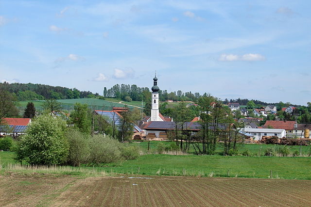
Aiglsbach, located in Bavaria, Germany, offers a peaceful and beautiful setting for hiking enthusiasts. The area is characterized by gentle hills, lush forests, and picturesque lakes, making it an excellent destination for both casual walkers and more experienced hikers.
Hiking Options:
-
Local Trails: There are numerous marked trails around Aiglsbach that cater to different skill levels. These trails often offer stunning views of the surrounding countryside and are well-maintained.
-
Scenic Routes: Some routes may lead to nearby attractions, such as historic sites or charming villages. Look for routes that take you along the rivers or through the dense forests to fully appreciate the natural beauty.
-
Wildlife Watching: The area is home to various wildlife, and dedicated hikers may spot deer, various bird species, and unique plant life. Early morning or late afternoon are typically the best times for sightings.
-
Family-Friendly Hikes: There are trails suitable for families, often with shorter distances and less strenuous terrain. These trails may also include educational signs about local flora and fauna.
Preparation Tips:
- Check Weather: Before heading out, always check the weather forecast to ensure you’re prepared for any conditions.
- Footwear: Wear comfortable hiking boots or shoes with good traction.
- Hydration: Carry enough water and snacks to keep your energy up during the hike.
- Map/Navigation: Although trails are marked, carrying a map or using a hiking app can help you stay on track and explore more.
Recommended Hike:
One popular option is the circular route that leads you around local lakes, providing opportunities for not only hiking but also photography and relaxation by the water.
Local Advice:
- Respect Nature: Follow the Leave No Trace principles to help preserve the natural beauty of Aiglsbach.
- Local Guides: If you’re unfamiliar with the area, consider joining a guided hike or group to make the most of your experience.
Conclusion:
Hiking in Aiglsbach can be a refreshing experience, offering a mix of natural beauty and tranquility. Whether you're looking for an adventurous trek or a leisurely stroll with family, Aiglsbach has a variety of trails suitable for every type of hiker. Happy hiking!
- Страна:

- Почтовый код: 84089
- Телефонный код: 08753
- Код автомобильного номера: KEH
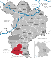
- Координаты: 48° 42' 0" N, 11° 43' 0" E


- GPS треки (wikiloc): [Ссылка]
- Высота над уровнем моря: 415 м m
- Площадь: 39.85 кв.км
- Население: 1331
- Веб сайт: http://www.aiglsbach.de/
- Википедия русская: wiki(ru)
- Википедия английская: wiki(en)
- Википедия национальная: wiki(de)
- Хранилище Wikidata: Wikidata: Q258021
- Катеория в википедии: [Ссылка]
- код Freebase: [/m/02q3rg3]
- код GeoNames: Альт: [2958887]
- код VIAF: Альт: [237002576]
- ID отношения в OpenStreetMap: [956660]
- код GND: Альт: [4550440-4]
- Bavarikon ID: [ODB_A00001486]
- идентификатор муниципалитетов в Германии: 09273113
Граничит с регионами:


Фобург-на-Дунае
Hiking in Фобург-на-Дунае
Vohburg, located in Bavaria, Germany, offers a variety of hiking opportunities that can appeal to both casual walkers and more serious hikers. Here are some highlights and tips for hiking in and around Vohburg:...
- Страна:
- Почтовый код: 85088
- Телефонный код: 08457
- Код автомобильного номера: PAF
- Координаты: 48° 46' 11" N, 11° 37' 6" E
- GPS треки (wikiloc): [Ссылка]
- Высота над уровнем моря: 371 м m
- Площадь: 45.19 кв.км
- Население: 5863
- Веб сайт: [Ссылка]

Эльзендорф
Hiking in Эльзендорф
Elsendorf, located in the region of Bavaria, Germany, is a quaint village surrounded by beautiful natural landscapes. While it may not be as popular as some other hiking destinations, it offers several opportunities for hikers to explore the picturesque countryside....
- Страна:
- Почтовый код: 84094
- Телефонный код: 08753
- Код автомобильного номера: KEH
- Координаты: 48° 42' 0" N, 11° 49' 0" E
- GPS треки (wikiloc): [Ссылка]
- Высота над уровнем моря: 439 м m
- Площадь: 32.63 кв.км
- Население: 1616
- Веб сайт: [Ссылка]

Майнбург
Hiking in Майнбург
Mainburg is a charming town located in Bavaria, Germany, and while it may not be as widely known for hiking as some of the more mountainous regions of the country, there are still opportunities for enjoying the outdoors in and around the area. Here are some highlights for hiking enthusiasts in Mainburg:...
- Страна:
- Почтовый код: 84042–84048
- Телефонный код: 08751
- Координаты: 48° 36' 13" N, 11° 46' 22" E
- GPS треки (wikiloc): [Ссылка]
- Высота над уровнем моря: 439 м m
- Площадь: 61.54 кв.км
- Население: 14855
- Веб сайт: [Ссылка]