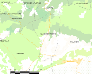
Aleyrac (Aleyrac)

 Hiking in Aleyrac
Aleyrac is a relatively lesser-known but beautiful area for hiking, located in the southern part of France near the borders of the Rhône-Alpes region. This area offers stunning landscapes, diverse flora and fauna, and excellent opportunities for both novice and experienced hikers.
Hiking Highlights in Aleyrac:
-
Scenic Trails: Aleyrac features various hiking trails that showcase the picturesque countryside, including vineyards, forests, and stunning views of nearby mountains. The trails vary in difficulty, so there is something for everyone.
-
Cultural Experience: Hiking in Aleyrac also provides an opportunity to explore local villages and experience the culture, cuisine, and history of the region. You may find charming towns with local markets and historic sites along the trails.
-
Wildlife Watching: The natural environment around Aleyrac supports a variety of wildlife. While hiking, keep an eye out for local bird species, deer, and other wildlife that inhabit the forests.
-
Best Seasons to Hike: The best times to hike in Aleyrac are typically in spring (April to June) and fall (September to October), when the weather is mild and the scenery is vibrant with blooming flowers or autumn foliage. Summer can be hot, so early morning or late afternoon hikes are advisable.
-
Essential Gear: Due to varying terrain, it's important to wear appropriate hiking boots and carry essentials like water, snacks, a map, and a first aid kit. Depending on the time of year, consider layering your clothing to accommodate changing temperatures.
-
Guided Hikes: If you’re unfamiliar with the area, consider joining a guided hike. Local guides can provide valuable insights about the landscape, flora, and fauna, as well as ensure a safe and enjoyable experience.
Before you go, it is always a good idea to check current trail conditions and any local regulations. Whether you're a seasoned hiker or just starting, Aleyrac offers a wonderful opportunity to immerse yourself in nature and enjoy breathtaking scenery.
- Страна:

- Почтовый код: 26770
- Координаты: 44° 29' 56" N, 4° 56' 18" E


- GPS треки (wikiloc): [Ссылка]
- Площадь: 6.65 кв.км
- Население: 46
- Википедия английская: wiki(en)
- Википедия национальная: wiki(fr)
- Хранилище Wikidata: Wikidata: Q384649
- Катеория в википедии: [Ссылка]
- код Freebase: [/m/03mgk7j]
- код Freebase: [/m/03mgk7j]
- код GeoNames: Альт: [6452210]
- код GeoNames: Альт: [6452210]
- номер SIREN: [212600035]
- номер SIREN: [212600035]
- код BNF: [152528645]
- код BNF: [152528645]
- WOEID: [575705]
- WOEID: [575705]
- код муниципалитета INSEE: 26003
- код муниципалитета INSEE: 26003
Граничит с регионами:

Salles-sous-Bois
Hiking in Salles-sous-Bois
Salles-sous-Bois, located in the Seine-et-Marne department in the Île-de-France region of France, offers beautiful landscapes and a variety of outdoor activities, including hiking. Although it might not be as well-known as some larger national parks or hiking areas, the region surrounding Salles-sous-Bois provides an opportunity for nature lovers to enjoy serene trails and scenic views....
- Страна:
- Почтовый код: 26770
- Координаты: 44° 27' 7" N, 4° 56' 7" E
- GPS треки (wikiloc): [Ссылка]
- Площадь: 9.5 кв.км
- Население: 182


Taulignan
- коммуна во Франции
Hiking in Taulignan
Taulignan is a charming village located in the Drôme department of the Auvergne-Rhône-Alpes region in southeastern France. It is surrounded by lovely landscapes and offers various hiking opportunities for both beginners and experienced hikers. Here are some details about hiking in and around Taulignan:...
- Страна:
- Почтовый код: 26770
- Координаты: 44° 26' 38" N, 4° 58' 52" E
- GPS треки (wikiloc): [Ссылка]
- Площадь: 34.65 кв.км
- Население: 1723


La Bégude-de-Mazenc
- коммуна во Франции
Hiking in La Bégude-de-Mazenc
La Bégude-de-Mazenc is a charming village located in the Drôme department in southeastern France, offering a variety of hiking opportunities amidst beautiful natural scenery. The area is characterized by its picturesque landscapes, valleys, and hills, making it an ideal destination for outdoor enthusiasts....
- Страна:
- Почтовый код: 26160
- Координаты: 44° 32' 39" N, 4° 56' 9" E
- GPS треки (wikiloc): [Ссылка]
- Площадь: 23.62 кв.км
- Население: 1684


Montjoyer
- коммуна во Франции
Hiking in Montjoyer
Montjoyer, located in the Drome department of southeastern France, is a charming village that offers a range of hiking opportunities amidst beautiful landscapes. While Montjoyer itself may not be widely known as a major hiking destination, it serves as a great base for exploring the surrounding regions, characterized by rolling hills, vineyards, and charming rural scenery....
- Страна:
- Почтовый код: 26230
- Координаты: 44° 28' 35" N, 4° 51' 7" E
- GPS треки (wikiloc): [Ссылка]
- Площадь: 18.02 кв.км
- Население: 268


Le Poët-Laval
- коммуна во Франции
Hiking in Le Poët-Laval
Le Poët-Laval is a charming village located in the Drôme department of southeastern France, known for its picturesque landscapes and rich history. Hiking in and around Le Poët-Laval offers a wonderful opportunity to explore the beautiful natural scenery, including rolling hills, vineyards, forests, and historical sites....
- Страна:
- Почтовый код: 26160
- Координаты: 44° 31' 49" N, 5° 0' 30" E
- GPS треки (wikiloc): [Ссылка]
- Площадь: 31.22 кв.км
- Население: 914
Portes-en-Valdaine
- коммуна во Франции
Hiking in Portes-en-Valdaine
Portes-en-Valdaine is a charming commune in the Drôme department of southeastern France, known for its stunning natural landscapes and rich cultural heritage. Hiking in this region can be a delightful experience, offering a variety of trails that cater to different skill levels and interests....
- Страна:
- Почтовый код: 26160
- Координаты: 44° 31' 46" N, 4° 54' 42" E
- GPS треки (wikiloc): [Ссылка]
- Площадь: 15.04 кв.км
- Население: 389