Taulignan (Taulignan)

- коммуна во Франции
 Hiking in Taulignan
Taulignan is a charming village located in the Drôme department of the Auvergne-Rhône-Alpes region in southeastern France. It is surrounded by lovely landscapes and offers various hiking opportunities for both beginners and experienced hikers. Here are some details about hiking in and around Taulignan:
Scenic Trails
-
Local Trails: The area around Taulignan features several marked hiking trails that showcase the beautiful countryside, vineyards, and charming stone houses typical of the region. Trails often weave through lavender fields and olive groves, offering picturesque views.
-
The Pays de Dieulefit: Just a short distance away, this region is known for its hilly terrain and provides a variety of hiking routes. You can explore paths that lead to stunning viewpoints over valleys and hills.
-
Vercors Regional Natural Park: This nearby park offers more challenging hikes, with opportunities for greater elevations and diverse terrains. It's an excellent option for those looking for more adventurous hikes.
Tips for Hiking in Taulignan
-
Preparation: Always check the weather before heading out and wear appropriate footwear. The trails can be rocky and uneven, so sturdy hiking boots are recommended.
-
Water and Supplies: Bring plenty of water, especially during warmer months, and pack snacks like energy bars or fruits.
-
Maps and Guides: While many trails are well-marked, having a map or a hiking app can be helpful, especially if you're venturing off the main paths.
-
Local Resources: Consider visiting the local tourist office for maps, specific trail recommendations, or guided hikes that may be available.
Best Times to Hike
- Spring (March to June): This is a fantastic time to hike, as the weather is mild, and the flora is in bloom.
- Autumn (September to November): Fall colors can provide a beautiful backdrop for your hikes, and temperatures are still comfortable.
Additional Activities
In addition to hiking, you may also enjoy the local culture in Taulignan, which is known for its artisan crafts, local markets, and delightful cuisine. A post-hike visit to a local café or restaurant can be a nice way to relax and enjoy the regional specialties.
Overall, Taulignan offers a wonderful blend of scenic hikes and cultural experiences, making it a great destination for outdoor enthusiasts.
- Страна:

- Почтовый код: 26770
- Координаты: 44° 26' 38" N, 4° 58' 52" E


- GPS треки (wikiloc): [Ссылка]
- Площадь: 34.65 кв.км
- Население: 1723
- Википедия английская: wiki(en)
- Википедия национальная: wiki(fr)
- Хранилище Wikidata: Wikidata: Q266099
- Катеория в википедии: [Ссылка]
- код Freebase: [/m/03mgkzk]
- код Freebase: [/m/03mgkzk]
- код GeoNames: Альт: [6430252]
- код GeoNames: Альт: [6430252]
- номер SIREN: [212603484]
- номер SIREN: [212603484]
- код BNF: [152532088]
- код BNF: [152532088]
- код VIAF: Альт: [248696035]
- код VIAF: Альт: [248696035]
- код GND: Альт: [4323798-8]
- код GND: Альт: [4323798-8]
- код тезауруса PACTOLS: [pcrtiqYwYBa4Q5]
- код тезауруса PACTOLS: [pcrtiqYwYBa4Q5]
- WOEID: [628117]
- WOEID: [628117]
- код муниципалитета INSEE: 26348
- код муниципалитета INSEE: 26348
Граничит с регионами:

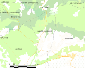
Salles-sous-Bois
Hiking in Salles-sous-Bois
Salles-sous-Bois, located in the Seine-et-Marne department in the Île-de-France region of France, offers beautiful landscapes and a variety of outdoor activities, including hiking. Although it might not be as well-known as some larger national parks or hiking areas, the region surrounding Salles-sous-Bois provides an opportunity for nature lovers to enjoy serene trails and scenic views....
- Страна:
- Почтовый код: 26770
- Координаты: 44° 27' 7" N, 4° 56' 7" E
- GPS треки (wikiloc): [Ссылка]
- Площадь: 9.5 кв.км
- Население: 182


Aleyrac
Hiking in Aleyrac
Aleyrac is a relatively lesser-known but beautiful area for hiking, located in the southern part of France near the borders of the Rhône-Alpes region. This area offers stunning landscapes, diverse flora and fauna, and excellent opportunities for both novice and experienced hikers....
- Страна:
- Почтовый код: 26770
- Координаты: 44° 29' 56" N, 4° 56' 18" E
- GPS треки (wikiloc): [Ссылка]
- Площадь: 6.65 кв.км
- Население: 46


Гриньян
- коммуна во Франции
Hiking in Гриньян
Grignan is a picturesque village in the Drôme department of southeastern France, known for its stunning medieval architecture and beautiful surrounding landscapes. Hiking in this area can be an enriching experience, as the terrain offers a mix of flat paths and more challenging trails through vineyards, lavender fields, and mixed woodlands....
- Страна:
- Почтовый код: 26230
- Координаты: 44° 25' 10" N, 4° 54' 29" E
- GPS треки (wikiloc): [Ссылка]
- Площадь: 43.43 кв.км
- Население: 1534


Le Poët-Laval
- коммуна во Франции
Hiking in Le Poët-Laval
Le Poët-Laval is a charming village located in the Drôme department of southeastern France, known for its picturesque landscapes and rich history. Hiking in and around Le Poët-Laval offers a wonderful opportunity to explore the beautiful natural scenery, including rolling hills, vineyards, forests, and historical sites....
- Страна:
- Почтовый код: 26160
- Координаты: 44° 31' 49" N, 5° 0' 30" E
- GPS треки (wikiloc): [Ссылка]
- Площадь: 31.22 кв.км
- Население: 914


Монбризон-сюр-Ле
- коммуна во Франции
Hiking in Монбризон-сюр-Ле
Montbrison-sur-Lez is a charming village located in the Drôme region of southeastern France. It is surrounded by beautiful natural landscapes, making it a great destination for hiking enthusiasts. Here are some highlights of hiking in and around Montbrison-sur-Lez:...
- Страна:
- Почтовый код: 26770
- Координаты: 44° 26' 13" N, 5° 1' 11" E
- GPS треки (wikiloc): [Ссылка]
- Высота над уровнем моря: 249 м m
- Площадь: 12.83 кв.км
- Население: 291


Вальреа
- коммуна во Франции
Hiking in Вальреа
Valréas, located in the Vaucluse department of the Provence-Alpes-Côte d'Azur region in southeastern France, is nestled in a scenic area characterized by its picturesque vineyards, olive groves, and rolling hills. While it's primarily known for its charming medieval architecture and nearby wine production, it also offers various hiking opportunities for outdoor enthusiasts....
- Страна:
- Почтовый код: 84600
- Координаты: 44° 23' 3" N, 4° 59' 25" E
- GPS треки (wikiloc): [Ссылка]
- Площадь: 57.97 кв.км
- Население: 9492
- Веб сайт: [Ссылка]


Roche-Saint-Secret-Béconne
- коммуна во Франции
Hiking in Roche-Saint-Secret-Béconne
Roche-Saint-Secret-Béconne is a beautiful area located in the Drôme department of southeastern France, known for its stunning landscapes and outdoor activities, including hiking. Here’s what you need to know about hiking in this region:...
- Страна:
- Почтовый код: 26770
- Координаты: 44° 28' 38" N, 5° 1' 43" E
- GPS треки (wikiloc): [Ссылка]
- Площадь: 33.23 кв.км
- Население: 440
- Веб сайт: [Ссылка]


Грийон
- коммуна во Франции
Hiking in Грийон
Grillon is a charming village located in the Drôme department of southeastern France. The area is known for its beautiful landscapes, picturesque vineyards, and olive groves, making it a lovely destination for hiking enthusiasts....
- Страна:
- Почтовый код: 84600
- Координаты: 44° 23' 42" N, 4° 55' 47" E
- GPS треки (wikiloc): [Ссылка]
- Площадь: 14.92 кв.км
- Население: 1766
- Веб сайт: [Ссылка]