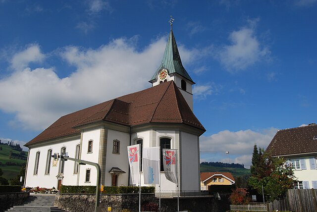
Альпнах (Alpnach, Alpnach)

 Hiking in Альпнах
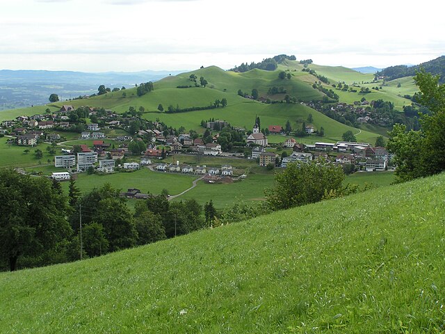
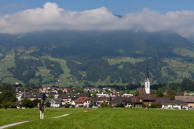
Alpnach, located in central Switzerland near Lake Alpnach and the foothills of the Swiss Alps, offers a range of hiking opportunities for outdoor enthusiasts. The area features stunning natural beauty, from lush forests and rolling hills to breathtaking alpine views.
Popular Hiking Trails:
-
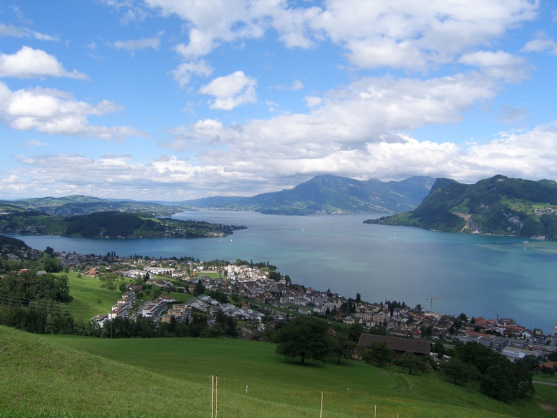
Pilatus: One of the most famous peaks in the region, Pilatus can be accessed from Alpnach. There are well-marked trails that lead to the summit, offering panoramic views of the surrounding landscape, including Lake Lucerne and the Swiss Alps. The hike can be strenuous, but it is well worth it. For a less challenging option, you can take the cogwheel train or cable car up and enjoy the trails near the summit.
-
Niederhorn: Another excellent hiking option is the Niederhorn. Trails vary in difficulty, and you can enjoy stunning views of the Thun and Brienz lakes. The area is also known for its rich wildlife, including chamois and various bird species.
-
Aussichtsturm Rigi: For those who enjoy scenic overlooks, the Rigi area provides numerous trails leading to viewpoints. The walk is considerably easier and great for families.
Tips for Hiking in Alpnach:
- Weather: Always check the weather forecast before heading out, as conditions can change rapidly in the mountains.
- Trail Maps: Make sure to have a trail map or a GPS device to stay oriented. The local tourism office can provide valuable information and resources.
- Equipment: Wear sturdy hiking boots, dress in layers, and pack enough water and snacks. Hiking poles can also be helpful on steeper trails.
- Wildlife Safety: Be aware of the wildlife in the area and practice safe wildlife viewing etiquette.
- Local Culture: After your hike, explore Alpnach's charming village and consider visiting local restaurants to sample traditional Swiss cuisine.
Hiking in Alpnach allows you to immerse yourself in the natural beauty of Switzerland while enjoying various trails suitable for different skill levels. Always respect nature and follow local guidelines to ensure a safe and enjoyable hiking experience.
- Страна:

- Почтовый код: 6055
- Телефонный код: 041
- Код автомобильного номера: OW
- Координаты: 46° 57' 0" N, 8° 13' 51" E


- GPS треки (wikiloc): [Ссылка]
- Высота над уровнем моря: 1039 м m
- Площадь: 56.98 кв.км
- Население: 6024
- Веб сайт: http://www.alpnach.ch
- Википедия русская: wiki(ru)
- Википедия английская: wiki(en)
- Википедия национальная: wiki(de)
- Хранилище Wikidata: Wikidata: Q69296
- Катеория в википедии: [Ссылка]
- код Freebase: [/m/01v1p8]
- код GeoNames: Альт: [7285054]
- код VIAF: Альт: [236775483]
- ID отношения в OpenStreetMap: [1683053]
- код GND: Альт: [4001352-2]
- место в MusicBrainz: [98142478-4472-4df7-b265-d3fef315c676]
- идентификатор HDS: [740]
- код швейцарского муниципалитета: [1401]
- код Цифрового атласа Римской империи: [19825]
Граничит с регионами:
Энтлебух
Hiking in Энтлебух
Entlebuch is a stunning area located in the Canton of Lucerne, Switzerland, known for its picturesque landscapes, diverse ecosystems, and opportunities for hiking. As a UNESCO Biosphere Reserve, it features a mix of wetlands, meadows, forests, and mountains, making it an ideal destination for hikers of all levels....
- Страна:
- Почтовый код: 6162
- Телефонный код: 041
- Код автомобильного номера: LU
- Координаты: 46° 59' 34" N, 8° 3' 47" E
- GPS треки (wikiloc): [Ссылка]
- Высота над уровнем моря: 723 м m
- Площадь: 56.95 кв.км
- Население: 3315
- Веб сайт: [Ссылка]

Шварценберг
Hiking in Шварценберг
Schwarzenberg, nestled in the beautiful Lucerne region of Switzerland, offers a variety of hiking opportunities that cater to different skill levels and preferences. The area is known for its stunning landscapes, characterized by rolling hills, lush forests, and picturesque views of the surrounding mountains....
- Страна:
- Почтовый код: 6103
- Телефонный код: 041
- Код автомобильного номера: LU
- Координаты: 47° 0' 51" N, 8° 10' 24" E
- GPS треки (wikiloc): [Ссылка]
- Высота над уровнем моря: 838 м m
- Площадь: 39.31 кв.км
- Население: 1690
- Веб сайт: [Ссылка]

Хергисвиль
Hiking in Хергисвиль
Hergiswil is a charming village located on the shores of Lake Lucerne in Switzerland, surrounded by beautiful mountains and stunning landscapes, making it a great destination for hiking enthusiasts. Here are some key points to consider when hiking in Hergiswil:...
- Страна:
- Почтовый код: 6052
- Телефонный код: 041
- Код автомобильного номера: NW
- Координаты: 46° 59' 8" N, 8° 16' 21" E
- GPS треки (wikiloc): [Ссылка]
- Высота над уровнем моря: 1121 м m
- Площадь: 17.00 кв.км
- Население: 5715
- Веб сайт: [Ссылка]


Зарнен
Hiking in Зарнен
Sarnen, located in the Canton of Obwalden in Switzerland, is a picturesque destination for hiking enthusiasts. Nestled between beautiful mountains and a tranquil lake, Sarnen offers a variety of hiking trails suitable for different skill levels, making it an ideal spot for both beginners and experienced hikers....
- Страна:
- Почтовый код: 6060
- Телефонный код: 041
- Код автомобильного номера: OW
- Координаты: 46° 53' 49" N, 8° 14' 49" E
- GPS треки (wikiloc): [Ссылка]
- Высота над уровнем моря: 1309 м m
- Площадь: 70.01 кв.км
- Население: 10233
- Веб сайт: [Ссылка]


Штанстад
Hiking in Штанстад
Stansstad, located in the canton of Nidwalden in Switzerland, offers a variety of stunning hiking opportunities. Nestled between Lake Lucerne and the surrounding mountains, it's an ideal destination for both casual walkers and experienced hikers....
- Страна:
- Почтовый код: 6362
- Телефонный код: 041
- Код автомобильного номера: NW
- Координаты: 46° 58' 49" N, 8° 20' 20" E
- GPS треки (wikiloc): [Ссылка]
- Высота над уровнем моря: 436 м m
- Площадь: 17.11 кв.км
- Население: 4494
- Веб сайт: [Ссылка]


Эннетмос
Hiking in Эннетмос
Ennetmoos is a charming village located near Lake Lucerne in Switzerland's scenic region. It is an excellent destination for hiking enthusiasts, offering a variety of trails that cater to different skill levels and preferences. Here are some highlights for hiking in Ennetmoos:...
- Страна:
- Почтовый код: 6372
- Телефонный код: 041
- Код автомобильного номера: NW
- Координаты: 46° 57' 24" N, 8° 20' 14" E
- GPS треки (wikiloc): [Ссылка]
- Высота над уровнем моря: 521 м m
- Площадь: 14.95 кв.км
- Население: 2147
- Веб сайт: [Ссылка]

Кернс
Hiking in Кернс
Kerns is a picturesque area in Utah, known for its stunning landscapes and outdoor recreation opportunities, including hiking. Here are some key points about hiking in Kerns:...
- Страна:
- Почтовый код: 6064
- Телефонный код: 041
- Код автомобильного номера: OW
- Координаты: 46° 50' 23" N, 8° 18' 5" E
- GPS треки (wikiloc): [Ссылка]
- Высота над уровнем моря: 1017 м m
- Площадь: 92.58 кв.км
- Население: 6295
- Веб сайт: [Ссылка]