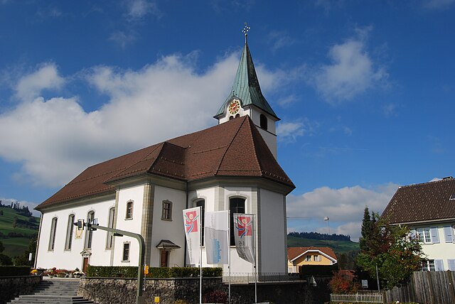
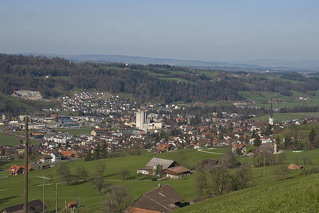
Шварценберг (Schwarzenberg, Schwarzenberg)

 Hiking in Шварценберг
Schwarzenberg, nestled in the beautiful Lucerne region of Switzerland, offers a variety of hiking opportunities that cater to different skill levels and preferences. The area is known for its stunning landscapes, characterized by rolling hills, lush forests, and picturesque views of the surrounding mountains.
Hiking Trails
-
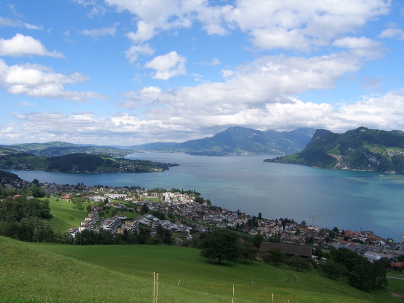
Schwarzenberg to the Zugerberg: This hike provides a moderate challenge and rewards hikers with panoramic views of Lake Zug and the surrounding Alps. The trail is well-marked and is suitable for those with a reasonable level of fitness.
-
Käppelliweg: A family-friendly circular trail that introduces hikers to the flora and fauna of the region. This trail is relatively easy and offers a great experience for families with children.
-
Rigi and Pilatus Hikes: For more experienced hikers, the nearby mountains of Rigi and Pilatus offer challenging trails with breathtaking views. You can spend a full day traversing ridges and enjoying high-altitude landscapes.
Seasonality and Weather
-
Best Hiking Season: The best time for hiking in Schwarzenberg is typically from late spring (May) to early autumn (October). During this time, the weather is generally mild, and the trails are accessible.
-
Weather Considerations: Always check the weather forecast before heading out, as conditions can change rapidly in the mountains. Higher elevations may have lingering snow in early summer.
Preparation and Safety
-
Gear: Wear sturdy hiking boots and bring layers of clothing. The weather can vary significantly with altitude changes.
-
Navigation: Use local maps or GPS devices to stay on the trails, as some paths can be less well-marked. It’s also a good idea to inform someone about your hiking plans.
Local Amenities and Access
Schwarzenberg is accessible by public transport from Lucerne, making it easy to reach for day trips. The area also has several accommodations, ranging from charming guesthouses to hotels, ensuring you can find a place to stay if you'd like to extend your hiking adventure.
In summary, hiking in Schwarzenberg provides a mix of scenic beauty and accessibility, making it a fantastic destination for both novice hikers and experienced trekkers. Always remember to respect nature, stay on marked trails, and prepare adequately for safety. Enjoy your hiking experience!
- Страна:

- Почтовый код: 6103
- Телефонный код: 041
- Код автомобильного номера: LU
- Координаты: 47° 0' 51" N, 8° 10' 24" E


- GPS треки (wikiloc): [Ссылка]
- Высота над уровнем моря: 838 м m
- Площадь: 39.31 кв.км
- Население: 1690
- Веб сайт: http://www.schwarzenberg.ch
- Википедия русская: wiki(ru)
- Википедия английская: wiki(en)
- Википедия национальная: wiki(de)
- Хранилище Wikidata: Wikidata: Q14576
- Катеория в википедии: [Ссылка]
- код Freebase: [/m/0fn6tm]
- код GeoNames: Альт: [7287123]
- код VIAF: Альт: [248709704]
- ID отношения в OpenStreetMap: [1682919]
- код GND: Альт: [4432642-7]
- идентификатор HDS: [629]
- код места в Facebook: [112223108794765]
- код швейцарского муниципалитета: [1066]
Граничит с регионами:
Энтлебух
Hiking in Энтлебух
Entlebuch is a stunning area located in the Canton of Lucerne, Switzerland, known for its picturesque landscapes, diverse ecosystems, and opportunities for hiking. As a UNESCO Biosphere Reserve, it features a mix of wetlands, meadows, forests, and mountains, making it an ideal destination for hikers of all levels....
- Страна:
- Почтовый код: 6162
- Телефонный код: 041
- Код автомобильного номера: LU
- Координаты: 46° 59' 34" N, 8° 3' 47" E
- GPS треки (wikiloc): [Ссылка]
- Высота над уровнем моря: 723 м m
- Площадь: 56.95 кв.км
- Население: 3315
- Веб сайт: [Ссылка]

Вертенштайн
Hiking in Вертенштайн
Werthenstein, located in the canton of Lucerne in Switzerland, is a beautiful area that offers a range of hiking opportunities amidst stunning natural scenery. The region is characterized by its picturesque landscapes, including the nearby Lake Uri and various mountain peaks....
- Страна:
- Почтовый код: 6106
- Телефонный код: 041
- Код автомобильного номера: LU
- Координаты: 47° 2' 13" N, 8° 6' 27" E
- GPS треки (wikiloc): [Ссылка]
- Высота над уровнем моря: 893 м m
- Площадь: 15.80 кв.км
- Население: 2115
- Веб сайт: [Ссылка]


Кринс
Hiking in Кринс
Kriens is a charming municipality located in the canton of Lucerne in Switzerland, nestled at the foot of the majestic Pilatus mountain range. It offers a variety of hiking opportunities suitable for different skill levels. Here are some highlights and recommendations for hiking in and around Kriens:...
- Страна:
- Почтовый код: 6010
- Телефонный код: 041
- Код автомобильного номера: LU
- Координаты: 47° 1' 15" N, 8° 15' 32" E
- GPS треки (wikiloc): [Ссылка]
- Высота над уровнем моря: 843 м m
- Площадь: 27.31 кв.км
- Население: 26997
- Веб сайт: [Ссылка]

Мальтерс
Hiking in Мальтерс
Malters is a charming municipality located in the canton of Lucerne, Switzerland. It’s nestled in the foothills of the Swiss Alps and offers a variety of hiking opportunities that cater to different skill levels....
- Страна:
- Почтовый код: 6102
- Телефонный код: 041
- Код автомобильного номера: LU
- Координаты: 47° 2' 34" N, 8° 11' 24" E
- GPS треки (wikiloc): [Ссылка]
- Высота над уровнем моря: 490 м m
- Площадь: 28.57 кв.км
- Население: 7231
- Веб сайт: [Ссылка]

Хергисвиль
Hiking in Хергисвиль
Hergiswil is a charming village located on the shores of Lake Lucerne in Switzerland, surrounded by beautiful mountains and stunning landscapes, making it a great destination for hiking enthusiasts. Here are some key points to consider when hiking in Hergiswil:...
- Страна:
- Почтовый код: 6052
- Телефонный код: 041
- Код автомобильного номера: NW
- Координаты: 46° 59' 8" N, 8° 16' 21" E
- GPS треки (wikiloc): [Ссылка]
- Высота над уровнем моря: 1121 м m
- Площадь: 17.00 кв.км
- Население: 5715
- Веб сайт: [Ссылка]

Альпнах
Hiking in Альпнах
Alpnach, located in central Switzerland near Lake Alpnach and the foothills of the Swiss Alps, offers a range of hiking opportunities for outdoor enthusiasts. The area features stunning natural beauty, from lush forests and rolling hills to breathtaking alpine views....
- Страна:
- Почтовый код: 6055
- Телефонный код: 041
- Код автомобильного номера: OW
- Координаты: 46° 57' 0" N, 8° 13' 51" E
- GPS треки (wikiloc): [Ссылка]
- Высота над уровнем моря: 1039 м m
- Площадь: 56.98 кв.км
- Население: 6024
- Веб сайт: [Ссылка]