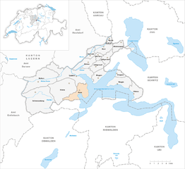
Штанстад (Stansstad, Stansstad)

 Hiking in Штанстад
Stansstad, located in the canton of Nidwalden in Switzerland, offers a variety of stunning hiking opportunities. Nestled between Lake Lucerne and the surrounding mountains, it's an ideal destination for both casual walkers and experienced hikers.
Hiking Trails
-
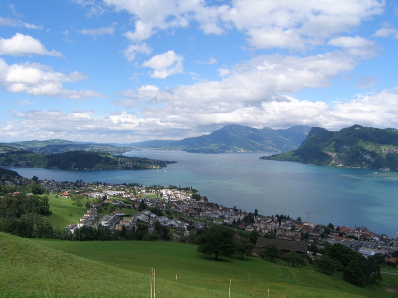
Stanserhorn: One of the most popular hikes is to the summit of Stanserhorn. The route takes you through beautiful alpine meadows and offers breathtaking views of Lake Lucerne and the surrounding mountain ranges. The hike can be challenging, but the cable car assistance makes it accessible to many.
-
Niederbauen-Chulm: This hike is particularly scenic, with panoramic views from the summit. The trail can be a bit steep in sections, but it rewards hikers with stunning views of the Swiss landscape.
-
Pilatus: While not directly in Stansstad, the nearby Pilatus mountain can be accessed via trails starting from Stansstad. It offers a range of hiking routes, from easier walks to more demanding climbs.
-
Lake Lucerne Trails: There are several trails that follow the shoreline of Lake Lucerne. These paths are generally easier and suitable for families. They provide an opportunity to enjoy the tranquil waters and beautiful scenery without the challenges of steep climbs.
Flora and Fauna
Hiking in Stansstad not only offers stunning views but also allows you to experience diverse flora and fauna. You can spot different alpine flowers, as well as various wildlife, including ibex and chamois in the higher altitudes.
Tips for Hiking in Stansstad
- Weather Check: Always check the weather forecasts before heading out, as conditions can change quickly in the mountains.
- Proper Gear: Wear suitable hiking shoes and dress in layers to accommodate varying temperatures.
- Stay Hydrated: Carry enough water, especially on longer hikes.
- Maps and Navigation: It’s a good idea to have a physical map or a reliable GPS device, as some trails may not be well-marked.
- Respect Nature: Follow Leave No Trace principles to preserve the natural beauty of the area.
Access and Transportation
Stansstad is easily accessible by train and car, making it a convenient base for hiking excursions. Public transportation can take you to starting points for various trails.
Conclusion
Hiking in Stansstad provides a perfect combination of natural beauty, a variety of trails, and stunning mountain landscapes. Whether you’re looking for a leisurely lakeside walk or a challenging mountain hike, Stansstad has something to offer every hiking enthusiast.
- Страна:

- Почтовый код: 6362
- Телефонный код: 041
- Код автомобильного номера: NW
- Координаты: 46° 58' 49" N, 8° 20' 20" E


- GPS треки (wikiloc): [Ссылка]
- Высота над уровнем моря: 436 м m
- Площадь: 17.11 кв.км
- Население: 4494
- Веб сайт: http://www.stansstad.ch
- Википедия русская: wiki(ru)
- Википедия английская: wiki(en)
- Википедия национальная: wiki(de)
- Хранилище Wikidata: Wikidata: Q64285
- Катеория в википедии: [Ссылка]
- код Freebase: [/m/01v2ff]
- код GeoNames: Альт: [7287218]
- код VIAF: Альт: [158419328]
- ID отношения в OpenStreetMap: [1683113]
- код LCNAF: Альт: [n92093213]
- место в MusicBrainz: [e946e45a-7933-47a4-90c3-44f35c6b9733]
- код темы Quora: [Stansstad]
- код TGN: [1064433]
- идентификатор HDS: [756]
- код швейцарского муниципалитета: [1510]
Граничит с регионами:

Хорв
Hiking in Хорв
Horw is a picturesque municipality located in the canton of Lucerne, Switzerland, known for its stunning natural landscapes and proximity to the Swiss Alps. Hiking in and around Horw offers a variety of trails suited for different skill levels, making it an excellent destination for both novice and experienced hikers....
- Страна:
- Почтовый код: 6048
- Телефонный код: 041
- Код автомобильного номера: LU
- Координаты: 47° 0' 48" N, 8° 18' 39" E
- GPS треки (wikiloc): [Ссылка]
- Высота над уровнем моря: 438 м m
- Площадь: 20.43 кв.км
- Население: 13915
- Веб сайт: [Ссылка]


Мегген
Hiking in Мегген
Meggen is a picturesque village located in the Canton of Lucerne in Switzerland, offering stunning views over Lake Lucerne and the surrounding mountains. Here are some aspects of hiking in and around Meggen that you might find interesting:...
- Страна:
- Почтовый код: 6045
- Телефонный код: 041
- Код автомобильного номера: LU
- Координаты: 47° 2' 47" N, 8° 22' 28" E
- GPS треки (wikiloc): [Ссылка]
- Высота над уровнем моря: 479 м m
- Площадь: 13.93 кв.км
- Население: 7138
- Веб сайт: [Ссылка]


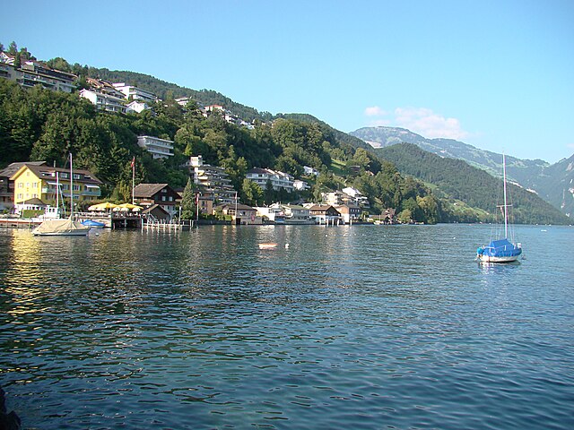
Веггис
Hiking in Веггис
Weggis is a charming lakeside village located in the Canton of Lucerne in Switzerland, nestled along the shores of Lake Lucerne and surrounded by stunning mountains. It is an excellent starting point for hiking enthusiasts due to its diverse range of trails and breathtaking scenery. Here are some highlights of hiking in Weggis:...
- Страна:
- Почтовый код: 6353
- Телефонный код: 041
- Код автомобильного номера: LU
- Координаты: 47° 2' 14" N, 8° 26' 34" E
- GPS треки (wikiloc): [Ссылка]
- Высота над уровнем моря: 582 м m
- Площадь: 25.29 кв.км
- Население: 4404
- Веб сайт: [Ссылка]

Хергисвиль
Hiking in Хергисвиль
Hergiswil is a charming village located on the shores of Lake Lucerne in Switzerland, surrounded by beautiful mountains and stunning landscapes, making it a great destination for hiking enthusiasts. Here are some key points to consider when hiking in Hergiswil:...
- Страна:
- Почтовый код: 6052
- Телефонный код: 041
- Код автомобильного номера: NW
- Координаты: 46° 59' 8" N, 8° 16' 21" E
- GPS треки (wikiloc): [Ссылка]
- Высота над уровнем моря: 1121 м m
- Площадь: 17.00 кв.км
- Население: 5715
- Веб сайт: [Ссылка]
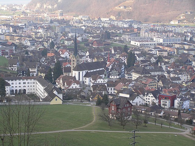

Штанс
Hiking in Штанс
Hiking in Stans, a picturesque town in the Lucerne region of Switzerland, offers a variety of trails that cater to different skill levels and preferences. The stunning backdrop of the Swiss Alps provides a breathtaking experience, making it a popular destination for outdoor enthusiasts. Here are some key points to consider when hiking in Stans:...
- Страна:
- Почтовый код: 6370
- Телефонный код: 041
- Код автомобильного номера: NW
- Координаты: 46° 57' 34" N, 8° 22' 0" E
- GPS треки (wikiloc): [Ссылка]
- Высота над уровнем моря: 452 м m
- Площадь: 11.08 кв.км
- Население: 8411
- Веб сайт: [Ссылка]

Эннетбюрген
Hiking in Эннетбюрген
Ennetbürgen is a picturesque village located near Lake Lucerne in the canton of Nidwalden, Switzerland. It offers a variety of hiking opportunities that immerse you in breathtaking natural landscapes, including stunning lake views and mountainous terrain. Here are some highlights and tips for hiking in and around Ennetbürgen:...
- Страна:
- Почтовый код: 6373
- Телефонный код: 041
- Код автомобильного номера: NW
- Координаты: 46° 59' 4" N, 8° 24' 50" E
- GPS треки (wikiloc): [Ссылка]
- Высота над уровнем моря: 435 м m
- Площадь: 17.70 кв.км
- Население: 4698
- Веб сайт: [Ссылка]


Эннетмос
Hiking in Эннетмос
Ennetmoos is a charming village located near Lake Lucerne in Switzerland's scenic region. It is an excellent destination for hiking enthusiasts, offering a variety of trails that cater to different skill levels and preferences. Here are some highlights for hiking in Ennetmoos:...
- Страна:
- Почтовый код: 6372
- Телефонный код: 041
- Код автомобильного номера: NW
- Координаты: 46° 57' 24" N, 8° 20' 14" E
- GPS треки (wikiloc): [Ссылка]
- Высота над уровнем моря: 521 м m
- Площадь: 14.95 кв.км
- Население: 2147
- Веб сайт: [Ссылка]

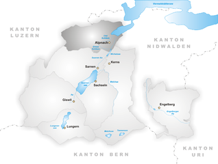
Альпнах
Hiking in Альпнах
Alpnach, located in central Switzerland near Lake Alpnach and the foothills of the Swiss Alps, offers a range of hiking opportunities for outdoor enthusiasts. The area features stunning natural beauty, from lush forests and rolling hills to breathtaking alpine views....
- Страна:
- Почтовый код: 6055
- Телефонный код: 041
- Код автомобильного номера: OW
- Координаты: 46° 57' 0" N, 8° 13' 51" E
- GPS треки (wikiloc): [Ссылка]
- Высота над уровнем моря: 1039 м m
- Площадь: 56.98 кв.км
- Население: 6024
- Веб сайт: [Ссылка]