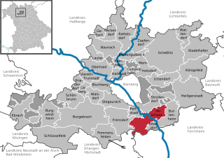
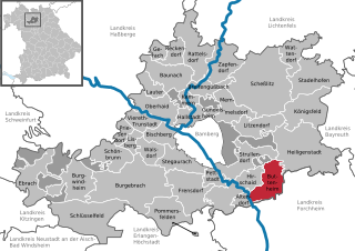
Альтендорф (Бамберг) (Altendorf, Altendorf)

 Hiking in Альтендорф (Бамберг)
Altendorf, located in Upper Franconia, Germany, is a charming community surrounded by beautiful landscapes that provide great opportunities for hiking and outdoor activities. Here’s what you should know if you're considering hiking in this area:
Terrain and Scenery
- Varied Terrain: The region features a mix of rolling hills, lush forests, and scenic meadows. The Franconian Switzerland region is nearby, known for its distinctive limestone cliffs, caves, and picturesque valleys, offering diverse hiking experiences.
- Natural Beauty: The landscapes are stunning, especially in spring and autumn, with vibrant flora and fauna. You can expect to see beautiful forests, small streams, and charming rural views.
Hiking Trails
- Marked Trails: There are several well-marked hiking trails in and around Altendorf. These trails vary in difficulty, so you can find ones suitable for families, beginners, or more experienced hikers.
- Local Recommendations: It’s a good idea to consult with the local tourism office or hiking clubs for updated maps and trail recommendations. They may offer guided tours or insights into hidden gems in the area.
Nearby Attractions
- Frankenwald Nature Park: A short drive from Altendorf, this park is an excellent spot for hiking, with numerous trails ranging from easy to more challenging routes, all while enjoying the natural beauty of the Franconian Forest.
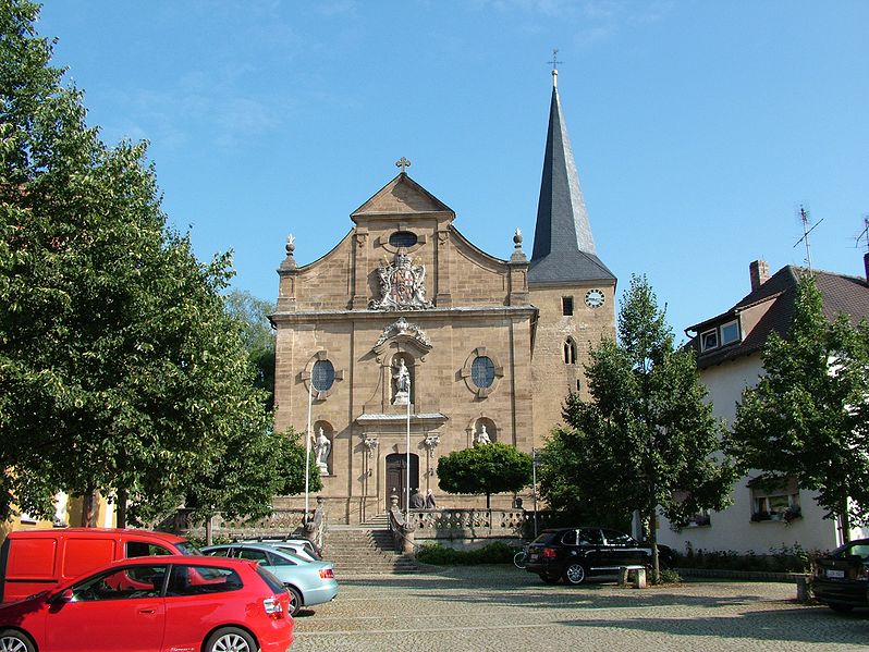
- Cultural Sites: If time permits, explore local landmarks, churches, and sites of historical significance. Combining hiking with cultural experiences can enrich your visit.
Safety and Preparation
- Weather Considerations: Always check the weather forecast before heading out. The region can experience varied weather, so dressing in layers is recommended.
- Local Wildlife: Be mindful of local wildlife and respect their habitats. It's always a good practice to stay on marked paths.
- Hydrate and Nourish: Ensure you carry enough water and snacks, especially on longer hikes.
Conclusion
Hiking in Altendorf provides an excellent opportunity to enjoy the serene beauty of Upper Franconia. Whether you’re a casual walker or an experienced hiker, the area has something to offer everyone. Be sure to plan ahead, respect nature, and enjoy your time exploring the scenic trails!
- Страна:

- Почтовый код: 96146
- Телефонный код: 09545
- Код автомобильного номера: BA
- Координаты: 49° 48' 0" N, 11° 1' 0" E


- GPS треки (wikiloc): [Ссылка]
- Высота над уровнем моря: 257 м m
- Площадь: 8.61 кв.км
- Население: 1542
- Веб сайт: http://www.altendorf-gemeinde.de
- Википедия русская: wiki(ru)
- Википедия английская: wiki(en)
- Википедия национальная: wiki(de)
- Хранилище Wikidata: Wikidata: Q437010
- Катеория в википедии: [Ссылка]
- код Freebase: [/m/02q0yqk]
- код GeoNames: Альт: [6556729]
- ID отношения в OpenStreetMap: [1077529]
- код GND: Альт: [4449640-0]
- Bavarikon ID: [ODB_A00001942]
- идентификатор муниципалитетов в Германии: 09471111
Граничит с регионами:

Хиршайд
Hiking in Хиршайд
Hirschaid, a small town in Bavaria, Germany, offers a variety of hiking opportunities in the surrounding countryside. While Hirschaid itself may not have extensive hiking trails, it serves as a great starting point for exploring the picturesque landscapes of the Upper Franconia region. Here are some highlights for hiking in and around Hirschaid:...
- Страна:
- Почтовый код: 96114
- Телефонный код: 09543
- Код автомобильного номера: BA
- Координаты: 49° 49' 0" N, 10° 59' 0" E
- GPS треки (wikiloc): [Ссылка]
- Высота над уровнем моря: 248 м m
- Площадь: 40.95 кв.км
- Население: 12193
- Веб сайт: [Ссылка]
Буттенхайм
Hiking in Буттенхайм
Buttenheim is a quaint town located in Bavaria, Germany, ideal for hiking enthusiasts looking to explore picturesque landscapes. Although it may not be as well-known as some larger hiking areas, it offers lovely trails and scenic views of the surrounding countryside....
- Страна:
- Почтовый код: 96155
- Телефонный код: 09545
- Код автомобильного номера: BA
- Координаты: 49° 47' 0" N, 11° 1' 0" E
- GPS треки (wikiloc): [Ссылка]
- Высота над уровнем моря: 273 м m
- Площадь: 30.03 кв.км
- Население: 2786
- Веб сайт: [Ссылка]