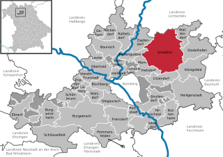
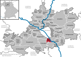
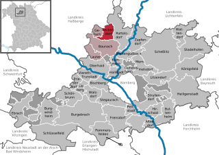
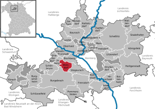
Бамберг (Bamberg, Landkreis Bamberg)
.svg)
 Hiking in Бамберг
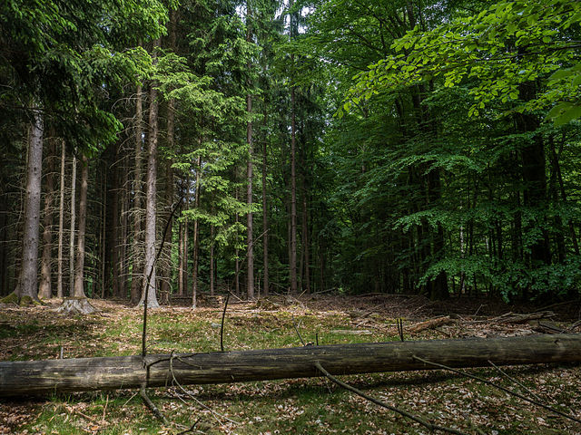
Bamberg district, located in Bavaria, Germany, offers a variety of scenic hiking opportunities amidst its charming landscapes, historical sites, and cultural attractions. Here’s an overview of what you can expect when hiking in the region:
Scenic Trails
-
Fränkische Schweiz (Franconian Switzerland): Just east of Bamberg, this area is famous for its striking limestone formations, gorges, and caves. The hiking trails here range from easy walks to more challenging routes, with the chance to see beautiful views of the countryside and visit quaint villages.
-
Main Cycling and Hiking Trail: This trail runs along the Main River, providing a flat and accessible option ideal for both hiking and biking. It showcases the beautiful riverbanks and local wildlife.
-
Bamberg's Nature Trails: Within the district, there are various nature trails that highlight the local flora and fauna. These trails often lead to historical monuments or panoramic viewpoints.
Historical Significance
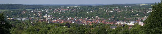
While hiking, you can encounter numerous historic sites, such as medieval castles, churches, and bustling town centers. Bamberg itself is a UNESCO World Heritage site, known for its well-preserved medieval architecture.
Local Flora and Fauna
The biodiversity in the Bamberg district is significant, with forests, meadows, and riverbanks providing habitats for various species. Depending on the season, you'll see different flora, like wildflowers in spring or colorful foliage in autumn.
Hiking Tips
-
Best Times to Hike: Spring and early autumn are ideal due to mild weather and beautiful scenery. Summer can be warm, while winter hiking is also possible but may require special gear.
-
Prepare Adequately: Ensure you have proper footwear, sufficient water, and snacks. Additionally, a map or a GPS device can be useful, as some trails may not be well-marked.
-
Guided Tours: If you're unfamiliar with the area, you may consider joining a guided hiking group or taking part in organized tours to highlight the region’s geography and history.
Amenities
Many local villages and towns have eateries and accommodation options for hikers needing breaks or overnight stays. Be sure to check local resources for any updates on trail conditions or additional information.
Hiking in Bamberg district promises a mix of natural beauty, charming architecture, and rich history, making it a great destination for outdoor enthusiasts!
- Страна:

- Столица: Бамберг
- Код автомобильного номера: BA
- Координаты: 49° 49' 48" N, 10° 49' 48" E


- GPS треки (wikiloc): [Ссылка]
- Высота над уровнем моря: 275 м m
- Площадь: 1168.00 кв.км
- Население: 119829
- Веб сайт: http://www.landkreis-bamberg.de/
- Википедия русская: wiki(ru)
- Википедия английская: wiki(en)
- Википедия национальная: wiki(de)
- Хранилище Wikidata: Wikidata: Q10444
- Галерея изображений в википедии: [Ссылка]
- Катеория в википедии: [Ссылка]
- Карты в википедии: [Ссылка]
- код Freebase: [/m/01csfx]
- код GeoNames: Альт: [3220844]
- код VIAF: Альт: [236334848]
- ID отношения в OpenStreetMap: [62627]
- код GND: Альт: [4004393-9]
- идентификатор местоположения ArchINFORM: [2330]
- код TGN: [7077286]
- код Historical Gazetteer: [adm_139471]
- Bavarikon ID: [ODB_A00001941]
- код NUTS: [DE245]
- код BabelNet: [01299924n]
- код района Германии: 09471
Включает регионы:
Geisberger Forst
Hiking in Geisberger Forst
Geisberger Forst is a beautiful forest area located near the town of Geisberg in Germany, known for its picturesque landscapes and well-maintained hiking trails. It offers a variety of hiking experiences suited for both beginners and more experienced hikers....
- Страна:
- Координаты: 49° 53' 0" N, 11° 2' 0" E
- GPS треки (wikiloc): [Ссылка]
Koppenwinder Forst
Hiking in Koppenwinder Forst
Koppenwinder Forst is a scenic area that offers a variety of hiking opportunities for all levels of outdoor enthusiasts. Located in a picturesque landscape, this forest features lush greenery, diverse wildlife, and various trails that make it an excellent destination for both casual hikers and those seeking more challenging terrains....
- Страна:
- Координаты: 49° 51' 0" N, 10° 32' 0" E
- GPS треки (wikiloc): [Ссылка]
Lindach
Hiking in Lindach
Lindach is a charming location in Germany, especially for those who appreciate nature and outdoor activities. While specific trails may vary, hiking in this gemeindefreies Gebiet (unincorporated area) offers beautiful landscapes, serene surroundings, and various opportunities for outdoor exploration. Here are some general tips and highlights to consider when hiking in Lindach:...
- Страна:
- Координаты: 49° 51' 0" N, 10° 38' 0" E
- GPS треки (wikiloc): [Ссылка]
Semberg
Hiking in Semberg
Semberg, while not widely known as a hiking destination, is a great place for outdoor enthusiasts looking for less crowded trails and beautiful nature. Accessible trails often wind through diverse landscapes, including forests, hills, and potentially some scenic views, depending on the specific area within Semberg you are exploring....
- Страна:
- Координаты: 49° 57' 0" N, 10° 49' 0" E
- GPS треки (wikiloc): [Ссылка]


Цапфендорф
Hiking in Цапфендорф
Zapfendorf, a community in the Bamberg district of Bavaria, Germany, offers a picturesque setting for hiking enthusiasts. The region is characterized by its scenic landscapes, lush forests, and charming villages, making it an inviting location for outdoor activities....
- Страна:
- Почтовый код: 96199
- Телефонный код: 09547
- Код автомобильного номера: BA
- Координаты: 50° 1' 3" N, 10° 55' 51" E
- GPS треки (wikiloc): [Ссылка]
- Высота над уровнем моря: 248 м m
- Площадь: 30.55 кв.км
- Население: 5095
- Веб сайт: [Ссылка]


Hauptsmoorwald
Hiking in Hauptsmoorwald
Hauptsmoorwald is a beautiful forest area located in Germany, known for its diverse flora and fauna. Hiking in this region can be a rewarding experience for outdoor enthusiasts of all skill levels....
- Страна:
- Координаты: 49° 53' 0" N, 10° 57' 0" E
- GPS треки (wikiloc): [Ссылка]


Штегаурах
Hiking in Штегаурах
Stegaurach is a charming village located in Bavaria, Germany, close to the city of Bamberg. It offers picturesque natural landscapes and is an excellent destination for hiking enthusiasts. Here are some highlights for hiking in and around Stegaurach:...
- Страна:
- Почтовый код: 96135
- Телефонный код: 0951
- Код автомобильного номера: BA
- Координаты: 49° 52' 12" N, 10° 46' 56" E
- GPS треки (wikiloc): [Ссылка]
- Высота над уровнем моря: 268 м m
- Площадь: 23.89 кв.км
- Население: 7041
- Веб сайт: [Ссылка]

Штадельхофен
Hiking in Штадельхофен
Stadelhofen is a district in the city of Zurich, Switzerland, located near the shores of Lake Zurich. While the area itself is urban and primarily residential, it offers great access to various hiking trails in the surrounding regions. Here are some hiking opportunities nearby:...
- Страна:
- Почтовый код: 96187
- Телефонный код: 09504
- Код автомобильного номера: BA
- Координаты: 50° 0' 0" N, 11° 2' 0" E
- GPS треки (wikiloc): [Ссылка]
- Высота над уровнем моря: 478 м m
- Площадь: 41.01 кв.км
- Население: 1291
- Веб сайт: [Ссылка]

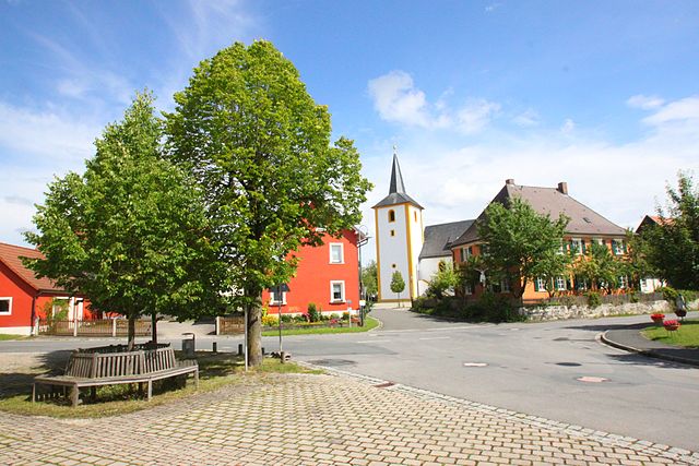
Шеслиц
Hiking in Шеслиц
Scheßlitz is a charming town located in Bavaria, Germany, surrounded by beautiful landscapes that offer excellent hiking opportunities. The region is characterized by its picturesque hills, forests, and scenic views, making it a great destination for outdoor enthusiasts....
- Страна:
- Почтовый код: 96110
- Телефонный код: 09542
- Код автомобильного номера: BA
- Координаты: 49° 58' 36" N, 11° 2' 2" E
- GPS треки (wikiloc): [Ссылка]
- Высота над уровнем моря: 298 м m
- Площадь: 94.88 кв.км
- Население: 7176
- Веб сайт: [Ссылка]


Халльштадт
Hiking in Халльштадт
Hallstatt, located in the Salzkammergut region of Austria, is known for its stunning alpine scenery, rich history, and picturesque lakeside setting. Hiking around Hallstatt offers a variety of trails that cater to different skill levels, blending breathtaking views with the charm of traditional Austrian culture....
- Страна:
- Почтовый код: 96103
- Телефонный код: 0951
- Код автомобильного номера: BA
- Координаты: 49° 55' 44" N, 10° 52' 31" E
- GPS треки (wikiloc): [Ссылка]
- Высота над уровнем моря: 242 м m
- Площадь: 14.54 кв.км
- Население: 8229
- Веб сайт: [Ссылка]

Петштадт
Hiking in Петштадт
Pettstadt is a small town in Bavaria, Germany, located near the city of Bamberg. It is surrounded by beautiful natural landscapes, making it a great destination for hiking enthusiasts. While specific trails may not be extensively developed like in larger national parks, there are several options for hikers of all levels in and around Pettstadt....
- Страна:
- Почтовый код: 96175
- Телефонный код: 09502
- Код автомобильного номера: BA
- Координаты: 49° 49' 48" N, 10° 55' 45" E
- GPS треки (wikiloc): [Ссылка]
- Высота над уровнем моря: 246 м m
- Площадь: 9.88 кв.км
- Население: 1968
- Веб сайт: [Ссылка]


Альтендорф (Бамберг)
Hiking in Альтендорф (Бамберг)
Altendorf, located in Upper Franconia, Germany, is a charming community surrounded by beautiful landscapes that provide great opportunities for hiking and outdoor activities. Here’s what you should know if you're considering hiking in this area:...
- Страна:
- Почтовый код: 96146
- Телефонный код: 09545
- Код автомобильного номера: BA
- Координаты: 49° 48' 0" N, 11° 1' 0" E
- GPS треки (wikiloc): [Ссылка]
- Высота над уровнем моря: 257 м m
- Площадь: 8.61 кв.км
- Население: 1542
- Веб сайт: [Ссылка]


Баунах
Hiking in Баунах
Baunach is a small town located in Bavaria, Germany, nestled in the scenic landscape of the Franconian region. While it might not be as widely known as some major hiking destinations, it offers various trails and outdoor activities that nature lovers can enjoy....
- Страна:
- Почтовый код: 96148
- Телефонный код: 09544
- Код автомобильного номера: BA
- Координаты: 49° 58' 0" N, 10° 50' 0" E
- GPS треки (wikiloc): [Ссылка]
- Высота над уровнем моря: 238 м m
- Площадь: 30.91 кв.км
- Население: 4005
- Веб сайт: [Ссылка]


Бургебрах
Hiking in Бургебрах
Burgebrach is a small municipality located in Bavaria, Germany, known for its picturesque landscapes and rural charm. Hiking in and around Burgebrach offers a wonderful opportunity to explore the natural beauty of the region, characterized by scenic forests, rolling hills, and picturesque farmland....
- Страна:
- Почтовый код: 96138
- Телефонный код: 09546
- Код автомобильного номера: BA
- Координаты: 49° 49' 0" N, 10° 45' 0" E
- GPS треки (wikiloc): [Ссылка]
- Высота над уровнем моря: 267 м m
- Площадь: 87.84 кв.км
- Население: 6862
- Веб сайт: [Ссылка]

Шлюссельфельд
Hiking in Шлюссельфельд
Schlüsselfeld is a small municipality located in Bavaria, Germany, and while it may not be as well-known as some of the larger national parks or hiking areas, it offers charming landscapes and trails that can provide a delightful hiking experience. When hiking in and around Schlüsselfeld, here are some key features to consider:...
- Страна:
- Почтовый код: 96132
- Телефонный код: 09552
- Код автомобильного номера: BA
- Координаты: 49° 46' 0" N, 10° 37' 0" E
- GPS треки (wikiloc): [Ссылка]
- Высота над уровнем моря: 299 м m
- Площадь: 70.22 кв.км
- Население: 5712
- Веб сайт: [Ссылка]


Эбрах
- Село в городе Бамберг
Hiking in Эбрах
Ebrach is a charming village located in Bavaria, Germany, and is part of the beautiful Franconian region. It is surrounded by lush forests, rolling hills, and picturesque landscapes, making it an excellent destination for hiking enthusiasts....
- Страна:
- Почтовый код: 96157
- Телефонный код: 09553
- Код автомобильного номера: BA
- Координаты: 49° 49' 0" N, 10° 30' 0" E
- GPS треки (wikiloc): [Ссылка]
- Высота над уровнем моря: 330 м m
- Площадь: 29.58 кв.км
- Население: 1806
- Веб сайт: [Ссылка]

Реккендорф
Hiking in Реккендорф
Reckendorf is a small municipality located in the northern part of Bavaria, Germany. While it may not be a primary hiking destination like some of the more famous areas in Bavaria, there are still opportunities for those looking to enjoy the outdoors and explore the beautiful countryside....
- Страна:
- Почтовый код: 96182
- Телефонный код: 09544
- Код автомобильного номера: BA
- Координаты: 50° 1' 50" N, 10° 49' 0" E
- GPS треки (wikiloc): [Ссылка]
- Высота над уровнем моря: 254 м m
- Площадь: 13.06 кв.км
- Население: 1546
- Веб сайт: [Ссылка]


Брайтенгюсбах
Hiking in Брайтенгюсбах
Breitengüßbach, a quaint village in Bavaria, Germany, is surrounded by beautiful natural landscapes, making it an excellent spot for hiking enthusiasts. Here are some insights into hiking in Breitengüßbach and its surroundings:...
- Страна:
- Почтовый код: 96149
- Телефонный код: 09544
- Код автомобильного номера: BA
- Координаты: 49° 53' 30" N, 10° 53' 30" E
- GPS треки (wikiloc): [Ссылка]
- Высота над уровнем моря: 245 м m
- Площадь: 16.86 кв.км
- Население: 4513
- Веб сайт: [Ссылка]

Кеммерн
Hiking in Кеммерн
Kemmern is a small village located in Bavaria, Germany, near the city of Bamberg. While it may not be a well-known destination for hiking, the surrounding region offers beautiful landscapes, small hills, and nature trails that are perfect for outdoor enthusiasts. Here are some highlights and tips for hiking in and around Kemmern:...
- Страна:
- Почтовый код: 96164
- Телефонный код: 09544
- Код автомобильного номера: BA
- Координаты: 49° 57' 0" N, 10° 52' 0" E
- GPS треки (wikiloc): [Ссылка]
- Высота над уровнем моря: 237 м m
- Площадь: 8.27 кв.км
- Население: 2595
- Веб сайт: [Ссылка]

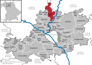
Раттельсдорф
Hiking in Раттельсдорф
Rattelsdorf, a small town in Bavaria, Germany, is surrounded by beautiful countryside that offers a variety of hiking opportunities. The region is characterized by rolling hills, forests, and charming rural landscapes, making it a great destination for both novice and experienced hikers....
- Страна:
- Почтовый код: 96179
- Телефонный код: 09547
- Код автомобильного номера: BA
- Координаты: 50° 0' 56" N, 10° 53' 13" E
- GPS треки (wikiloc): [Ссылка]
- Высота над уровнем моря: 259 м m
- Площадь: 39.58 кв.км
- Население: 3987
- Веб сайт: [Ссылка]


Бургвиндхайм
Hiking in Бургвиндхайм
Burgwindheim is a small village located in Bavaria, Germany, and while it may not be as widely known as some larger hiking destinations, it offers beautiful landscapes and a tranquil environment for hiking enthusiasts. Here are some tips and information about hiking in and around Burgwindheim:...
- Страна:
- Почтовый код: 96154
- Телефонный код: 09551
- Код автомобильного номера: BA
- Координаты: 49° 50' 0" N, 10° 36' 0" E
- GPS треки (wikiloc): [Ссылка]
- Высота над уровнем моря: 292 м m
- Площадь: 37.35 кв.км
- Население: 1350
- Веб сайт: [Ссылка]


Френсдорф
Hiking in Френсдорф
Frensdorf, a small municipality in Bavaria, Germany, offers scenic hiking opportunities that allow you to explore the beautiful natural landscapes of the region. Here are some key points to consider if you're planning a hiking trip in and around Frensdorf:...
- Страна:
- Почтовый код: 96158
- Телефонный код: 09502
- Код автомобильного номера: BA
- Координаты: 49° 49' 0" N, 10° 51' 0" E
- GPS треки (wikiloc): [Ссылка]
- Высота над уровнем моря: 255 м m
- Площадь: 43.96 кв.км
- Население: 4961
- Веб сайт: [Ссылка]


Бишберг
Hiking in Бишберг
Bischberg, located in Bavaria, Germany, offers a variety of hiking opportunities, primarily characterized by its picturesque landscapes and serene environments. While Bischberg itself is a small town, it serves as a great base for exploring the surrounding areas, which are rich in natural beauty....
- Страна:
- Почтовый код: 96120
- Телефонный код: 0951
- Код автомобильного номера: BA
- Координаты: 49° 54' 0" N, 10° 49' 0" E
- GPS треки (wikiloc): [Ссылка]
- Высота над уровнем моря: 236 м m
- Площадь: 17.55 кв.км
- Население: 5281
- Веб сайт: [Ссылка]


Призендорф
Hiking in Призендорф
Priesendorf is a small village located in Bavaria, Germany, and while it may not be as widely known for hiking as some larger regions, it still offers access to beautiful natural landscapes and potential hiking routes in the surrounding area....
- Страна:
- Почтовый код: 96170
- Телефонный код: 09549
- Код автомобильного номера: BA
- Координаты: 49° 54' 0" N, 10° 42' 0" E
- GPS треки (wikiloc): [Ссылка]
- Высота над уровнем моря: 297 м m
- Площадь: 8.35 кв.км
- Население: 1240
- Веб сайт: [Ссылка]


Оберхайд
Hiking in Оберхайд
Oberhaid, located in Bavaria, Germany, offers a delightful experience for hikers looking to explore the beautiful natural landscapes of the region. The area is characterized by its rolling hills, forests, and scenic trails that cater to various skill levels. Here are some highlights about hiking in Oberhaid:...
- Страна:
- Почтовый код: 96173
- Телефонный код: 09503
- Код автомобильного номера: BA
- Координаты: 49° 55' 0" N, 10° 49' 0" E
- GPS треки (wikiloc): [Ссылка]
- Высота над уровнем моря: 239 м m
- Площадь: 27.22 кв.км
- Население: 4090
- Веб сайт: [Ссылка]

Меммельсдорф
Hiking in Меммельсдорф
Memmelsdorf, located near Bamberg in Bavaria, Germany, offers a variety of beautiful hiking opportunities. The region is characterized by its picturesque landscapes, lush forests, and charming villages, making it an excellent destination for hikers of all levels....
- Страна:
- Почтовый код: 96117
- Телефонный код: 09542; 0951; 09505
- Код автомобильного номера: BA
- Координаты: 49° 55' 58" N, 10° 57' 12" E
- GPS треки (wikiloc): [Ссылка]
- Высота над уровнем моря: 262 м m
- Площадь: 26.16 кв.км
- Население: 8831
- Веб сайт: [Ссылка]

Хиршайд
Hiking in Хиршайд
Hirschaid, a small town in Bavaria, Germany, offers a variety of hiking opportunities in the surrounding countryside. While Hirschaid itself may not have extensive hiking trails, it serves as a great starting point for exploring the picturesque landscapes of the Upper Franconia region. Here are some highlights for hiking in and around Hirschaid:...
- Страна:
- Почтовый код: 96114
- Телефонный код: 09543
- Код автомобильного номера: BA
- Координаты: 49° 49' 0" N, 10° 59' 0" E
- GPS треки (wikiloc): [Ссылка]
- Высота над уровнем моря: 248 м m
- Площадь: 40.95 кв.км
- Население: 12193
- Веб сайт: [Ссылка]


Штруллендорф
Hiking in Штруллендорф
Strullendorf is a charming village located in Bavaria, Germany, and serves as a great starting point for various hiking adventures in the surrounding region. Here are some aspects of hiking in and around Strullendorf:...
- Страна:
- Почтовый код: 96129
- Телефонный код: 09543
- Код автомобильного номера: BA
- Координаты: 49° 50' 0" N, 10° 58' 0" E
- GPS треки (wikiloc): [Ссылка]
- Высота над уровнем моря: 251 м m
- Площадь: 31.69 кв.км
- Население: 7956
- Веб сайт: [Ссылка]


Шёнбрунн-им-Штайгервальд
Hiking in Шёнбрунн-им-Штайгервальд
Schönbrunn im Steigerwald is a beautiful area for hiking located in Bavaria, Germany. It’s part of the larger Steigerwald region, characterized by its lush forests, rolling hills, and scenic views. Here are some key points about hiking in this area:...
- Страна:
- Почтовый код: 96185
- Телефонный код: 09546
- Код автомобильного номера: BA
- Координаты: 49° 52' 0" N, 10° 42' 0" E
- GPS треки (wikiloc): [Ссылка]
- Высота над уровнем моря: 280 м m
- Площадь: 24.67 кв.км
- Население: 1732
- Веб сайт: [Ссылка]
Буттенхайм
Hiking in Буттенхайм
Buttenheim is a quaint town located in Bavaria, Germany, ideal for hiking enthusiasts looking to explore picturesque landscapes. Although it may not be as well-known as some larger hiking areas, it offers lovely trails and scenic views of the surrounding countryside....
- Страна:
- Почтовый код: 96155
- Телефонный код: 09545
- Код автомобильного номера: BA
- Координаты: 49° 47' 0" N, 11° 1' 0" E
- GPS треки (wikiloc): [Ссылка]
- Высота над уровнем моря: 273 м m
- Площадь: 30.03 кв.км
- Население: 2786
- Веб сайт: [Ссылка]


Лисберг
Hiking in Лисберг
Lisberg, located in Bavaria, Germany, is known for its picturesque landscapes and outdoor activities, including hiking. While it may not be as popular as some larger hiking destinations in the region, it still offers charming trails that showcase the area's natural beauty....
- Страна:
- Почтовый код: 96170
- Телефонный код: 09549
- Код автомобильного номера: BA
- Координаты: 49° 52' 50" N, 10° 43' 46" E
- GPS треки (wikiloc): [Ссылка]
- Высота над уровнем моря: 288 м m
- Площадь: 8.36 кв.км
- Население: 1345
- Веб сайт: [Ссылка]
Лаутер
- муниципалитет в Германии, Бавария
Hiking in Лаутер
Lauter, a picturesque village located in Bavaria, Germany, serves as a fantastic base for hiking enthusiasts looking to explore the beautiful landscapes of the region. Surrounded by the stunning Bavarian Alps, Lauter offers a range of hiking trails catering to all skill levels....
- Страна:
- Почтовый код: 96169
- Телефонный код: 09544
- Код автомобильного номера: BA
- Координаты: 49° 58' 0" N, 10° 47' 0" E
- GPS треки (wikiloc): [Ссылка]
- Высота над уровнем моря: 269 м m
- Площадь: 12.76 кв.км
- Население: 1021
- Веб сайт: [Ссылка]


Литцендорф
Hiking in Литцендорф
Litzendorf, located in Bavaria, Germany, is a charming village that offers several opportunities for hiking and enjoying the picturesque landscapes of the region. Here are some key points about hiking in this area:...
- Страна:
- Почтовый код: 96123
- Телефонный код: 09505
- Код автомобильного номера: BA
- Координаты: 49° 54' 0" N, 11° 0' 0" E
- GPS треки (wikiloc): [Ссылка]
- Высота над уровнем моря: 311 м m
- Площадь: 25.85 кв.км
- Население: 4825
- Веб сайт: [Ссылка]

Ваттендорф
Hiking in Ваттендорф
Wattendorf, located in Bavaria, Germany, offers a scenic backdrop for hiking enthusiasts. The region is characterized by its lush landscapes, rolling hills, and charming rural settings. Here are some key points about hiking in Wattendorf:...
- Страна:
- Почтовый код: 96196
- Телефонный код: 09504
- Код автомобильного номера: BA
- Координаты: 50° 2' 0" N, 11° 8' 0" E
- GPS треки (wikiloc): [Ссылка]
- Высота над уровнем моря: 530 м m
- Площадь: 22.23 кв.км
- Население: 662
- Веб сайт: [Ссылка]


Фирет-Трунштадт
Hiking in Фирет-Трунштадт
Viereth-Trunstadt is a small municipality located in Bavaria, Germany, known for its beautiful natural landscapes and hiking opportunities. While it may not be as famous as some larger hiking destinations in Germany, it offers a charming experience for hikers looking to explore the region's countryside....
- Страна:
- Почтовый код: 96191
- Телефонный код: 09503
- Код автомобильного номера: BA
- Координаты: 49° 55' 22" N, 10° 46' 37" E
- GPS треки (wikiloc): [Ссылка]
- Высота над уровнем моря: 261 м m
- Площадь: 15.78 кв.км
- Население: 3696
- Веб сайт: [Ссылка]


Гундельсхайм
Hiking in Гундельсхайм
Gundelsheim is a charming municipality in Bavaria, Germany, known for its picturesque landscapes and outdoor recreational opportunities. While it may not be as widely known as other hiking destinations, it offers some lovely trails and beautiful scenery. Here are some highlights and tips for hiking in and around Gundelsheim:...
- Страна:
- Почтовый код: 96163
- Телефонный код: 0951
- Код автомобильного номера: BA
- Координаты: 49° 55' 0" N, 10° 55' 0" E
- GPS треки (wikiloc): [Ссылка]
- Высота над уровнем моря: 249 м m
- Площадь: 3.78 кв.км
- Население: 2755
- Веб сайт: [Ссылка]

Вальсдорф
Hiking in Вальсдорф
Walsdorf, located in Bavaria, Germany, is a charming area that offers several opportunities for hiking enthusiasts. The region is characterized by its picturesque landscapes, rolling hills, and lush forests, making it ideal for outdoor activities....
- Страна:
- Почтовый код: 96194
- Телефонный код: 09549
- Код автомобильного номера: BA
- Координаты: 49° 52' 0" N, 10° 47' 0" E
- GPS треки (wikiloc): [Ссылка]
- Высота над уровнем моря: 290 м m
- Площадь: 16.22 кв.км
- Население: 1695
- Веб сайт: [Ссылка]


Герах
Hiking in Герах
Gerach is a charming village located in the Bavarian region of Germany, known for its beautiful landscapes and outdoor activities, including hiking. The area offers a variety of hiking trails that cater to different skill levels, from leisurely walks to more challenging hikes....
- Страна:
- Почтовый код: 96161
- Телефонный код: 09544
- Код автомобильного номера: BA
- Координаты: 50° 2' 0" N, 10° 48' 0" E
- GPS треки (wikiloc): [Ссылка]
- Высота над уровнем моря: 276 м m
- Площадь: 7.78 кв.км
- Население: 927
- Веб сайт: [Ссылка]


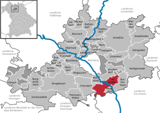
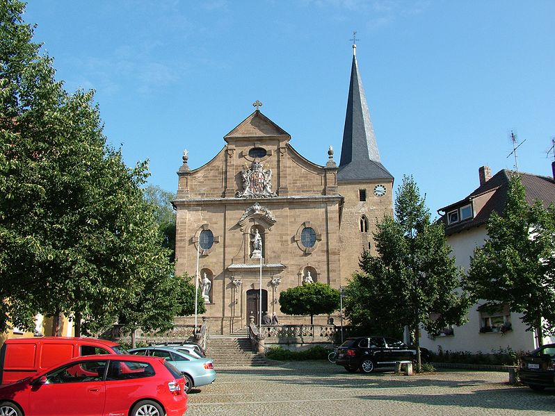
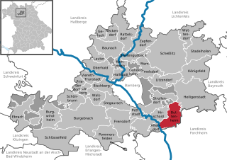
Поммерсфельден
Hiking in Поммерсфельден
Pommersfelden, located in Bavaria, Germany, is a charming location that offers various hiking opportunities amidst beautiful natural landscapes and historical sites. Here are some highlights and tips for hiking in this area:...
- Страна:
- Почтовый код: 96178
- Телефонный код: 09548; 09502
- Код автомобильного номера: BA
- Координаты: 49° 46' 0" N, 10° 49' 0" E
- GPS треки (wikiloc): [Ссылка]
- Высота над уровнем моря: 270 м m
- Площадь: 35.71 кв.км
- Население: 2253
- Веб сайт: [Ссылка]

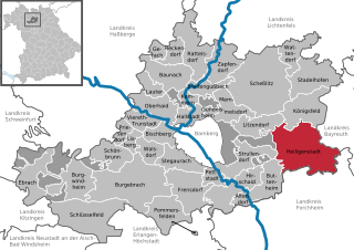
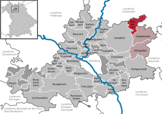
Хайлигенштадт
Hiking in Хайлигенштадт
Heiligenstadt in Oberfranken, a charming town nestled in the Franconian region of Germany, offers an array of hiking opportunities set against a backdrop of beautiful landscapes, rolling hills, and picturesque countryside. Here are some highlights and tips for hiking in the area:...
- Страна:
- Почтовый код: 91332
- Телефонный код: 09198
- Код автомобильного номера: BA
- Координаты: 49° 52' 0" N, 11° 10' 0" E
- GPS треки (wikiloc): [Ссылка]
- Высота над уровнем моря: 304 м m
- Площадь: 76.71 кв.км
- Население: 3583
- Веб сайт: [Ссылка]


Кёнигсфельд
- муниципалитет в Германии, Бавария
Hiking in Кёнигсфельд
Königsfeld is a beautiful village located in Bavaria, Germany, surrounded by stunning landscapes that provide fantastic opportunities for hiking enthusiasts. The area is known for its scenic trails, rich biodiversity, and picturesque views of the Bavarian countryside and the nearby Alps....
- Страна:
- Почтовый код: 96167
- Телефонный код: 09207
- Код автомобильного номера: BA
- Координаты: 49° 57' 0" N, 11° 10' 0" E
- GPS треки (wikiloc): [Ссылка]
- Высота над уровнем моря: 460 м m
- Площадь: 42.72 кв.км
- Население: 1309
- Веб сайт: [Ссылка]

Ebracher Forst
Hiking in Ebracher Forst
Ebracher Forst, a beautiful forested area located in Germany, offers a range of hiking opportunities that cater to both novice and experienced hikers. Here are some highlights about hiking in Ebracher Forst:...
- Страна:
- Координаты: 49° 52' 0" N, 10° 28' 0" E
- GPS треки (wikiloc): [Ссылка]
Eichwald
Hiking in Eichwald
Eichwald is a beautiful area located in Germany that offers stunning landscapes suitable for hiking and outdoor activities. Given that it's a gemeindefreies Gebiet (municipality-free area), it provides a unique experience away from urbanization. Here are some insights into hiking in Eichwald:...
- Страна:
- Координаты: 49° 51' 0" N, 11° 2' 0" E
- GPS треки (wikiloc): [Ссылка]
Steinachsrangen
Hiking in Steinachsrangen
Steinachsrangen is a lesser-known but beautiful hiking destination that can provide a peaceful outdoor experience. While specific details about trails and routes in Steinachsrangen may not be as well-documented as more popular hiking areas, I can share some general tips for hiking in such regions and what to expect....
- Страна:
- Координаты: 49° 47' 0" N, 10° 32' 0" E
- GPS треки (wikiloc): [Ссылка]
Winkelhofer Forst
Hiking in Winkelhofer Forst
Winkelhofer Forst is a beautiful forest area that offers various hiking opportunities for outdoor enthusiasts. Located in Germany, it features a mix of well-marked trails suitable for all skill levels, making it an excellent destination for families, casual hikers, and more experienced trekkers alike....
- Страна:
- Координаты: 49° 49' 0" N, 10° 31' 0" E
- GPS треки (wikiloc): [Ссылка]
Zückshuter Forst
Hiking in Zückshuter Forst
Zückshuter Forst is a beautiful forest area ideal for hiking and outdoor activities. Located in Germany, it offers a mix of serene landscapes, diverse flora, and fauna, along with well-marked trails suitable for various skill levels. Here are some key points to consider when hiking in Zückshuter Forst:...
- Страна:
- Координаты: 49° 57' 0" N, 10° 54' 0" E
- GPS треки (wikiloc): [Ссылка]
Граничит с регионами:

Байройт
- район Баварии
Hiking in Байройт
Bayreuth, located in the northern part of Bavaria, Germany, offers a diverse range of hiking opportunities set against a backdrop of beautiful landscapes, forests, and cultural sites. The region is known for its rich history, stunning scenery, and well-marked trails suitable for hikers of all levels....
- Страна:
- Столица: Байройт
- Код автомобильного номера: PEG; MÜB; KEM; ESB; EBS; BT
- Координаты: 49° 55' 12" N, 11° 30' 0" E
- GPS треки (wikiloc): [Ссылка]
- Высота над уровнем моря: 507 м m
- Площадь: 1273.00 кв.км
- Население: 96772
- Веб сайт: [Ссылка]
Кобург
- район в Баварии, Германия
Hiking in Кобург
Coburg district, located in Bavaria, Germany, offers a variety of hiking opportunities for outdoor enthusiasts. The region is characterized by beautiful landscapes, including rolling hills, woodlands, and scenic views that make for enjoyable hiking experiences....
- Страна:
- Столица: Кобург
- Код автомобильного номера: NEC; CO
- Координаты: 50° 16' 0" N, 10° 55' 0" E
- GPS треки (wikiloc): [Ссылка]
- Высота над уровнем моря: 306 м m
- Площадь: 592.00 кв.км
- Население: 82033
- Веб сайт: [Ссылка]

Лихтенфельс
- Район в Германии
Hiking in Лихтенфельс
Lichtenfels is a district in Bavaria, Germany, known for its picturesque landscapes and scenic hiking trails. Nestled in the heart of the Franconian region, it offers a variety of hiking opportunities suitable for different skill levels and preferences. Here are some key points about hiking in Lichtenfels:...
- Страна:
- Столица: Лихтенфельс
- Код автомобильного номера: STE; LIF
- Координаты: 50° 6' 36" N, 11° 7' 12" E
- GPS треки (wikiloc): [Ссылка]
- Высота над уровнем моря: 422 м m
- Площадь: 552.00 кв.км
- Население: 65602
- Веб сайт: [Ссылка]

Форххайм
Hiking in Форххайм
Forchheim, located in Bavaria, Germany, is a charming district known for its picturesque landscapes, historical sites, and access to various hiking trails. Here’s an overview of what you can expect when hiking in this region:...
- Страна:
- Код автомобильного номера: PEG; FO; EBS
- Координаты: 49° 45' 0" N, 11° 5' 0" E
- GPS треки (wikiloc): [Ссылка]
- Высота над уровнем моря: 377 м m
- Площадь: 643.00 кв.км
- Население: 97433
- Веб сайт: [Ссылка]

Эрланген-Хёхштадт
Hiking in Эрланген-Хёхштадт
Erlangen-Höchstadt is a scenic district in Bavaria, Germany, known for its beautiful landscapes and opportunities for outdoor activities, including hiking. The region offers a mix of rolling hills, woodlands, and agricultural fields, making it suitable for both casual and more adventurous hikers....
- Страна:
- Столица: Эрланген
- Код автомобильного номера: ERH
- Координаты: 49° 40' 12" N, 10° 49' 48" E
- GPS треки (wikiloc): [Ссылка]
- Высота над уровнем моря: 287 м m
- Площадь: 56465.80 кв.км
- Население: 134136
- Веб сайт: [Ссылка]
Нойштадт-ан-дер-Айш-Бад-Виндсхайм
- район в Баварии, Германия
Hiking in Нойштадт-ан-дер-Айш-Бад-Виндсхайм
Neustadt (Aisch)-Bad Windsheim, located in the Franconian region of Bavaria, Germany, offers a variety of scenic hiking opportunities for outdoor enthusiasts. The area is characterized by its picturesque landscapes, charming villages, and the rich cultural heritage of Franconia. Here are some highlights of hiking in this region:...
- Страна:
- Столица: Нойштадт-ан-дер-Айш
- Код автомобильного номера: UFF; SEF; NEA
- Координаты: 49° 34' 48" N, 10° 30' 0" E
- GPS треки (wikiloc): [Ссылка]
- Высота над уровнем моря: 384 м m
- Площадь: 1267.54 кв.км
- Население: 85686
- Веб сайт: [Ссылка]

Китцинген
Hiking in Китцинген
Kitzingen district, located in Bavaria, Germany, offers a variety of scenic landscapes suitable for hiking. The region is characterized by vineyards, rolling hills, and charming riverside paths along the Main River. Here are some highlights for hiking in Kitzingen district:...
- Страна:
- Столица: Китцинген
- Код автомобильного номера: KT
- Координаты: 49° 45' 0" N, 10° 15' 36" E
- GPS треки (wikiloc): [Ссылка]
- Высота над уровнем моря: 231 м m
- Площадь: 684.00 кв.км
- Население: 79304
- Веб сайт: [Ссылка]

Швайнфурт
Hiking in Швайнфурт
Schweinfurt, located in the northern part of Bavaria, Germany, offers a variety of hiking opportunities that showcase the beautiful landscapes of the region. The area is characterized by rolling hills, forests, and scenic valleys, making it ideal for both leisurely strolls and more challenging hikes....
- Страна:
- Столица: Швайнфурт
- Код автомобильного номера: GEO; SW
- Координаты: 50° 1' 12" N, 10° 15' 36" E
- GPS треки (wikiloc): [Ссылка]
- Высота над уровнем моря: 222 м m
- Площадь: 842.00 кв.км
- Население: 103697
- Веб сайт: [Ссылка]

Хасберге
- Район в Германии. Центр района — город Хасфурт.
Hiking in Хасберге
The Haßberge district, located in the northern part of Bavaria, Germany, is known for its beautiful landscapes, rolling hills, dense forests, and quaint villages, making it an excellent destination for hiking enthusiasts. Here are some key points about hiking in the Haßberge district:...
- Страна:
- Столица: Хасфурт
- Код автомобильного номера: HAS
- Координаты: 50° 4' 48" N, 10° 40' 12" E
- GPS треки (wikiloc): [Ссылка]
- Высота над уровнем моря: 368 м m
- Площадь: 956.00 кв.км
- Население: 80257
- Веб сайт: [Ссылка]
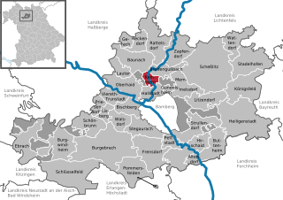
Бамберг
- город в Германии
Hiking in Бамберг
Bamberg, a charming city in Bavaria, Germany, is known for its historic architecture, beautiful landscapes, and vibrant culture. While Bamberg itself is not primarily a hiking destination, it is surrounded by scenic areas that offer great opportunities for hiking....
- Страна:
- Почтовый код: 96052; 96001
- Телефонный код: 0951
- Код автомобильного номера: BA
- Координаты: 49° 53' 30" N, 10° 53' 20" E
- GPS треки (wikiloc): [Ссылка]
- Высота над уровнем моря: 262 м m
- Площадь: 54580000 кв.км
- Население: 71465
- Веб сайт: [Ссылка]