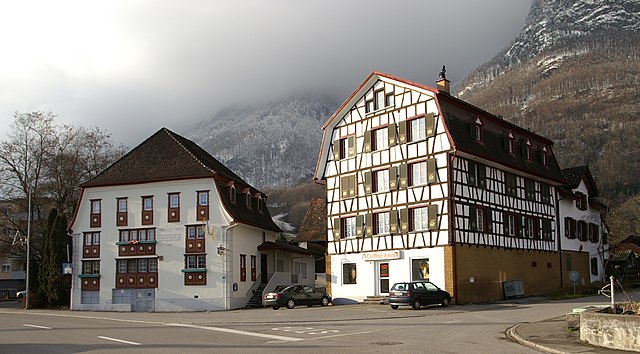
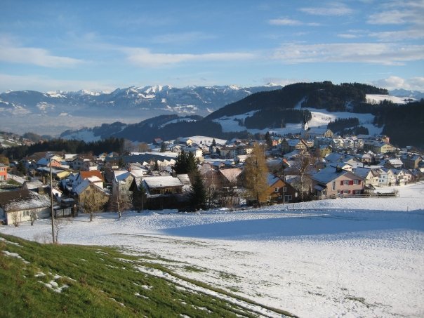
Альтштеттен (Altstätten, Altstätten)

 Hiking in Альтштеттен
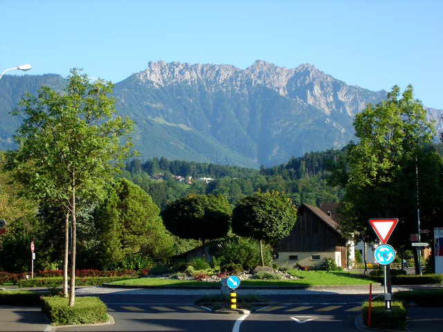
Altstätten, located in the eastern part of Switzerland, is a charming town nestled near the Appenzell region, offering a variety of hiking opportunities that cater to all levels of hikers. The surrounding landscape is characterized by rolling hills, lush forests, and stunning mountain views, making it a fantastic destination for outdoor enthusiasts.
Hiking Trails:
-
St. Anton Pass: A popular route starting from Altstätten, the St. Anton Pass offers breathtaking views of the mountains and valleys. The trail is moderate in difficulty and can be completed in a few hours.
-
Schwarzer Grat: This hike provides a more challenging option with a steep ascent that rewards hikers with panoramic views of the Rhine Valley and the surrounding Alps at the summit.
-
Herisau to Altstätten: This scenic route follows the hillside, combining forest paths with meadows. It's a great option for families and those looking for a leisurely walk.
-
Appenzeller Land: Just a short distance from Altstätten, the Appenzeller area boasts numerous trails that pass through picturesque villages, traditional farms, and rolling hills dotted with grazing cows.
Flora and Fauna:
Hiking in Altstätten allows hikers to experience Switzerland's rich biodiversity. The area is home to various plant species, including wildflowers in spring and summer. Keep an eye out for local wildlife, such as deer, chamois, and a variety of bird species.
Best Time to Hike:
The best time for hiking in the Altstätten area typically runs from late spring through early autumn (May to October). During this time, the trails are usually clear of snow, and the weather is more stable.
Preparation:
- Trail Maps: It's advisable to have a detailed map or a GPS device, as some trails may not be well-marked.
- Gear: Wear sturdy hiking boots and dress in layers, as mountain weather can change quickly.
- Hydration & Snacks: Carry enough water and some snacks to keep your energy up during the hike.
Accessibility:
Altstätten is well-connected by public transport, making it easy to access the starting points for many trails. The town itself also has amenities such as restaurants and shops for supplies.
In summary, Altstätten offers a variety of hiking experiences set against a stunning backdrop, making it an excellent choice for both casual walkers and seasoned hikers. Enjoy your adventure!
- Страна:

- Почтовый код: 9450
- Телефонный код: 071
- Код автомобильного номера: SG
- Координаты: 47° 22' 41" N, 9° 32' 56" E


- GPS треки (wikiloc): [Ссылка]
- Высота над уровнем моря: 465 м m
- Площадь: 39.11 кв.км
- Население: 11549
- Веб сайт: http://www.altstaetten.ch
- Википедия русская: wiki(ru)
- Википедия английская: wiki(en)
- Википедия национальная: wiki(de)
- Хранилище Wikidata: Wikidata: Q68281
- Катеория в википедии: [Ссылка]
- код Freebase: [/m/0gmfsw]
- код GeoNames: Альт: [7285064]
- код VIAF: Альт: [137292431]
- ID отношения в OpenStreetMap: [1683857]
- код GND: Альт: [4202774-3]
- код LCNAF: Альт: [n86126456]
- место в MusicBrainz: [89a96286-55ac-4c61-be96-6120427396d8]
- идентификатор HDS: [1340]
- код швейцарского муниципалитета: [3251]
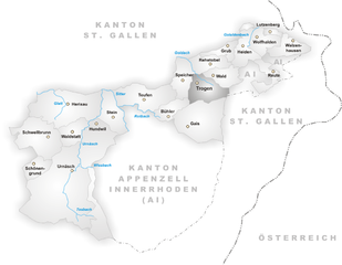
Граничит с регионами:

Руггелль
- община в Лихтенштейне
Hiking in Руггелль
Ruggell is a charming municipality in Liechtenstein, located near the borders of Austria and Switzerland. While it's a small area, it offers some beautiful hiking opportunities that cater to various skill levels....
- Страна:

- Почтовый код: 9491
- Телефонный код: 7010
- Координаты: 47° 14' 42" N, 9° 32' 0" E
- GPS треки (wikiloc): [Ссылка]
- Высота над уровнем моря: 433 м m
- Площадь: 7.4 кв.км
- Веб сайт: [Ссылка]


Оберрит
Hiking in Оберрит
Oberriet, located in the picturesque region of eastern Switzerland, offers a unique hiking experience characterized by stunning landscapes, charming villages, and a variety of trails suitable for different skill levels. Here are some key points to consider for hiking in Oberriet:...
- Страна:
- Почтовый код: 9463
- Телефонный код: 071
- Код автомобильного номера: SG
- Координаты: 47° 20' 6" N, 9° 33' 49" E
- GPS треки (wikiloc): [Ссылка]
- Высота над уровнем моря: 421 м m
- Площадь: 34.51 кв.км
- Население: 8839
- Веб сайт: [Ссылка]


Айхберг
Hiking in Айхберг
Eichberg, located near the city of St. Gallen in Switzerland, offers a variety of hiking opportunities in a picturesque alpine setting. The region is known for its stunning landscapes, lush green meadows, and panoramic views of the surrounding mountains....
- Страна:
- Почтовый код: 9453
- Телефонный код: 071
- Код автомобильного номера: SG
- Координаты: 47° 20' 35" N, 9° 31' 51" E
- GPS треки (wikiloc): [Ссылка]
- Высота над уровнем моря: 481 м m
- Площадь: 5.43 кв.км
- Население: 1524
- Веб сайт: [Ссылка]


Рюти
Hiking in Рюти
Rüthi, located in the Swiss canton of St. Gallen, is a wonderful area for hiking, offering a mix of scenic views, diverse landscapes, and well-maintained trails. Here are some key points to consider when hiking in Rüthi:...
- Страна:
- Почтовый код: 9464
- Телефонный код: 071
- Код автомобильного номера: SG
- Координаты: 47° 17' 45" N, 9° 32' 14" E
- GPS треки (wikiloc): [Ссылка]
- Высота над уровнем моря: 431 м m
- Площадь: 9.34 кв.км
- Население: 2357
- Веб сайт: [Ссылка]


Гайс
- коммуна в Швейцарии
Hiking in Гайс
Gais, a charming village in the Appenzell Innerrhoden region of Switzerland, offers stunning hiking opportunities suitable for various skill levels. The surrounding landscapes are characterized by rolling hills, lush meadows, and spectacular mountain views, making it a paradise for outdoor enthusiasts....
- Страна:
- Почтовый код: 9056
- Телефонный код: 071
- Код автомобильного номера: AR
- Координаты: 47° 21' 38" N, 9° 27' 4" E
- GPS треки (wikiloc): [Ссылка]
- Высота над уровнем моря: 983 м m
- Площадь: 21.23 кв.км
- Население: 3096
- Веб сайт: [Ссылка]


Рюте
Hiking in Рюте
Rüte, a charming area in Switzerland, is nestled in the picturesque Appenzell region. The region is characterized by rolling hills, lush pastures, and stunning mountain views, making it a fantastic destination for hiking enthusiasts. Here are some highlights and tips for hiking in Rüte:...
- Страна:
- Почтовый код: 9050
- Телефонный код: 071
- Код автомобильного номера: AI
- Координаты: 47° 19' 14" N, 9° 25' 48" E
- GPS треки (wikiloc): [Ссылка]
- Высота над уровнем моря: 799 м m
- Площадь: 40.9 кв.км
- Население: 3606
- Веб сайт: [Ссылка]


Марбах
Hiking in Марбах
Marbach, located in the St. Gallen region of Switzerland, is a beautiful destination for hiking enthusiasts. Nestled in the Alpine foothills, this area offers a variety of trails suited for different skill levels, from easy walks to more challenging hikes. Here are some key points to consider when hiking in Marbach:...
- Страна:
- Почтовый код: 9437
- Телефонный код: 071
- Код автомобильного номера: SG
- Координаты: 47° 23' 30" N, 9° 34' 5" E
- GPS треки (wikiloc): [Ссылка]
- Высота над уровнем моря: 413 м m
- Площадь: 4.42 кв.км
- Население: 2055
- Веб сайт: [Ссылка]

Троген
Hiking in Троген
Trogen is a charming village located in the Appenzell region of Switzerland, surrounded by beautiful landscapes, rolling hills, and stunning views of the Alps. The area is known for its varied hiking trails that cater to all levels of experience, making it an excellent destination for both novice and experienced hikers....
- Страна:
- Почтовый код: 9043
- Телефонный код: 071
- Код автомобильного номера: AR
- Координаты: 47° 24' 27" N, 9° 27' 53" E
- GPS треки (wikiloc): [Ссылка]
- Высота над уровнем моря: 903 м m
- Площадь: 10.02 кв.км
- Население: 1721
- Веб сайт: [Ссылка]
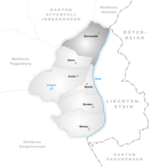
Зеннвальд
Hiking in Зеннвальд
Sennwald is a picturesque municipality located in the Canton of St. Gallen, Switzerland. It is surrounded by breathtaking landscapes and offers a variety of hiking opportunities that cater to different skill levels. Here’s what you can expect when hiking in Sennwald:...
- Страна:
- Почтовый код: 9466
- Телефонный код: 081
- Код автомобильного номера: SG
- Координаты: 47° 14' 38" N, 9° 28' 37" E
- GPS треки (wikiloc): [Ссылка]
- Высота над уровнем моря: 441 м m
- Площадь: 41.53 кв.км
- Население: 5564
- Веб сайт: [Ссылка]
Оберегг
- коммуна в Швейцарии, в кантоне Аппенцелль-Иннерроден
Hiking in Оберегг
Hiking in the Oberegg District, located in the canton of Appenzell Innerrhoden in Switzerland, offers a beautiful blend of scenic landscapes, cultural experiences, and varied terrains. This area is characterized by rolling hills, lush fields, and magnificent views of the surrounding mountains, making it a perfect destination for both novice and experienced hikers....
- Страна:
- Почтовый код: 9413
- Телефонный код: 071
- Код автомобильного номера: AI
- Координаты: 47° 25' 1" N, 9° 33' 27" E
- GPS треки (wikiloc): [Ссылка]
- Высота над уровнем моря: 885 м m
- Площадь: 14.7 кв.км
- Население: 1907
- Веб сайт: [Ссылка]