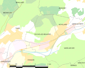
Amagney (Amagney)

- коммуна во Франции
 Hiking in Amagney
Amagney is a charming village located in the beautiful landscapes of the Jura region in France. While it may not be as well-known as some major hiking destinations, it offers a variety of scenic trails and opportunities for outdoor enthusiasts to explore the natural beauty of the surrounding area.
Hiking Trails
-
Local Routes: Various marked paths weave through the countryside around Amagney, leading you through lush forests, rolling hills, and past picturesque farms. Trails can range from easy strolls to more challenging hikes.
-
Jura Mountains: Just a short distance from Amagney, the Jura Mountains provide an array of hiking trails with breathtaking views, including routes that lead to panoramic viewpoints or along escarpments.
-
Nature reserves: Check nearby nature reserves for marked trails that allow for wildlife observation and a deep appreciation of local flora.
Recommendations
- Difficulty Levels: Always consider your fitness level and experience. Some trails can be steep or require good navigation skills.
- Weather: The weather in the Jura can change rapidly, so check forecasts and dress in layers.
- Local Rule: Respect nature, follow trail markers, and if you're hiking in a group, maintain a reasonable pace.
Preparation
- Gear: Ensure you have suitable hiking boots, clothing, and hydration supplies.
- Map: Carry a map or download a GPS app to keep track of your route.
- Safety: Notify someone of your plans, and consider hiking with a buddy for safety.
Conclusion
Hiking in and around Amagney offers a chance to explore the serene beauty of the Jura region. Whether you're looking for a peaceful nature walk or a more strenuous hike, you'll find plenty to enjoy. Happy hiking!
- Страна:

- Почтовый код: 25220
- Координаты: 47° 18' 18" N, 6° 9' 6" E


- GPS треки (wikiloc): [Ссылка]
- Площадь: 13.13 кв.км
- Население: 759
- Веб сайт: http://www.amagney.fr
- Википедия английская: wiki(en)
- Википедия национальная: wiki(fr)
- Хранилище Wikidata: Wikidata: Q616534
- Катеория в википедии: [Ссылка]
- код Freebase: [/m/03mgbht]
- код Freebase: [/m/03mgbht]
- код GeoNames: Альт: [6447807]
- код GeoNames: Альт: [6447807]
- номер SIREN: [212500144]
- номер SIREN: [212500144]
- код BNF: [15252240h]
- код BNF: [15252240h]
- код муниципалитета INSEE: 25014
- код муниципалитета INSEE: 25014
Граничит с регионами:


Thise
- коммуна во Франции
Hiking in Thise
Thise, located in the Doubs department of France, offers a variety of hiking opportunities amidst beautiful natural landscapes. The region is characterized by rolling hills, dense forests, and picturesque views, making it an appealing destination for both novice and experienced hikers....
- Страна:
- Почтовый код: 25220
- Координаты: 47° 16' 56" N, 6° 4' 31" E
- GPS треки (wikiloc): [Ссылка]
- Площадь: 8.93 кв.км
- Население: 3091
- Веб сайт: [Ссылка]


Châtillon-Guyotte
- коммуна во Франции
Hiking in Châtillon-Guyotte
Châtillon-Guyotte is a beautiful location for hiking, situated in the stunning French Alps. This area offers a mix of natural scenery, from lush forests and alpine meadows to impressive mountain views....
- Страна:
- Почтовый код: 25640
- Координаты: 47° 19' 51" N, 6° 10' 7" E
- GPS треки (wikiloc): [Ссылка]
- Площадь: 4.44 кв.км
- Население: 127


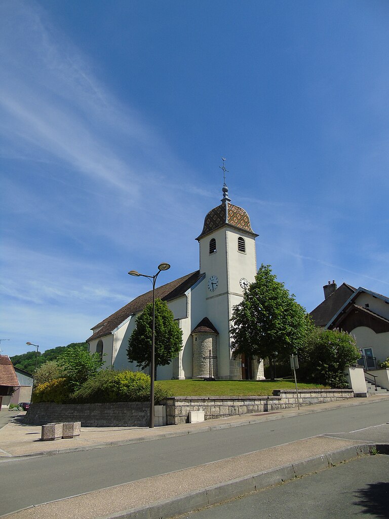
Novillars
Hiking in Novillars
Novillars is a charming village located in the Doubs department of the Bourgogne-Franche-Comté region in eastern France. While it may not be as commonly known as some other hiking destinations, it offers beautiful landscapes and a tranquil environment for outdoor enthusiasts....
- Страна:
- Почтовый код: 25220
- Координаты: 47° 17' 9" N, 6° 7' 46" E
- GPS треки (wikiloc): [Ссылка]
- Площадь: 2.02 кв.км
- Население: 1522


Vaire-le-Petit
Hiking in Vaire-le-Petit
Vaire-le-Petit is a charming village in northeastern France, located in the Grand Est region. While it might not be as widely recognized as some other hiking destinations, it is surrounded by beautiful natural landscapes, making it a great spot for outdoor enthusiasts....
- Страна:
- Почтовый код: 25220
- Координаты: 47° 17' 13" N, 6° 8' 46" E
- GPS треки (wikiloc): [Ссылка]
- Площадь: 1.26 кв.км
- Население: 226

Roche-lez-Beaupré
- коммуна во Франции
Hiking in Roche-lez-Beaupré
Roche-lez-Beaupré, located in the Doubs region of France, offers a scenic and exciting environment for hiking enthusiasts. The area is characterized by its beautiful natural landscapes, which include lush forests, impressive cliffs, and picturesque views overlooking the surrounding valleys....
- Страна:
- Почтовый код: 25220
- Координаты: 47° 16' 34" N, 6° 6' 51" E
- GPS треки (wikiloc): [Ссылка]
- Высота над уровнем моря: 265 м m
- Площадь: 5.63 кв.км
- Население: 2053
- Веб сайт: [Ссылка]
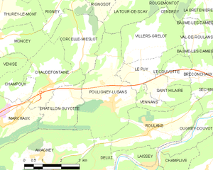
Pouligney-Lusans
- коммуна во Франции
Hiking in Pouligney-Lusans
Pouligney-Lusans is a small commune located in the Doubs department of the Bourgogne-Franche-Comté region in eastern France. While it may not be a widely recognized hiking destination, the surrounding area does offer opportunities for nature walks and hiking experiences....
- Страна:
- Почтовый код: 25640
- Координаты: 47° 19' 43" N, 6° 12' 14" E
- GPS треки (wikiloc): [Ссылка]
- Площадь: 11.6 кв.км
- Население: 835