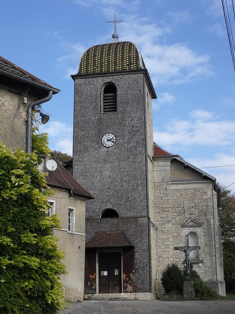
Pouligney-Lusans (Pouligney-Lusans)

- коммуна во Франции
 Hiking in Pouligney-Lusans
Pouligney-Lusans is a small commune located in the Doubs department of the Bourgogne-Franche-Comté region in eastern France. While it may not be a widely recognized hiking destination, the surrounding area does offer opportunities for nature walks and hiking experiences.
Hiking in Pouligney-Lusans and Surroundings
-
Scenic Trails: The region is characterized by rolling hills, forests, and picturesque landscapes. While specific trails may not be well-documented, local paths can often lead to beautiful views of the countryside.
-
Nature Observation: The area's natural environment provides opportunities for observing local wildlife and plant species. Birdwatching can be particularly rewarding.
-
Nearby Parks: Consider exploring nearby natural parks or reserves in the Doubs region. The Parc Naturel Régional du Haut-Jura is not far and offers extensive hiking opportunities with marked trails ranging from easy to challenging.
-
Historical Sites: The area is rich in history, and some hikes may lead to historical landmarks or sites of cultural significance. Be on the lookout for old farms, churches, and traditional architecture.
-
Local Amenities: When planning a hike, check for nearby villages and towns for local amenities such as cafes, restaurants, and accommodations. This can enhance your hiking experience.
Tips for Hiking in the Area
- Check Trail Maps: Before heading out, it’s a good idea to get a map or a hiking app to understand the trails available in the vicinity.
- Weather Conditions: Be mindful of the weather, as conditions can change rapidly in the region.
- Equipment: Wear appropriate footwear and carry sufficient water, snacks, and a first-aid kit.
- Respect Nature: Follow Leave No Trace principles to help preserve the natural beauty of the area.
Conclusion
While Pouligney-Lusans may not be a major hiking hub, its serene environment and proximity to more extensive trails makes it a charming spot for a peaceful hike, especially for those looking to explore the quiet beauty of eastern France.
- Страна:

- Почтовый код: 25640
- Координаты: 47° 19' 43" N, 6° 12' 14" E


- GPS треки (wikiloc): [Ссылка]
- Площадь: 11.6 кв.км
- Население: 835
- Википедия английская: wiki(en)
- Википедия национальная: wiki(fr)
- Хранилище Wikidata: Wikidata: Q905851
- Катеория в википедии: [Ссылка]
- код Freebase: [/m/03mgxy_]
- код Freebase: [/m/03mgxy_]
- код GeoNames: Альт: [6614419]
- код GeoNames: Альт: [6614419]
- номер SIREN: [212504682]
- номер SIREN: [212504682]
- код BNF: [15252694j]
- код BNF: [15252694j]
- код муниципалитета INSEE: 25468
- код муниципалитета INSEE: 25468
Граничит с регионами:


Chaudefontaine
- коммуна во Франции
Hiking in Chaudefontaine
Chaudefontaine, located in the Doubs department in the Bourgogne-Franche-Comté region of France, offers a beautiful natural setting for hiking enthusiasts. The area is characterized by its picturesque landscapes, including rolling hills, dense forests, and serene rivers, making it an ideal destination for both casual walkers and more experienced hikers....
- Страна:
- Почтовый код: 25640
- Координаты: 47° 20' 23" N, 6° 9' 35" E
- GPS треки (wikiloc): [Ссылка]
- Площадь: 6.33 кв.км
- Население: 212

Amagney
- коммуна во Франции
Hiking in Amagney
Amagney is a charming village located in the beautiful landscapes of the Jura region in France. While it may not be as well-known as some major hiking destinations, it offers a variety of scenic trails and opportunities for outdoor enthusiasts to explore the natural beauty of the surrounding area....
- Страна:
- Почтовый код: 25220
- Координаты: 47° 18' 18" N, 6° 9' 6" E
- GPS треки (wikiloc): [Ссылка]
- Площадь: 13.13 кв.км
- Население: 759
- Веб сайт: [Ссылка]


Corcelle-Mieslot
- коммуна во Франции
Hiking in Corcelle-Mieslot
Corcelle-Mieslot, located in the picturesque region of the French Alps, offers a variety of hiking trails that cater to different skill levels. Here's a brief overview:...
- Страна:
- Почтовый код: 25640
- Координаты: 47° 21' 37" N, 6° 11' 14" E
- GPS треки (wikiloc): [Ссылка]
- Площадь: 6.42 кв.км
- Население: 108


Châtillon-Guyotte
- коммуна во Франции
Hiking in Châtillon-Guyotte
Châtillon-Guyotte is a beautiful location for hiking, situated in the stunning French Alps. This area offers a mix of natural scenery, from lush forests and alpine meadows to impressive mountain views....
- Страна:
- Почтовый код: 25640
- Координаты: 47° 19' 51" N, 6° 10' 7" E
- GPS треки (wikiloc): [Ссылка]
- Площадь: 4.44 кв.км
- Население: 127


Deluz
- коммуна во Франции
Hiking in Deluz
Deluz, located in the Doubs department of the Bourgogne-Franche-Comté region in France, offers a beautiful setting for hiking enthusiasts. The area is characterized by its picturesque landscapes, rolling hills, dense forests, and varied terrain, making it a great destination for outdoor activities....
- Страна:
- Почтовый код: 25960
- Координаты: 47° 17' 40" N, 6° 12' 3" E
- GPS треки (wikiloc): [Ссылка]
- Площадь: 8.03 кв.км
- Население: 625


Roulans
Hiking in Roulans
Roulans is a small commune located in the Doubs department in the Bourgogne-Franche-Comté region of eastern France. While it may not be as widely known for hiking as some other areas in France, it offers natural beauty and a peaceful environment for outdoor activities....
- Страна:
- Почтовый код: 25640
- Координаты: 47° 18' 59" N, 6° 14' 0" E
- GPS треки (wikiloc): [Ссылка]
- Высота над уровнем моря: 350 м m
- Площадь: 8.31 кв.км
- Население: 1125
- Веб сайт: [Ссылка]


La Tour-de-Sçay
- коммуна во Франции
Hiking in La Tour-de-Sçay
La Tour-de-Sçay, located in the beautiful region of Haute-Savoie in France, offers a variety of hiking opportunities that showcase the stunning landscapes of the French Alps. Here are some key points to consider for hiking in this region:...
- Страна:
- Почтовый код: 25640
- Координаты: 47° 23' 12" N, 6° 13' 34" E
- GPS треки (wikiloc): [Ссылка]
- Площадь: 8.82 кв.км
- Население: 287


Le Puy
- коммуна во Франции
Hiking in Le Puy
Le Puy in Doubs, located in the Bourgogne-Franche-Comté region of France, is a fantastic spot for hiking, with its beautiful natural landscapes, varied terrain, and rich cultural history. Here’s a brief overview of what you can expect when hiking in the area:...
- Страна:
- Почтовый код: 25640
- Координаты: 47° 20' 43" N, 6° 13' 41" E
- GPS треки (wikiloc): [Ссылка]
- Площадь: 3.42 кв.км
- Население: 110


Vennans
- коммуна во Франции
Hiking in Vennans
It seems like there may be a typo in your question, as "Vennans" doesn't correspond to a well-known hiking destination. However, if you meant a specific area or region, such as Vennans in a certain country or context (like perhaps a mountain range, national park, or hiking trail), please clarify so I can provide you with the best information. Alternatively, if you were referring to a popular hiking destination nearby or a different name, just let me know, and I can give you detailed insights about hiking in that location!...
- Страна:
- Почтовый код: 25640
- Координаты: 47° 19' 45" N, 6° 14' 12" E
- GPS треки (wikiloc): [Ссылка]
- Площадь: 1.36 кв.км
- Население: 258

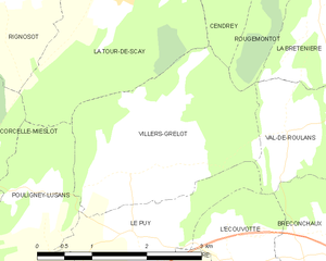
Villers-Grélot
- коммуна во Франции
Hiking in Villers-Grélot
Villers-Grélot is a charming and lesser-known destination for hiking enthusiasts, situated in Belgium. Given its rural landscape and natural beauty, it offers a variety of trails that cater to different skill levels....
- Страна:
- Почтовый код: 25640
- Координаты: 47° 21' 24" N, 6° 13' 36" E
- GPS треки (wikiloc): [Ссылка]
- Площадь: 7.02 кв.км
- Население: 157